

The first week of our 23-day September road trip delivered much to appreciate, from the pumice plain and cinder cones beside California’s Mono Lake to the rugged beauty of the Ruby Mountains of Nevada, and the dramatic lakes and peaks of Montana’s Glacier National Park. But in truth, it was all just preamble to the main event: the Canadian Rockies.
My partner Leslie and I have been trying to visit that area for some time, forced to cancel our plans one year by injury and another by the outbreak of wildfires that rendered much of the province of Alberta virtually uninhabitable. It was worth the wait.
The day after our chilly visit to Logan Pass in the heart of Glacier National Park, we headed north, crossed the international border at Carway and headed across 160 miles of Northern Plains farmland before picking up the Trans-Canada Highway in Calgary. The highway took us west, and we repeated the experience of four days earlier as we crossed gently undulating grassland and suddenly found ourselves surrounded by mountains, rearing up against the sky like lithic skyscrapers. We checked in to the Airbnb we had rented for two nights on the outskirts of Banff town, and planned the next day’s explorations.
After so many days of blustery winds, intermittent rain, and view-obscuring overcast and smoke, it was a relief to wake up the next morning to blue sky and calm air. Clouds scudded above the landscape, but as picturesque accents, not as a gray ceiling.
And what a landscape it was.
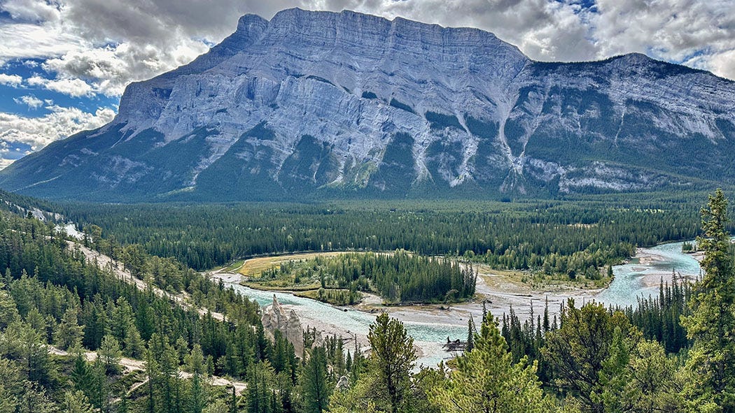
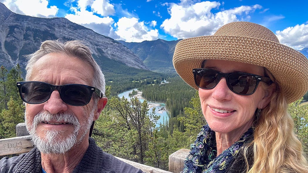
As we followed the highway into the town of Banff, entering Banff National Park along the way, we encountered the first real traffic since our first day on the road. We picked our way through, encountering jammed parking lots and tour buses disgorging thickets of sightseers at scenic viewpoints, eventually making our way to a trailhead high above the town where traffic thinned.
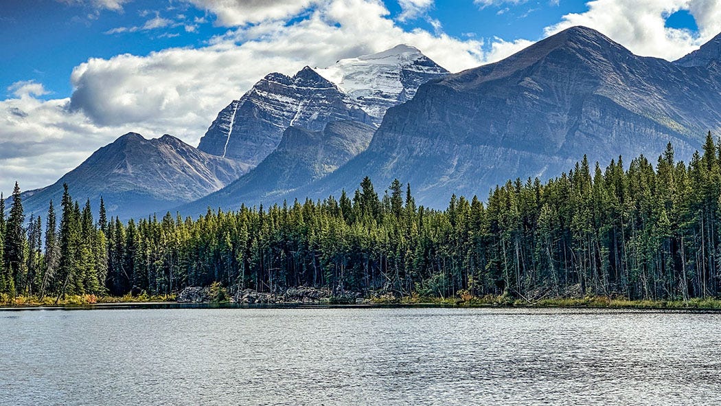
A short hike took us to breathtaking views of the Bow River, winding through a valley surrounded by massive peaks, its water the telltale turquoise of a glacier-fed stream digesting rock flour milled by grinding ice. In the center of the scene loomed Mt. Rundle, a sheer-walled sandwich of stone with erosion-resistant limestone and dolomite layers as the top and bottom, and softer shale as the filling. In every direction more mountains loomed, scattered patches of snow and ice glinting from their flanks in the welcome sunshine.
I have explored many mountain ranges in my life, from the Sierra Nevada of California to the Cascades of Oregon and Washington; the Rockies of Wyoming, Idaho and Montana; the Appalachians of Tennessee, North Carolina and Virginia; and the Andes of Peru, Chile and Argentina. But the accessible and jaw-dropping beauty of the Canadian Rockies we traversed over the next several days left me speechless at times.
That afternoon we went into town and visited the Whyte Museum of the Canadian Rockies, which besides a gallery devoted to the human history of the region also had exhibitions featuring paintings of Rockies landscapes — including more than 100 works by a single artist, J.E.H. MacDonald, who repeatedly returned to several favorite locations in the mountains near Banff to paint lakes, peaks and woods between 1924 and 1932. MacDonald’s paintings were paired with the work of equally obsessive geologists, Patricia Cucman and Stanley Munn, who tracked down and photographed the precise locations rendered in the paintings. It made for a fascinating visit and whetted our appetite for the exploration of Banff, Yoho and Kootenay national parks we were about to undertake.
After leaving our Airbnb, we headed deeper into the park on our way to Johnston Canyon Campground, where we had a site reserved for two nights. We detoured at the turnoff to Lake Louise — hoping to visit the iconic Fairmont Chateau Lake Louise and one of the most famously scenic landmarks in the park — only to find ourselves redirected to a nearby shuttle parking lot because the lot at the lake was full.
What we found when we reached it was horrifying. The lot — or lots, really, with multiple entrances and exits — was vast and clogged with hundreds of cars, while scores of parked motorhomes lined both sides of the access road for more than half a mile. We found one of the final empty slots, parked the van and went looking for the shuttle stop, which was nowhere obvious.
We encountered a parking attendant and asked her for directions. She asked if we had shuttle reservations. When we said we didn’t she advised that we might be able to buy tickets but that the short ride would cost each of us $50 to $100. And she gestured at the crowded lot, noting that all the thousands of people represented by the parked vehicles were currently crowding around the relatively small lake and its trails.
“It’s shoulder-to-shoulder up there,” she said, recommending that we seek out beautiful but less-crowded sites in the park and offering tips on where to find them.
So we fled to the refuge of our campsite in Johnston Canyon, where the next day we would have the pair of red fox encounters I described in the previous installment of Next Chapter Notes.
Bludgeoned by beauty
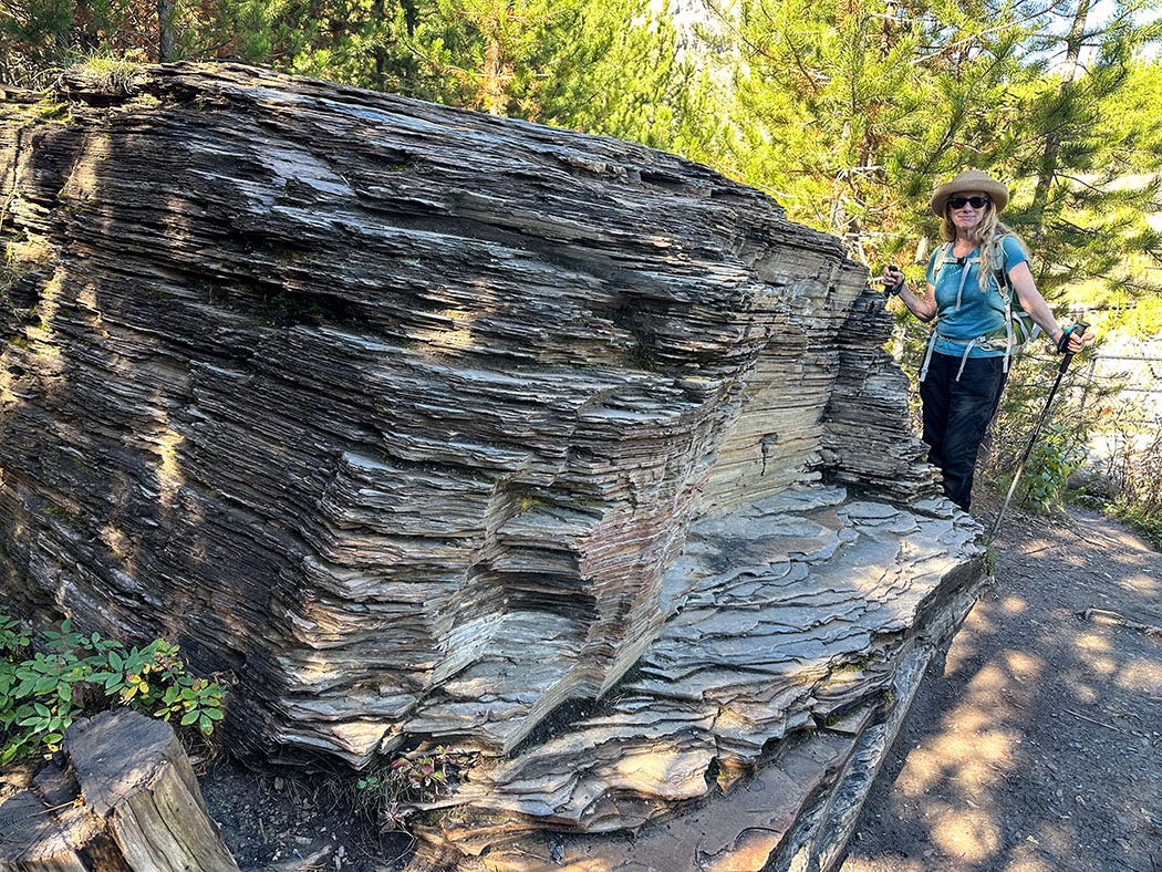
That morning we drove to Kootenay National Park and hiked along the rim of Marble Canyon, a deep and narrow slot carved into limestone by the blue-green glacial waters of Tokumm Creek above its confluence with the Vermilion River. Along the way, we stopped to admire an outcrop of the Burgess shale formation, legendary among paleontologists for the fossils it contains — the exquisitely preserved remains of a startling diversity of creatures that flourished 530 million years ago in a long-vanished sea — which upended the scientific understanding of the history of life on Earth. (The Burgess shale is the centerpiece of a fascinating book by the late paleontologist and gifted science writer Stephen Jay Gould that I highly recommend, even though it is a bit outdated and requires some tolerance for technical language.)
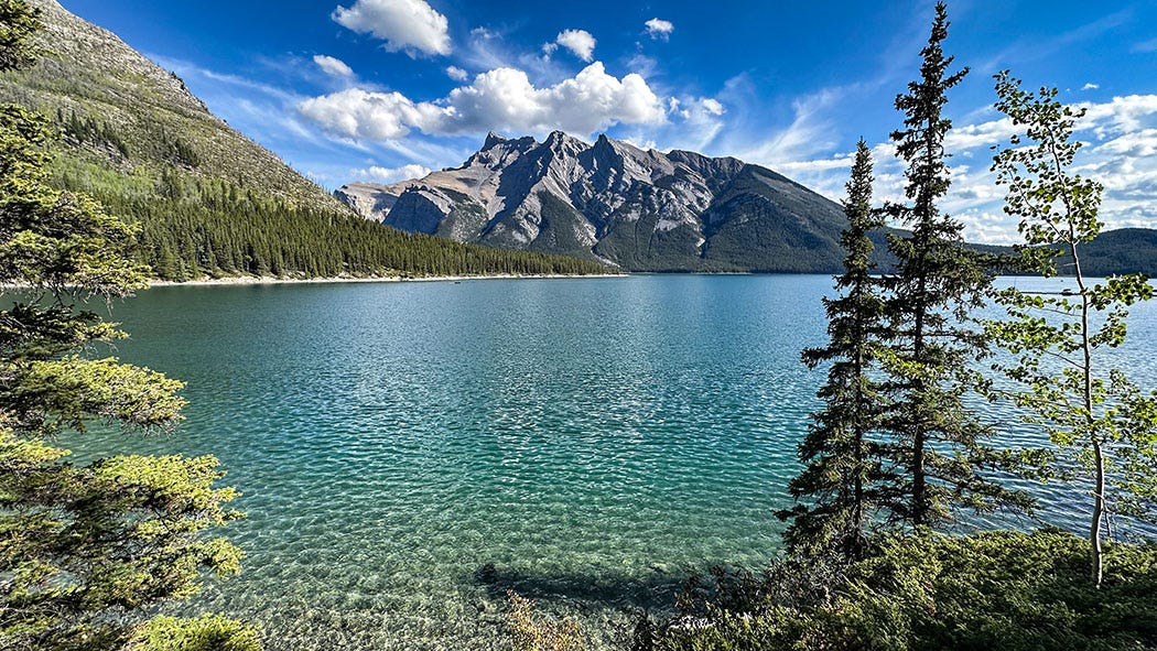
That afternoon, we walked the shore of expansive Lake Minnewanka, just outside of the town of Banff, and although there were more visitors there — along with boating concessions, a tour operator, and a bar and grill — we found a trail that allowed us to leave most of the bustle behind while enjoying the views of lake and mountains.
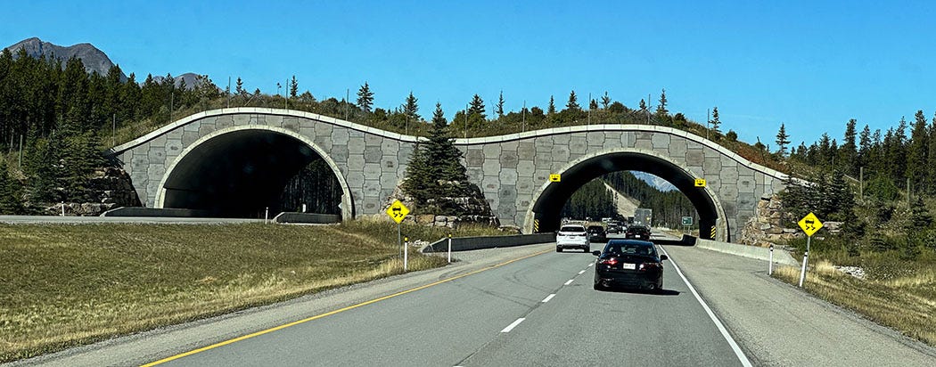
The drive through Banff National Park along the Trans-Canada Highway was remarkable for more than just scenery. Because it follows the relatively narrow Bow Valley between parallel mountain ranges, the highway — originally built in the 1950s as a scenic two-lane road — also runs through the middle of a natural wildlife corridor, and for many years it was a deathtrap for animals big and small. To stem the carnage, and to widen the highway to accommodate growing vehicle traffic, the Canadian government in 1981 launched a major remake of the 52-mile stretch in the park. It’s now a four-lane divided highway, and the project included constructing 44 wildlife crossing structures (38 underpasses and six overpasses) along with more than 50 miles of fencing to steer animals toward them. The result has been a dramatic reduction in wildlife mortality.
The next day, we followed the Icefields Parkway (a world-class highway name) north to an unmarked trailhead that Leslie found using one of our hiking apps. From the small parking area, which was almost invisible from the parkway, we hiked a mile through a fairytale forest that was lavishly mossy and bedecked with a rainbow of mushrooms: chocolate, cream, crimson, black, pink, gray, yellow. We emerged from the woods onto the rocky shore of a turquoise lake, nestled in a bowl cupped by rugged peaks, the edge of a glacier looming above the far side.
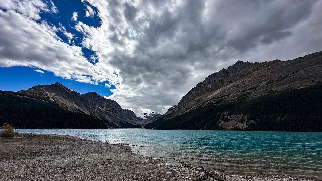


When we arrived, we were the only souls in sight, and the only sounds were of wind and waves lapping on a “beach” of morainal hash — a mélange of sand, gravel, cobbles and boulders ground up and shoved by the snout of a glacier into the bowl it carved and then filled with its own melt as it retreated. To be alone in such a setting, knowing how crowded the highway-accessible scenic spots were, was by far the most magical interlude of our trip. The subsequent arrival of a small group of hikers did nothing to dilute it; we simply walked out of earshot and eyesight. (I’m leaving the location unnamed in accordance with the principles of Leave No Trace For Social Media.)
That night we camped near a creek turbid with glacial runoff in Yoho National Park, where one of the most important Burgess shale fossil quarries is located. The next morning, we hiked to Wapta Falls, where the broad Kicking Horse River — swollen by runoff from the Wapta and Waputik icefields as well as numerous glaciers tucked among the neighboring peaks — plunges over a 100-foot cliff and ignites an explosion of mist that blasts its downstream banks.
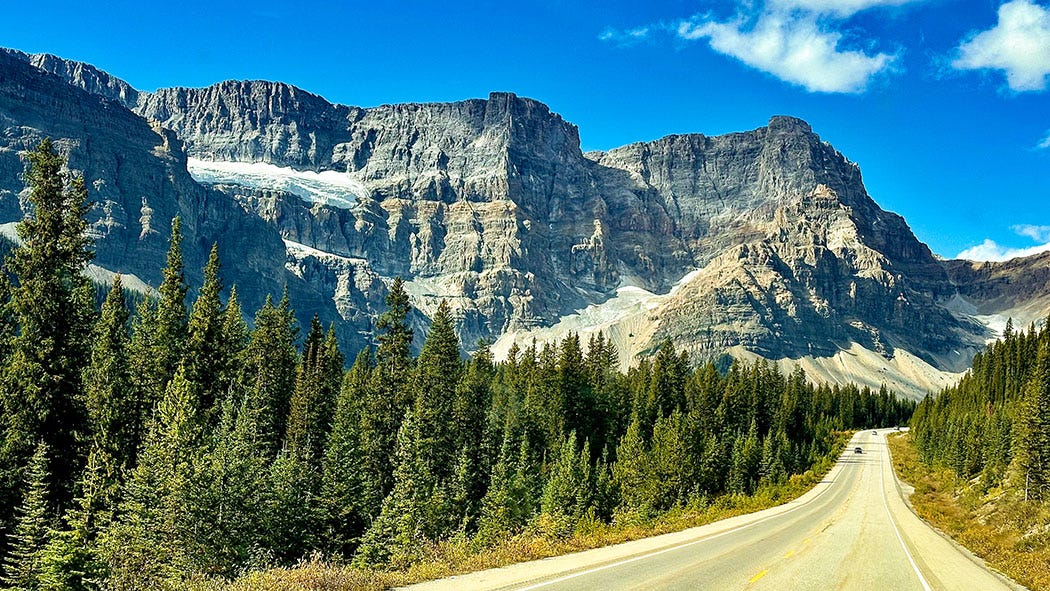
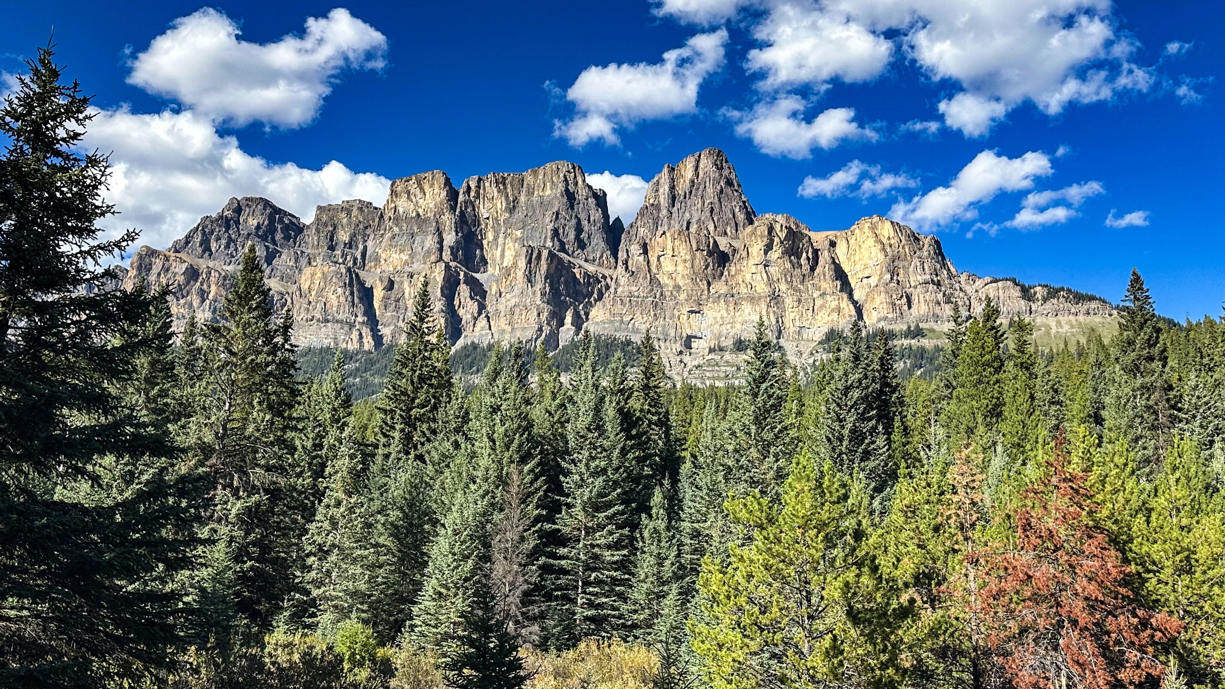
And everywhere we drove we were confronted by vistas of staggering beauty. Along the Bow River and Icefields parkways, and even from the Trans-Canada Highway, we took in the sight of glaciers, turquoise rivers and lakes, soaring mountains scarred by ice, stark and almost brutal in their naked angularity. It was scenery of a scale that confounded perception. Only among the Patagonian peaks of the Andes have I encountered anything like it, and you can’t drive through that landscape the way you can through the Canadian Rockies. After five days of this visual feast we felt almost numb, our senses bludgeoned by one superlative scene after another.
Old growth
In our original planning for this trip, we would have headed next to Jasper National Park, home to more peerless Canadian Rockies scenery. Earlier this year we made reservations at a lodge and a campground there, planning to stay four days. But in late July several wildfires ignited in the Jasper region, and they quickly combined into an inferno that swept across the park, forcing its closure and evacuation. It then roared into Jasper town, destroying about a third of its buildings — including much of the lodge where we had planned to stay. (The park is only now reopening.)
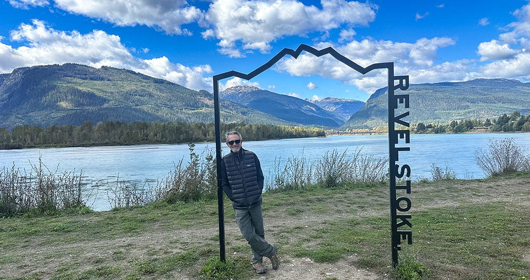
So we shifted our itinerary. From Yoho we headed west on the Trans-Canada Highway deeper into British Columbia, with plans to visit Glacier National Park (the Canadian one, not to be confused with its American counterpart in Montana) and Mount Revelstoke National Park. Our basecamp would be a cabin we’d rented for two nights just outside the town of Revelstoke.
The town’s name seems fitting for its role as a year-round recreational hub, surrounded by enough mountain slopes and fast-moving rivers to inject plenty of stoke into whatever revels might strike your fancy, from skiing to hiking, mountain biking and kayaking. The name, however, has a much less colorful origin: It honors Edward Bering, known as Baron Revelstoke, a British noble and banker who played a key role in financing construction of the Canadian Pacific Railway. The CPR was Canada’s first transcontinental railroad, constructed between 1881 and 1885, and Revelstoke grew up around one of the most important train stations in the region.
The highway pushes into the wildly rugged Selkirk Mountains, following the valley of the Beaver River before climbing to a summit at Rogers Pass in Glacier National Park. Beyond the pass, it descends along the Illecillewaet River toward the valley of the Columbia River. Along much of its route, the highway and CPR’s tracks closely parallel each other, but that changes on the approach to the pass. The highway plows up and over it; the railroad burrows below it, using an ingenious series of tunnels that at one point form a figure 8 inside the mountain as they cross the contour lines.
On the other side of the pass, we paused in Glacier National Park for a leisurely stroll on a boardwalk in a grove of trees dominated by old-growth hemlocks, which a sign erected by the interpretive staff enthusiastically declares to be “the only inland hemlock/cedar rainforest in the world!” We made a second stop in nearby Mount Revelstoke National Park to follow a similar boardwalk in a grove dominated by old-growth western red cedars. Although they couldn’t really compete with the awe-inspiring old-growth coast redwoods or giant sequoias of our home state, the groves in both parks provided a welcome pause on the drive to Revelstoke. Really, any time spent in a forest of big old trees is a gift to savor.
Railroad ballad
We had a full day to explore the town, which we put to good use by first visiting the Revelstoke Railway Museum, located immediately adjacent to the CPR tracks. Reaching it took two tries: When we arrived initially, a very long idling freight train was blocking the only access road, so we killed time running errands until it cleared out of town. There is a certain irony in being prevented from visiting a railway museum by an actual train, but as we toured the galleries we could feel the building vibrating when long freights repeatedly rumbled by just a few yards from the walls. That proximity added a potent sensory element to the historical, technical and cultural information presented by the museum exhibits.

In their physical and symbolic importance, there are similarities between the first transcontinental railroads in Canada and the United States. They were completed just 16 years apart, the American version in 1869 and the Canadian in 1885. Both knitted together continental nations for the first time with a fast, efficient transportation network. Both triggered white settlement of the vast spaces between the nations’ coastal population centers that resulted in displacement of the indigenous people who had occupied that interior landscape for millennia. The Canadian version, however, was literally a key to political unification: The huge province of British Columbia agreed to join the Canadian confederation only upon the promise of a railroad linking it to the rest of the country.
But the construction of the CPR seems woven into Canada’s contemporary national mythology in a way that feels different from that of the transcontinental artery constructed in the U.S. by the Western Pacific, Central Pacific and Union Pacific railroads. Perhaps that’s just the lingering takeaway impression from the time we spent in the spectacular Railway Museum, which features an enormous 1948 steam locomotive and tender in its bright and airy central gallery.
It may also be because one of Canada’s greatest folk-music balladeers, Gordon Lightfoot, wrote and recorded an iconic song about the railway for a Canadian Broadcasting Corp. special that kicked off a yearlong celebration of the country’s centennial in 1967. The “Canadian Railroad Trilogy” appears on two of his albums and was a staple of his live performances, and Leslie and I listened to it that evening in our rented cabin. It has been stuck in our heads ever since.
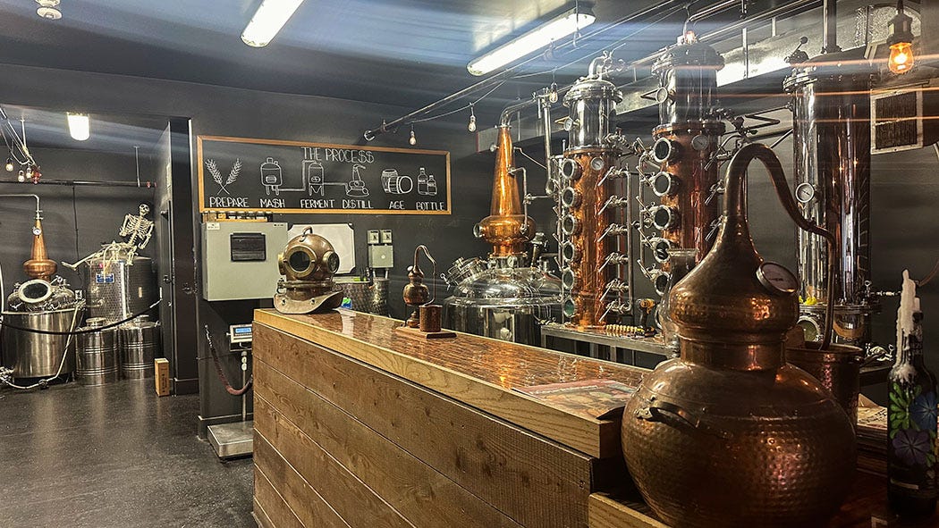
After our visit to the Railway Museum, we headed into Revelstoke’s charming downtown for lunch at a popular cafe, followed by a long walk along a trail in a greenbelt on the banks of the Columbia and Illecillewaet rivers, which meet on the edge of town. To recover from that exertion we repaired to a delightful bar/distillery, where we celebrated International Negroni Week with, well, negronis.
It was somewhat surprising to encounter the Columbia River there, and to find it flowing swift and tinted blue-green by glacial silt. I thought I knew the Columbia pretty well, having followed its course by road from the free-flowing Hanford Reach in eastern Washington to its mouth near Astoria, Oregon, and having once spent a week as a history lecturer aboard a paddlewheel cruise ship following it and one of its primary tributaries, the Snake River, all the way to Idaho. But on those and other travels along the great river of the West, I had never thought about the Columbia’s northernmost headwaters. I certainly was unaware that it begins its 1,200-mile journey to the Pacific at Columbia Lake in the Canadian Rockies not far from Banff National Park.
We left Revelstoke the next day, beginning a long journey home that included several detours. The first saw us stop overnight outside of Vernon, B.C., to visit some of Leslie’s family. Another side trip took us to the Seattle area for two nights to visit members of both our families. Thematically, however — the theme of this journey being grand alpine scenery — it was our final night camped on the edge of an American national park that seems the most fitting place to draw this narrative to a close.
Layover day
From Vernon, we drove south through the intensively farmed Okanagan Valley, a landscape of vineyards and apple orchards, and more roadside fruit and produce stands per highway mile than I have seen anywhere else. Crossing the international border again, we were relieved of our lemons and limes by a U.S. Department of Agriculture inspector, although she gave a pass to the apples we’d purchased at a farmers market in Canada.
Once back in the U.S., we drove south and then west, aiming for Washington’s North Cascades National Park. We originally had intended to camp in the park for two nights and spend the layover day hiking near the campground. Just before leaving Canada, however, we checked the park status report online and found that wildfires had forced closure of the areas where we planned to be.
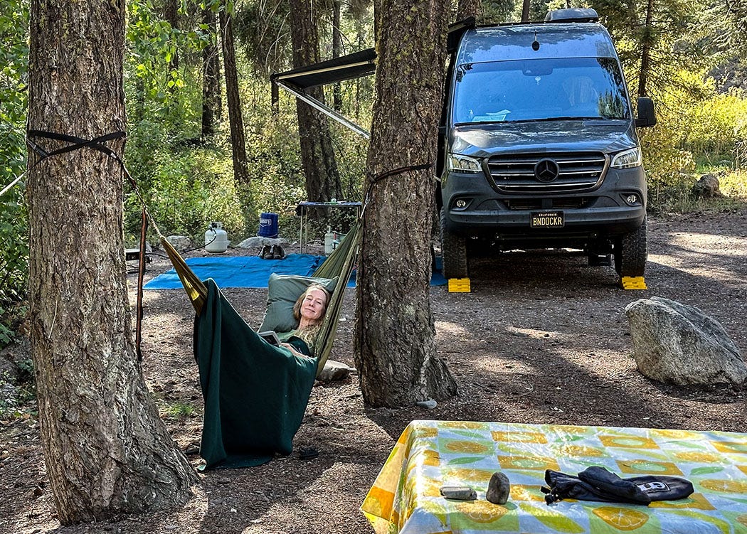
So we modified our plans on the fly. After driving through the acutely charming towns of Twisp and Mazama in the valley of the Methow River, we detoured from the highway about 20 miles east of the national park onto a dirt road leading into the Okanogan-Wenatchee National Forest. Several miles of tooth-rattling washboard brought us to a small developed campground along the river, which drains from the eastern slope of the Cascade Range. The woodsy campground was mostly empty, so we selected an expansive site with convenient river access and settled in.
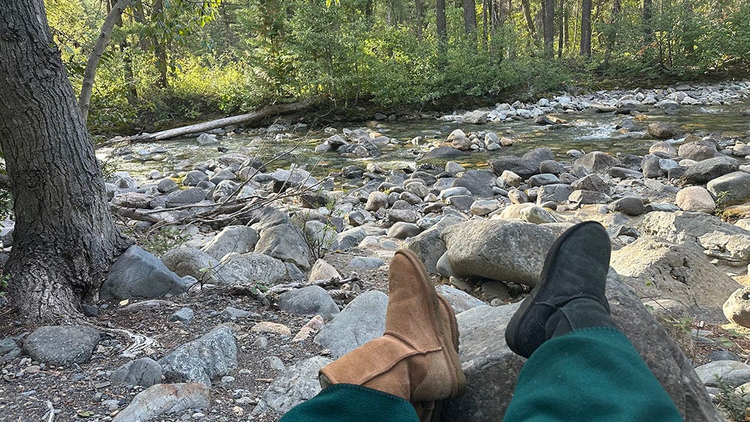
The next morning, we took our coffee and folding loveseat to the river’s edge and watched the rising sun ignite sparkles on the water. We consulted maps and pondered options for the day’s activities, one being a rigorous hike from our camp along a trail that followed a creek north into a canyon hemmed by steep ridges. Another would be to drive several miles to the end of the dirt road that had brought us to the campground, and then hike along a stretch of the Pacific Crest National Scenic Trail deeper into the Cascades.
But then we looked around us.
It was quiet but for the sounds of river and birds. Rugged peaks poked above the forest. Clouds and sprinkles on the previous day’s drive out of Canada had given way to warmth and sunshine, and the trees were dense enough to cast welcome shade but not so close as to plunge the narrow river valley into gloom.
They were also were perfectly spaced to hang the hammocks we carry in our kit. We would find no better scenery on the trail than in camp, and we hadn’t had a lazy day in the two and a half weeks since we left Ventura.
A drive and a hike, or a hammock and a good book?
It really was no contest.
That photo of Lake Minnewanka stands out among all your beautiful photos. Your story and photos have given me my first view of the Canadian Rockies! Thank you for sharing them. I had no idea how stunning they were.
Great storytelling & beautiful photos. Pretty jealous on this one!