


The Road to Wonder
Encountering glaciers and grand vistas on a trek through the Canadian Rockies

Part 1: Gifts of the forest
On its first trip through our campsite, the red fox arrived while I was boiling water for morning coffee on the induction cooktop in our camper van, not ready to brave the 30-degree chill outside.
As I watched through the galley window, the fox paused, then leaped high into the air as if launched by a pogo stick, and dropped acrobatically into the tall grass at the edge of camp. This was presumably an attempt to capture breakfast, but did not appear to succeed. The fox continued on its way, vanishing into the forest understory.
It came back through camp early that evening as my partner Leslie and I ate dinner at the picnic table. The fox did not give us so much as a sideways glance as it trotted by less than 10 feet away, its slender body trailing a preposterously large and bushy tail. It was headed in the opposite direction from its morning traverse, as if it were completing the homeward leg of a daily commute to and from work. Which, in a way, it probably was. After it disappeared into the bushes, Leslie and I just looked at each in speechless wonder, feeling as though we’d just been handed a gift.
It turned out to be just one of many gifts served up by our most recent road trip. At the time of the fox apparition, we were camped in Canada’s Banff National Park, at the midpoint of a 23-day, 3,700-mile journey. Our September travels took us from Ventura through the Mojave Desert, up the Owens Valley and across Nevada; from there we traversed Idaho and Montana before heading into the Canadian provinces of Alberta and British Columbia. On the homeward leg, we crossed Washington, Oregon and most of the length of California.
Along the way we visited glacial lakes and rivers, explored five national parks in Canada and two in the U.S., hiked among towering old-growth hemlocks and western red cedars, and spent time in three very different but equally fascinating museums.
One of them had a train in it. Not a model. An actual steam locomotive.
Basin and range
The first day we covered familiar ground, enduring 121-degree heat as we crossed the Mojave on the way to Highway 395 and the scenic route along the eastern front of the Sierra Nevada. We camped that night near Mono Lake in a boondocking site we have used before, high enough in the Inyo National Forest to escape the scorching heat.
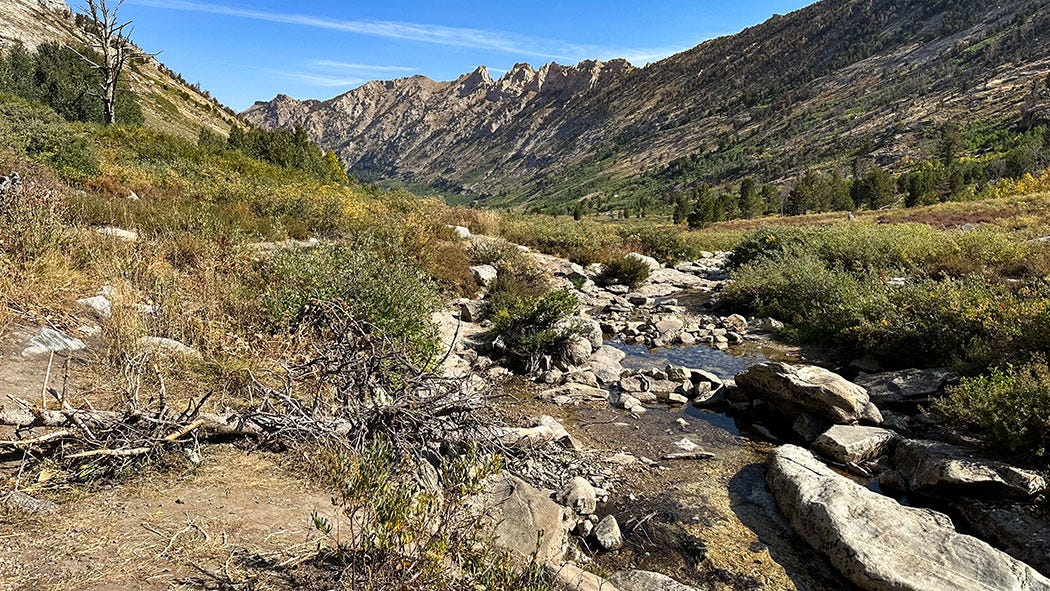
The next day took us 400 miles across Nevada to the Ruby Mountains, one of the classic ranges of the Basin and Range desert province and a destination we have long been meaning to visit. We pulled into a campground in Lamoille Canyon after dark on a Friday night — a risky gamble I do not recommend — and were fortunate to find an unoccupied site. Our luck was enhanced by the late season and the fact that the Rubys are pretty much in the middle of nowhere.
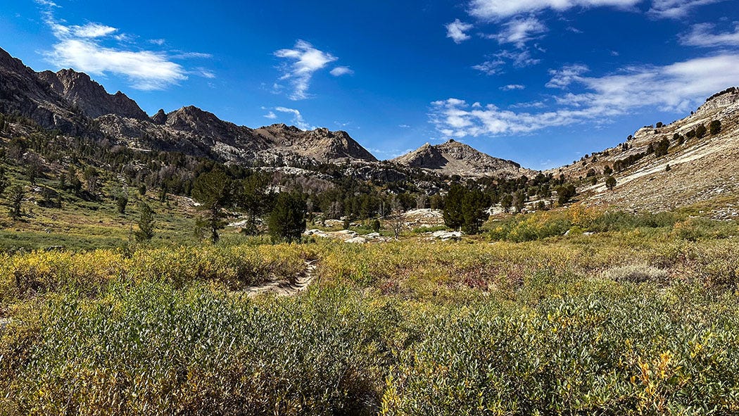
The next morning we drove the Lamoille Canyon Scenic Byway for 12 miles to its terminus at an elevation of 8,800 feet. It’s a short drive, but may be the most beautiful one in all of Nevada: Winding alongside a lovely creek among towering, glacier-sculpted granitic and metamorphic peaks, the paved road ends at a turnaround in a meadow dotted with beaver ponds at the foot of 11,387-foot Ruby Dome. The area lies within the Humboldt-Toiyabe National Forest, and a trailhead at road’s end beckons hikers into the Ruby Mountains Wilderness Area, with its abundance of backcountry lakes cupped by dramatic peaks.
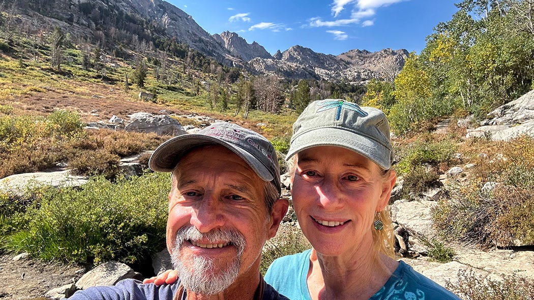
Alas, we did not have time to explore the trails during this visit. After a short creekside ramble among wildflowers and aspens, already beginning to turn autumn-yellow, we reluctantly headed back down to flatter ground and our next overnight destination: a Hipcamp site in the forested hills outside Pocatello, Idaho.
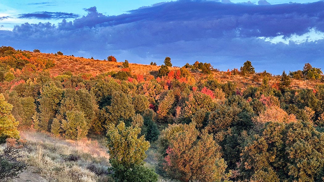
We found fall color there, too, the maples in the woods already bright crimson, and enjoyed a spectacular sunset from our hilltop camp. The next morning we were off for another long day of driving, which brought us to another Hipcamp site in Helena, Montana. From there, our fourth day on the road delivered us at last to our first significant destination: Glacier National Park, which abuts the U.S.-Canada border, and where we planned to spend four days.
Rising from the Plains
Approaching Glacier, the highway crosses many miles of High Plains grassland, the distant peaks of the Rocky Mountains stuttering along the horizon and growing almost imperceptibly larger as the miles pass. Then, after a preamble of modest rolling slopes and inclines, the mountains suddenly loom above you on all sides.
We skirted the town of Browning, Agency Headquarters for the Blackfeet Indian Reservation — home to Montana’s largest native tribe — and made our way to the park’s St. Mary Campground. It was late in the season and the reservation system had been discontinued for the year, so all sites in the large campground were available on a first-come first-served basis. We managed to snag one of the last unoccupied spaces, set up camp, and then walked across a bridge over the St. Mary River to explore one of the park’s visitor centers.
In theory it was a scenic walk, but the air was hazy with smoke from wildfires in Idaho that had drifted east, and the peaks around us were indistinct. The same had been true during my only previous visit to Glacier, more than 20 years ago, an unwelcome and disappointing coincidence.

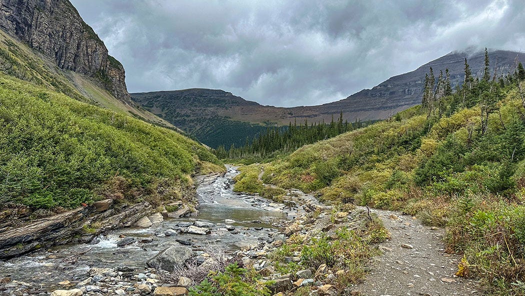
A weather front drifted into the area overnight, and in the morning we moved to a new campsite in the only campground loop that would remain open through our entire planned stay; the rest were scheduled to be closed for the season and the water system shut off. We set up camp in a light drizzle, ate lunch, and then donned rain gear for a pleasant loop hike over a ridge along the St. Mary River to a beaver pond in a tributary drainage.
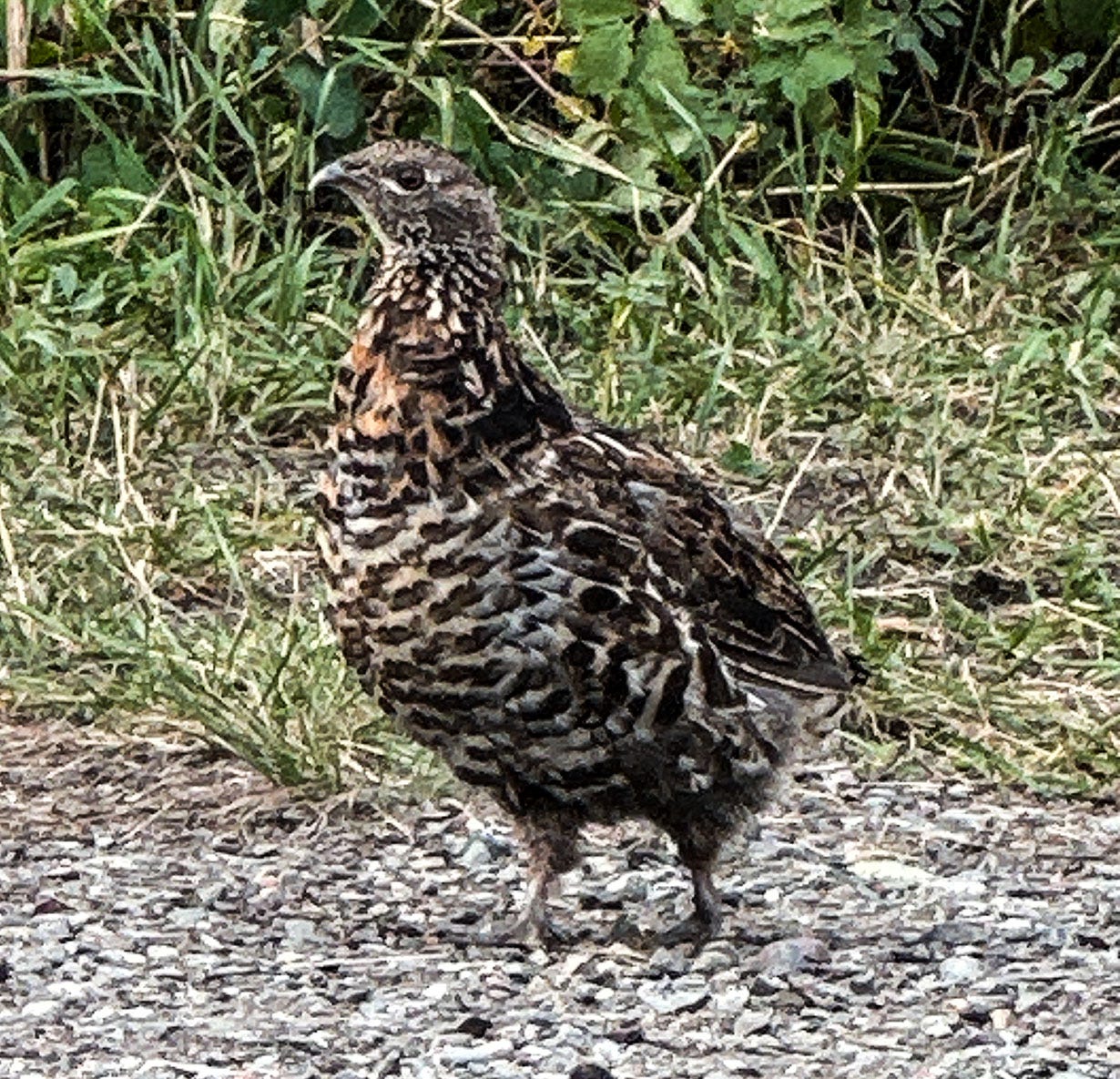
That evening, as we enjoyed a libation under the shelter of our van’s awning, a family of ruffed grouse hesitantly emerged from the shrubbery surrounding our campsite and quietly picked their way across it. Grouse are exquisitely camouflaged for foraging undetected in dense forest understory, and although they are fairly large birds, it is not uncommon while hiking to be nearly on top of them without knowing it, only to have them abruptly and quite noisily explode into flight under your feet. The “ruffed” in the species’ common name refers to the collar of neck feathers that males flare during mating displays, but they might as well be called Heart Attack Birds. This less-alarming and uncommon apparition was, as our fox encounter a few days later would be, a gift from the forest.
The next day again dawned damp, and as we enjoyed morning coffee we decided not to challenge the weather. We buttoned up Next Chapter and drove to East Glacier Park — which, confusingly, is not a park but a town on the edge of the national park — where we had lunch, and then back to Browning, to visit the Museum of the Plains Indian.
The museum’s parentage is unusual. It is operated by an obscure arm of the federal government, the Indian Arts and Crafts Board, lodged within the U.S. Department of Interior. The IACB was established by the Indian Arts and Crafts Act of 1935, a Depression-era law passed by Congress to improve tribal economies by outlawing the sale of counterfeit native American handiwork and promoting the sale of “authentic” Indian arts and crafts. In addition to the museum in Browning, the IACB operates the Sioux Indian Museum in Rapid City, South Dakota, and the Southern Plains Indian Museum in Andarko, Oklahoma.
The Browning museum was founded in 1941 and hosts a treasure trove of art, historic clothing, horse gear, weapons, and other artifacts of the Northern Plains people, including the Blackfeet, Crow, Northern Cheyenne, Sioux, Assiniboine, Arapaho, Shoshone, Nez Perce, Flathead, Chippewa and Cree. Its visual centerpiece is a large display of mannequins dressed in lavishly decorated clothing from the 19th and early 20th centuries, a dazzling gallery of expressive work that marries artistry and functionality.
Perhaps the most striking element of the display is the intricate beadwork and quillwork that adorns nearly every item, from storage bags and cradleboards to ceremonial dresses, capes, trousers and moccasins. There were also displays explaining the techniques used to create some of the many items on display — the beadwork stitching patterns, varying by type of bead and desired visual effect; the painstaking method for turning porcupine quills into brightly colored embellishments, which traditionally required that the softened and dyed quills be held in the artist’s mouth during the stitching process to keep them pliable. (There’s a good description of modern quillwork — which no longer involves holding possibly contaminated wild animal parts in your mouth — on this website.)
Detailing the techniques behind a work of art can have the effect of diminishing its magic, but in this case it did the opposite. Photography is prohibited in the museum, so we have no images to share, but the hours we spent there on a rainy Thursday left a lasting impression.
Whiteout
On our final day in Glacier, we took the free park shuttle to Logan Pass, where the east-west highway bisecting the park (known as Going-to-the-Sun Road, one of the better transportation-system labels in North America) crosses the continental divide. It’s a popular spot and the small parking lot at the visitor center there generally fills up by mid-morning, so the shuttles are generally the best travel option. They run every 15 minutes or so, and stop at several trailheads and picnic areas along the way.
When we boarded the bus at the St. Mary Visitor Center that morning, the weather seemed to have improved, sunshine and scattered clouds having replaced the previous days’ drizzles. But a few miles into the ride, as we commenced climbing toward the pass, we found ourselves ascending into clouds that clung thickly to the higher slopes and peaks. Visibility dropped steadily, and when we disembarked at the Logan Pass Visitor Center we could not even see it although it was only about 100 feet away.
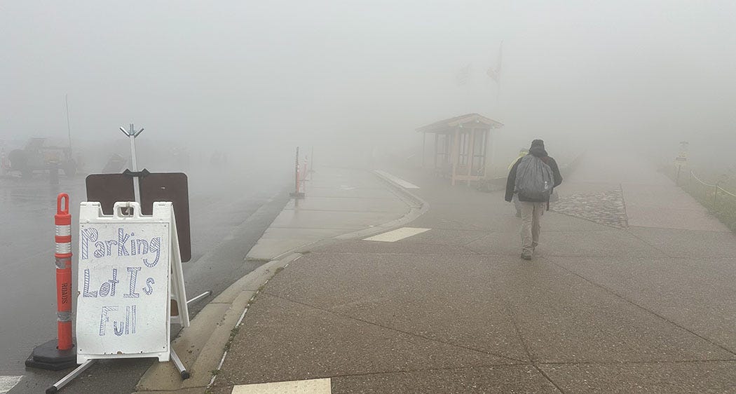
It was also cold and windy, and most of the scores of people whose cars clogged the parking lot had taken refuge in the visitor center, which was too crowded for comfort. We quickly caught another bus headed down the mountain, planning to get off at a nearby trailhead and hike to a suitable picnic spot for lunch.
This was not a good decision.
The fog had cleared somewhat, but as soon as we disembarked and started up the trail we were blasted by frigid wind and spitting rain. We pushed against it for a while, but soon decided we were out of our minds thinking this a suitable setting for al fresco dining. We headed back to the shuttle stop and waited for the next bus. And waited. Eventually a bus arrived but it was full and the driver said the other eastbound shuttles were parked at the visitor center while their drivers took a lunch break. By the time we were able to board one, we’d been standing in the cold, wet wind for an hour.
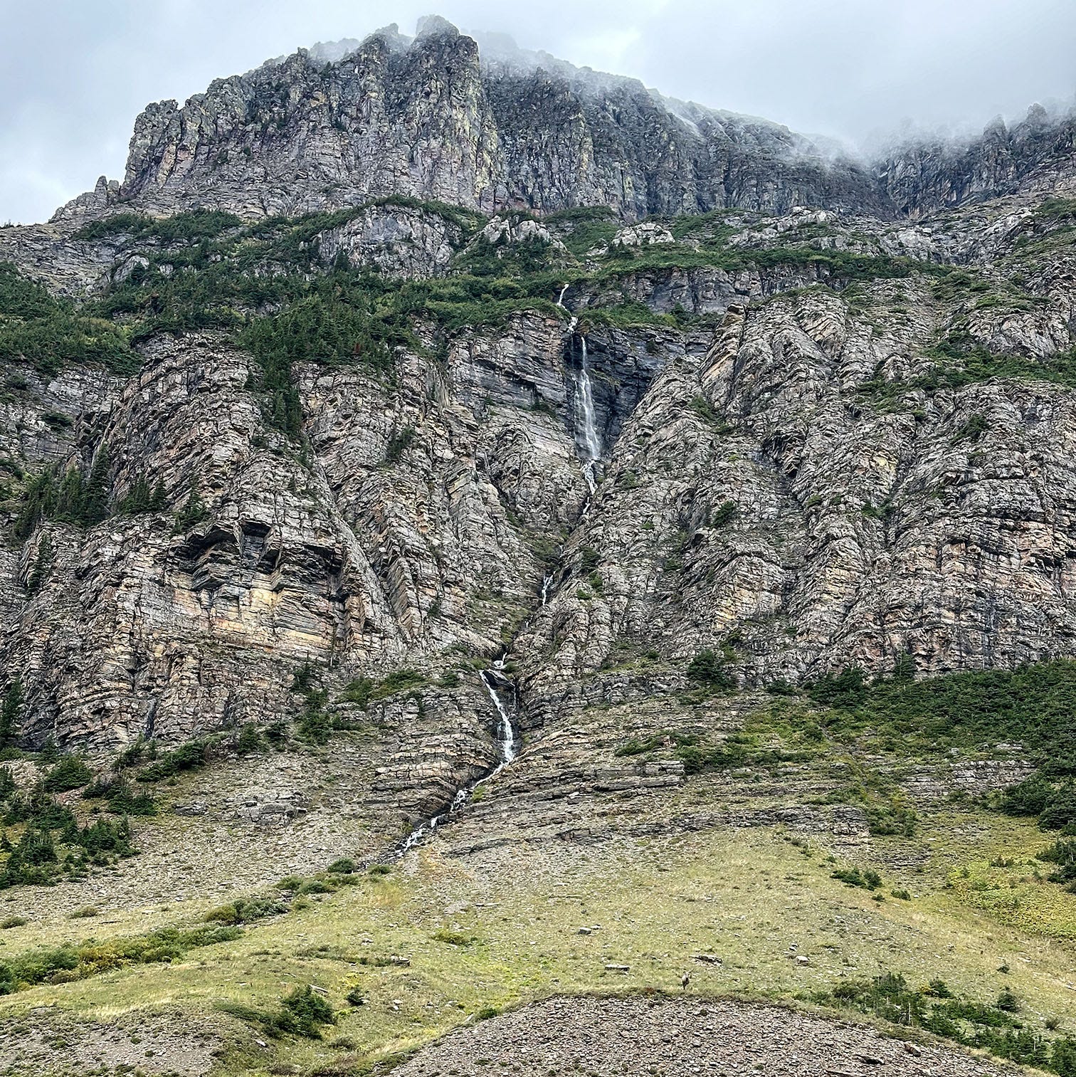
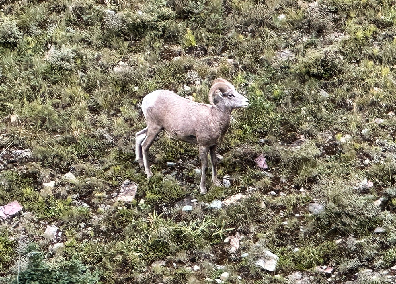
It wasn’t a total waste of time, though. The storm system had banished the smoky haze that had first greeted us in Glacier, so we had a great view across the canyon of a towering wall of stone decorated by a wispy waterfall. And while we shivered beneath the gloomy sky, a female bighorn sheep came careening down the rocky slope above us, rocketed across the highway and came to a halt along the creek below us, where it posed for photos. Another gift.
Coming in Part 2: Crossing Canada

Wow, John! When I saw Leslie a bit ago, I asked when you were going to write about this last adventure...she said, soon! AND I loved it. Can't wait for part 2.
Can't wait for part 2