


Names on the Land
Learning the stories behind what we call places

On our trip to Oregon this summer, my partner Leslie and I found ourselves piloting our camper van across the volcanic highlands west of Klamath Falls along one of the most unfortunately named rural byways we’ve ever traversed.
“Dead Indian Road” would be an ugly name under any circumstances, but it was particularly unsettling to be following that road through a sylvan fantasyland of sky-blue lakes and conifer forest dominated by old-growth Douglas firs. On one lakeshore, tucked within the Fremont-Winema National Forest, the road carried us past an expansive resort complex built on the ancestral homeland of the Klamath Tribes, who were forced from most of that homeland by the U.S. government in the 19th century.
Farther south, as the scenic byway winds through wooded mountains on its way to Ashland, signs along it change to indicate it is called “Dead Indian Memorial Road,” which is something of an improvement but still unfortunate, particularly in light of the fraught history of white-indigenous relations in this part of the West. But it reflects an attempt, however feeble, to modify or replace an old name to better reflect modern sensibilities and sensitivities.
Over the past few years, the United States has found itself in a slow-motion spasm of such renaming, as communities, institutions and public agencies across the country grapple with the modern implications of place names, building names, monuments and memorials from another time that honor slave holders, insurrectionists and architects of massacres. The same goes for names that employ what are now regarded as demeaning and derogatory terms for blacks, Native Americans, immigrants and other historically marginalized groups. Also up for discussion are modern labels that erased indigenous names from a landscape still occupied by the descendants of those who inhabited it centuries before Europeans and Americans showed up.
Leslie and I think about place names a lot when we are traveling. This is both a practical necessity for route-planning and an instructive exercise, for the truth is that every name on the land has a story behind it. And as a teller of stories I am also a collector of stories; crossing a new landscape is for me like reading a new book. The human history reflected in place names — and the ways they may have changed over time — can teach us much about what has happened there and what has been important to its inhabitants.
Grappling with history
According to the Historical Marker Database, there used to be a roadside monument along Dead Indian Road, erected by Oregon Travel Experience and the Confederated Tribes of Siletz Indians, explaining the origin of the name, but it has since been removed. Here’s what it said:
Long before the first Euro-American emigrants trekked westward, this road was a trail used by the Takelma and Shasta Peoples as a trade route. With the arrival of settlers and gold-seekers, the trail quickly became a wagon road called “Indian Market Road.”
During the 1850s, the increased population of Euro-Americans, their occupation of traditional food gathering areas, and often hostile behavior, caused the most serious “Indian Wars” in U.S. history. In 1854, the bodies of several dead, possibly murdered, Native Americans were discovered along this road in a narrow prairie several miles northeast of this marker. For many years thereafter this portion of Oregon was known as the “Dead Indian Country,” and until recently, this road was officially called “Dead Indian Road.”
Recognizing the negative connotations associated with the name “Dead Indian Road,” and acknowledging that many Native Americans lost their lives in this valley as a consequence of westward expansion, the name was changed to “Dead Indian Memorial Road” in 1993.
In explanation of the marker’s removal, the database entry says this: “This Oregon 'Beaver Board' historical marker was permanently removed in 2017 by the City of Ashland as part of local and worldwide political correctness movements.” Despite assiduous Googling, I have been unable to locate any other documentary explanation for the decision, and this one bears a hint of conservative rural Oregonian disdain for “liberal” Ashlanders, but there you have it.
Both of the road’s names take on additional significance, however, when considered in the larger context of Klamath Country history.
As the sign once noted, whites began moving into the Klamath Basin in the mid-1800s, and in 1864 The Klamath Tribes — now a confederacy comprising the Klamath and Modoc tribes, and the Yahooskin band of Snake Indians — were pressured into signing a treaty under which they ceded more than 20 million acres of their ancestral lands to the U.S. government. Accepting confinement on a reservation of less than 2 million acres, they retained the right — at least on paper — to hunt, fish, gather and trap on their ancestral lands in perpetuity.
The natives were, of course, eventually prevented from accessing most of their ancient subsistence grounds, as land passed into private or federal ownership. Against long odds, however, the tribes managed to become economically self-sufficient on their reservation lands through livestock and logging operations.
But efforts to whittle away their assets did not end in the Civil War era. In 1954, under a policy by which the U.S. government hoped to force American Indians to join the majority culture, the Klamath Tribes were “terminated” by congressional decree — no longer recognized as sovereign entities by the United States, federal social-service programs canceled, reservation lands seized and sold. In essence, Congress perversely declared that because the tribes had managed to become economically self-sufficient, they were ready for assimilation, which meant they no longer needed the reservation timber and ranch lands that had enabled them to become economically self-sufficient.
Twenty years later, the Klamath Tribes won a court ruling that they had not relinquished their traditional hunting, fishing and water rights when they ceded their lands, and in 1986 they regained federal recognition of their tribal status. They are still negotiating for return of the reservation lands lost through termination, most of which ended up in what is today’s Fremont-Winema National Forest.
The same year the roadside marker explaining the origin of Dead Indian Memorial Road’s name was removed by the city of Ashland, the Jackson County Board of Commissioners considered renaming the road, which is under the county’s jurisdiction, and even conducted a poll to gauge community support for the idea. Ultimately it decided not to do so, although the Oregon Geographic Names Board recommended that Dead Indian Soda Spring, Dead Indian Mountain and Dead Indian Creek all be renamed to recognize the native Latgawa tribe, a change approved by the U.S. Board on Geographic Names that took effect in 2021.
Localities all over the country are grappling with similar issues, and so are states and the federal government. In 2020, for example, California State Parks launched a program under the state government’s Re-examining Our Past Initiative to “identify and remove residual derogatory place names; inappropriate honorifics associated with the historical legacy of some of its monuments, statues and plaques; and inadequate interpretive programs or exhibits that fall short in fully contextualizing California’s history in parks.” And three years ago, Interior Secretary Deb Haaland ordered the U.S. Board on Geographic Names to develop a process to remove the term “squaw” from all place names on federal lands, and established a federal advisory committee “to broadly solicit, review, and recommend changes to other derogatory geographic and federal land unit names.”
The power of a name
One of the older books in my reference library is George R. Stewart’s Names on the Land, a classic history of how many American place names came to be. It was first published in 1945; my edition is the revised and expanded third (and final) version published in 1967. (Alaska and Hawaii were not states when the 1945 and 1958 editions were published, and Stewart thought it necessary to rework the material to reflect this status.)
Early in my writing career, Stewart’s book — although somewhat dated even then — helped kindle my fascination with how the features of our landscape came to be named, what those names mean or represent, and how the power to name things reflects the exercise of power over how they are used, owned and remembered. Place names influence and reflect the stories we tell ourselves and our descendants about the history of the landscape that has shaped us and which we in turn have shaped.
Leslie and I have encountered examples of this renaming process in action during our travels over the past four years, since we launched our post-retirement Next Chapter adventures. The first came early, only two months after our inaugural trip with the van in 2020, when we journeyed to California’s North Coast to celebrate Thanksgiving among the redwoods.
It's difficult to recall now what that holiday journey felt like. It was during the height of the COVID lockdown, with social distancing and isolation the norm, traditional family gatherings ill-advised and most public gatherings prohibited. Our new van was the “perfect pandemic bubble on wheels” (described as such by our good friend Ed McFadden), so Leslie and I planned an outdoor observance of the holiday in a remote part of the state — a modest attempt to carve an episode of normalcy out of the disorienting and nearly hallucinogenic abnormality of that year.
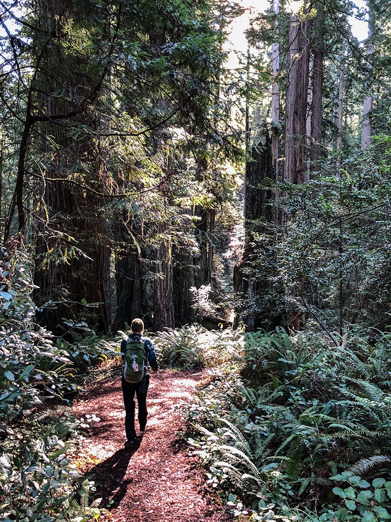
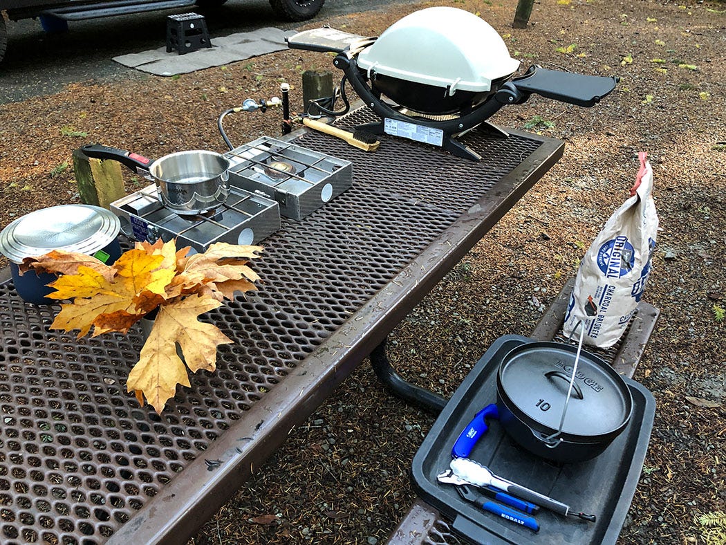
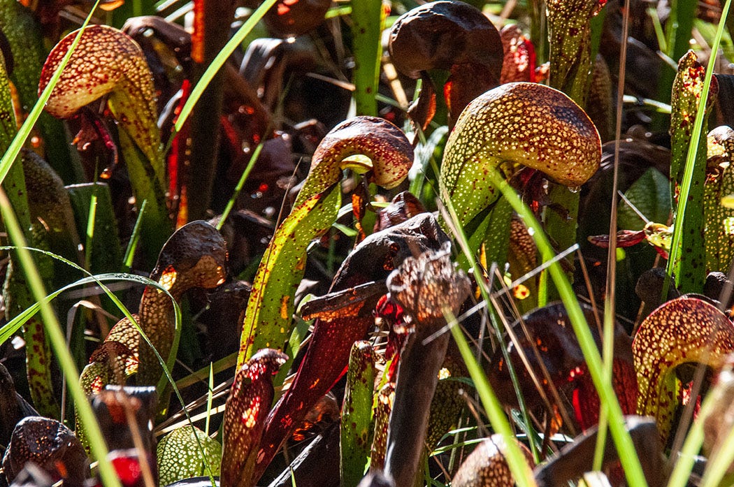
After a journey of several days, we ended up alone in a campground on the bank of the Middle Fork Smith River in Six Rivers National Forest. We explored the area, hiking among the big trees in Jedediah Smith Redwoods State Park, visiting a pitcher-plant bog, hanging out on the Smith’s shoreline amid autumn-fired foliage. And we enjoyed a Thanksgiving feast in camp: turkey breast cooked on our portable propane grill, dressing baked in a cast-iron Dutch oven on coals in the fire pit, gravy and sides brought from home. All things considered, it remains among the most memorable holiday dinners I can recall.


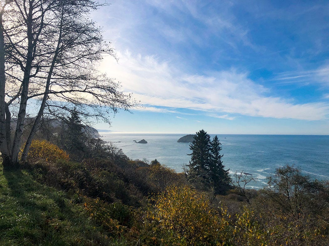
One of our stops during the drive to the redwoods was a picnic area in Patrick’s Point State Park, 30 miles north of Eureka, with a striking view of the Pacific. According to California Parks, the name references Irish homesteader Patrick Beegan, who in 1851 “recorded a preemption claim on the westernmost promontory of the peninsula and built a small cabin there. Beegen was implicated in the murder of a Native American boy in 1854, then escaped to the Bald Hills, east of present-day Orick. In 1864, he led a militia to a Native American village where numerous Indigenous people were massacred . . . When the State of California purchased the site in 1930 and brought it into the State Parks system, they adopted the name already widely in use at the time, Patrick’s Point.”
(Beegan’s “preemption claim” refers to the Preemption Act enacted by Congress in 1841. Unlike claims filed under the Homestead Act of 1862, which made public land available for free, a pre-emption claim gave the filer the right to eventually purchase up to 160 acres from the federal government at the base price of $1.25 an acre. It was intended to provide a legal means for squatters to to obtain title to federal land even before it had been surveyed, systematically subdivided and offered for sale by the U.S. government under the process established by the Ordinance of 1785, still the governing statute at the time.)
In light of the dismal association between the state park and a presumed participant in massacre, the Yurok Tribe petitioned the state in January 2021 to rename Patrick’s Point to reflect the word their people have long used to refer to a prominent rock formation on the peninsula, Sumêg (pronounced “soo-may” and meaning “always done” or “habitually done”). On Sept. 21, 2021, the California State Park and Recreation Commission unanimously granted that petition, and by the next time we stopped there for a road-trip picnic lunch (in March 2022), the signs had been changed to identify it as Su-meg State Park. It was the first park to be renamed since the state launched its re-evaluation program.

New names, new stories
The most common renaming we’ve directly or indirectly encountered during our travels is associated with Interior Secretary Haaland’s 2021 order that the derogatory term “squaw” be removed from all place names on federal land. The U.S. Board on Geographic Names responded by announcing nearly 650 new names, approved in September 2022 and January 2023 after an extensive public review process. They are scattered primarily across the landscape of the West, although no part of the country was immune to Euro-Americans’ habit of appending “squaw” to the landforms they encountered in North America.
In Utah alone — the state where we have probably spent the most time traveling and exploring in Next Chapter — 50 place names are on the board’s list. Some of the new names represent simple substitution using non-controversial names appended to nearby features, such as “Squaw Butte” in San Juan County becoming “Salt Flat Butte.” Many, however, replace the offensive term with an indigenous one — “Squaw Spring” in the same county (the heart of southern Utah’s canyon country) becoming “Tukuhnikivatz Spring.”

I have no idea what the many new indigenous-derived place names mean, how to pronounce them or what stories they tell, but I look forward to learning them.
The frequency with which indigenous names appear on the list of renamed landmarks and features, many of them the result of tribal consultation, puts the lie to one of the unfortunate elements of Stewart’s book: his assumption that many place names were bestowed on rivers, lakes, mountains and valleys by white newcomers because the natives already there had not named them. He states this plainly in one of the introductory chapters of Names on the Land:
The more distinct a place was, the more likely an Indian was to name it. A small lake set cleanly in the forest was a thing in itself, as individual as a person; so was a small island or a single up-standing rock.
Also, the more useful a place was, the more it was frequented, and the more it needed a name. If a bay had a mud-flat with a fine oyster bed and another without any, there was no need of wasting a name on the useless one.
On both counts, mountains generally went unnamed. They were huge and vague; they mingled with one another, and faded off into their own shoulders; no one was really sure just where a mountain began. Some high peaks served as landmarks, but most mountains were of little use. An Indian might have names for the game-haunted glades on the slope, and for the lakes and streams where he fished — but no name for the mountain itself. Most of the resonant Indian names of high peaks were placed there later by white men.
Stewart was very much a man of his time, and although he was a diligent scholar of geography, he appears to have been blinkered by the unconscious biases and assumptions common among mid-20th century historians. It seems not to have occurred to him that there is a plausible alternative to his theory that mountains and other features were named by white men because the Indians hadn’t done so themselves.
Perhaps nobody bothered to ask the natives what they called them. Until now.
Nice post John, really enjoyed it. Dale and I (ask Leslie who we are haha) attended Humboldt State and many of our early dates were to "Patrick's Point". I never thought about how it was named, it just was. Do you know if Sumeg Rock is what we knew as " Wedding Rock" at the park?
Fresno County is currently fighting tooth and nail to keep from renaming "Squaw Valley" to Yokohl Valley.