Books have a habit of sticking around once they’ve made it into my house. Not all of them, to be sure; I routinely pass some along to family and friends after I’ve finished them, others I box up and donate to the Friends of the Library.
It’s mostly the fiction that escapes. Nonfiction tends to be stickier, especially those works that have shaped my thinking about subjects that have been important during my career as a journalist and author. I appreciate being able to pull them off the shelves now and then, like dropping in on an old friend or colleague, when I need to refresh my memory about a fact or line of reasoning pertinent to a project I’m working on.
A recent road trip with Leslie in our Next Chapter camper van sent me back to the bookshelf. I own only one book by Gerald Haslam, but it helped change the way I think about my native state and so I keep it around. It’s called The Other California: The Great Central Valley in Life and Letters, a collection of 19 essays about the landscape, communities, economy and people of the state’s vast interior heartland. It was first published in 1990, and revised and expanded in a 1993 edition.
Before I first picked that book up three decades ago, I thought about California’s internal political, cultural and economic divides in terms familiar to most Golden State natives: It was north and south, the San Francisco Bay Area vs. the Los Angeles Basin, Wine Country (and later Silicon Valley) vs. Hollywood, Giants vs. Dodgers.
Continuing sports rivalries notwithstanding, the competition between north and south has not truly been all that intense since the late 19th and early 20th centuries when civic and business boosters in Los Angeles and San Francisco were vying for economic supremacy on the Pacific Coast. Haslam’s writing opened my eyes to the fact that the most potent political, cultural and economic divide in the state more recently is longitudinal, between the urban coast and the more rural interior. If you spend much time traveling around California, as I have since then, this becomes abundantly clear, but early in my career it was a revelation.
There’s a similar coastal-interior dichotomy in the other states that border the Pacific. Leslie and I have experienced this during numerous sojourns in eastern Washington and Oregon, most recently a springtime trip that culminated with a five-day rafting adventure on the Owyhee River. After our return, I dipped into Haslam to refresh my appreciation of the fact that the relatively empty corners of the West, far from the centers of power and wealth, harbor stories worth telling.
Down the river
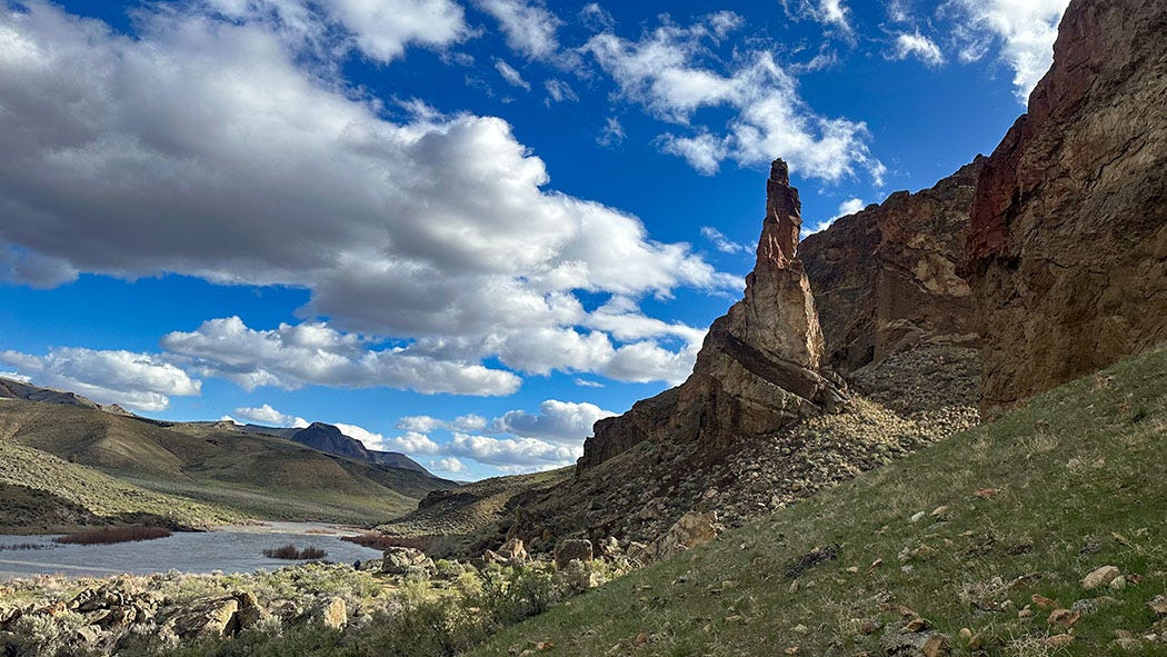
The Owyhee rises in the arid mountains of northeastern Nevada and runs generally north for about 400 miles, crossing the southwestern corner of Idaho and a slice of southeastern Oregon before meeting the Snake River on the Oregon-Idaho border. Along the way, the river has carved a thousand-foot-deep canyon into the volcanic Owyhee Plateau, a chasm that rivals its more famous cousins in the redrock country of Utah and Arizona for sheer beauty and wildness. A 120-mile stretch of the Owyhee through this desert landscape of sagebrush and junipers, mountain lions and pronghorns and bighorn sheep, was designated a Wild and Scenic River in 1984. Altogether, the Owyhee canyonlands encompass more than 2 million acres, half of which have been identified by the Bureau of Land Management (BLM) as candidates for wilderness protection. It is, according to advocates pressing for federal recognition of these qualities, “one of the most wild, diverse, yet under-protected landscapes in the U.S.”
Needless to say, this is not the Oregon of Portland and the verdant Willamette Valley, of craggy coastline and Crater Lake. It’s dry, not drippy; drab and dun, not emerald and evergreen.
One quality that sets the Owyhee apart from many commercially rafted Western rivers is its remoteness. You will drive for hours across the southeastern quadrant of Oregon without encountering anything that might be called a town. It’s a region of more cows than humans, thousands of square miles of unpaved countryside patchworked by hardscrabble cattle ranches. It is unencumbered by luxury and indulgence, and you will search in vain for a cell signal or a market selling fresh produce.
Which makes it just our kind of destination.
We rolled into the BLM’s Rome campground and boater launch site in mid-afternoon the day before our river trip was to begin. It was April 20, and we had been on the road for a week, spending time in Utah around Boulder and exploring a magnificent rock art site near Price, among other adventures. The parking lot was crowded with cars and vans and pickups and boat trailers, although there were relatively few people present, most of the vehicles’ owners being somewhere downstream. We parked in a campsite along the water and settled in, taking refuge inside the van from the cold and drizzly damp as evening fell upon us. It might have been spring at home, but winter had yet to loosen its grip on the Owyhee country.
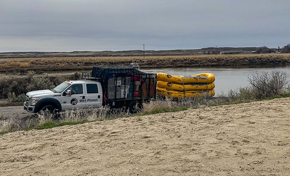
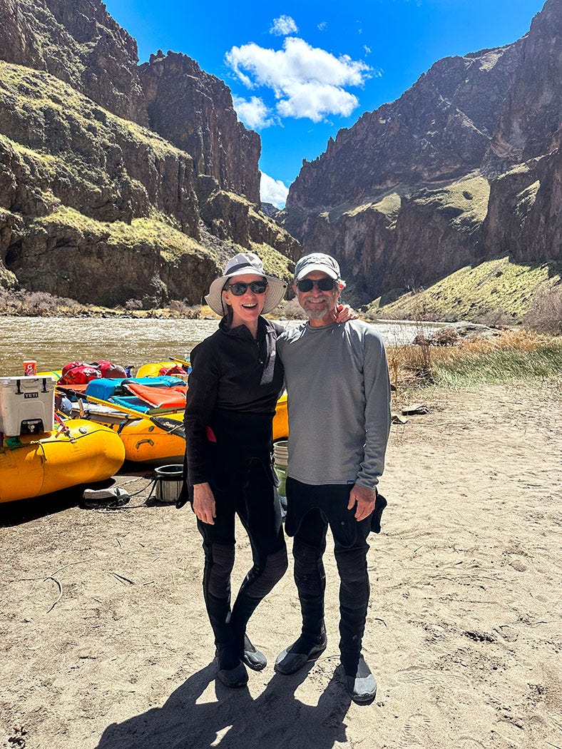
Sometime during the night, the campground filled up. When we awoke the next morning, the campsites were busy with boaters swilling coffee, sorting through river gear and preparing to launch, including our guides with Wet Planet Whitewater. We wandered over to meet them at 8 a.m., and they handed us dry bags, wetsuits, splash tops and life jackets — our on-the-water kit for the next few days. We changed and packed, moved Next Chapter to the long-term parking area, and prepared to shove off.
Our group consisted of 14 guests in five 18-foot oar rafts, each rowed by a guide. It was cloudy and 46 degrees when we launched (water temp was around 42), and it was not long before Leslie and I — and pretty much everyone not actively rowing — figured out we had under-dressed for the conditions. The breeze on the water was bitterly cold, and by the time we stopped a few miles downstream for lunch, we were shivering enough to raise concerns about hypothermia. The guides allowed us to break into the dry bags to grab warmer clothing, which made the afternoon much more endurable.
Another quality that sets the Owyhee apart from many of Western rivers popular with boaters is the capriciousness of its flows. Erratic snowmelt and rainfall drive its hydrology, meaning it is largely unpredictable. “About the best one can say is that in most years the river gets one or more surges of runoff sometime between February and May, then recedes to unboatable levels by mid-June,” according to my venerable copy of Western Whitewater, a bible for river runners. “Some years the river has no season at all, some years it stays runnable through early July, and some years the runoff pattern is so fluky that the hydrograph looks like the Dow Jones Industrial Average.”
Just before our trip launched, the river flow had been dropping, from a high of 8,200 cubic feet per second (CFS) on April 18 to 3,200 CFS on April 21, the day we put in. Then it started raining, and the flow surged to nearly 5,200 CFS over the next two days.
Tip: An NBA basketball has a volume of roughly a cubic foot, so the standard way water wonks translate that flow rate into a more graphic mental image is to suggest that you visualize 5,200 basketballs flying past you every second.
Go ahead and try.
Yeah, I can’t do it either. But CFS numbers do not really tell you much about what a river will feel like. The only way to know that is to just hop in a big inflatable boat and ride it.
Answer in this case: A high-speed, high-octane blast, seasoned with drizzle, boxed wine and campfire smoke.
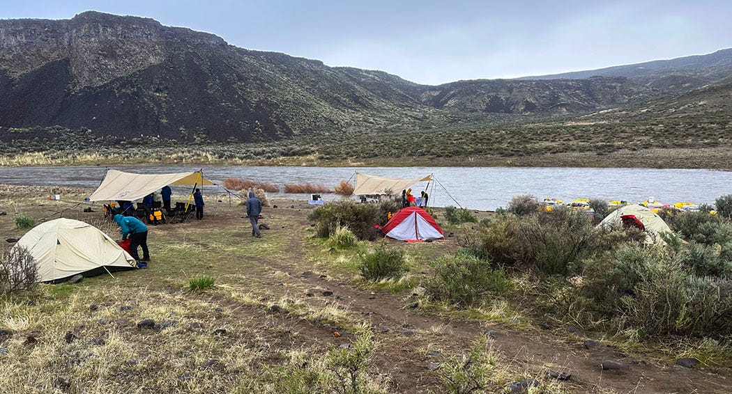
By the second day, we had our on-the-water clothing layers dialed in. Remaining comfortable, we learned, required long underwear beneath a wetsuit, topped with a fleece sweater, a down jacket, and a waterproof outer jacket. It was easily the coldest river trip I can recall. But the canyon is ruggedly spectacular, the current was swift, and our campsites, although sometimes wet, always commanded magnificent views of eroded rock and flowing water. At one, we washed off the chill of a cold day on the water by soaking in a natural hot spring, legacy of the canyon’s volcanic ancestry. In another, we set up our tent in a rocky alcove surrounded by petroglyph-incised basaltic boulders, legacy of the indigenous people who first inhabited the region 5,000 years before white trappers and settlers stumbled across it.
Stories of the Other Oregon
About that name …
Owyhee country was long home to the indigenous Shoshone, Bannock and Paiute people. What they called the river appears lost to history, although the Shoshone are known to have referred to the Snake River as Bia Ogwaide, or “big river.” Outsiders made their way into the region in the early 1800s, when fur trappers and traders of the Montreal-based North West Company began exploring and exploiting the Snake’s watershed, primarily seeking beaver. The company’s men entered southeastern Oregon in 1818-1819, and dispatched a party of native Hawaiians — the Big Island was known as “Owyhee” in that era — to explore an uncharted river. They were never seen again. The river and surrounding countryside were named for the vanished “Owyhees.”
Surprisingly, a significant number of the trappers and canoeists employed by the North West Company and its competitors, including the Hudson’s Bay Company and John Jacob Astor’s American Fur Company, were native Hawaiian islanders. The paddling part makes sense (Polynesians have long been legendary for the water skills) but specializing in fur trapping might seem odd for people whose native country is devoid of fur-bearing creatures. But Hawaii was a regular rest and re-provisioning stop in the 19th century for ships traveling around Cape Horn on their way to the Pacific Northwest, and histories of the fur trade report that Hawaiians were often recruited to join exploring and settling expeditions on the West Coast because they possessed skills — gardening, pig husbandry, swimming and paddling — difficult to find among the usual ship’s complement. So, there’s a quiet strand of Hawaiian history woven through the tapestry of Pacific Northwest settlement
There are other unexpected strands as well. We ran across one of them on our way home, following our adventure on the Owyhee.
Our final day on the river found us transitioning from whitewater to flatwater as we reached Owyhee Reservoir, 52 miles upstream from the dam that impounds it. With the lake level rising from rain early in our trip, we had to cross several miles of slackwater lake against a headwind to reach our takeout. That can make for a fantastically unpleasant rowing exercise in a heavily laden gear boat, so the crew lashed the rafts together and deployed a small outboard motor to push our unwieldy flotilla to the boat ramp at Leslie Gulch.
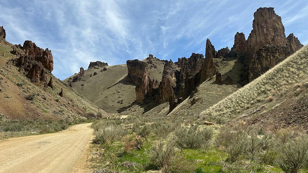
Next Chapter had been shuttled to the takeout for us, so after de-rigging the boats, retrieving our gear and saying our goodbyes, Leslie and I loaded up for the slow drive on a maze of unpaved roads back to Highway 95, also known as the ION Highway because it links Idaho, Oregon and Nevada. We were bound that afternoon for an Airbnb in Nampa, Idaho, where hot showers and cold cocktails awaited us.
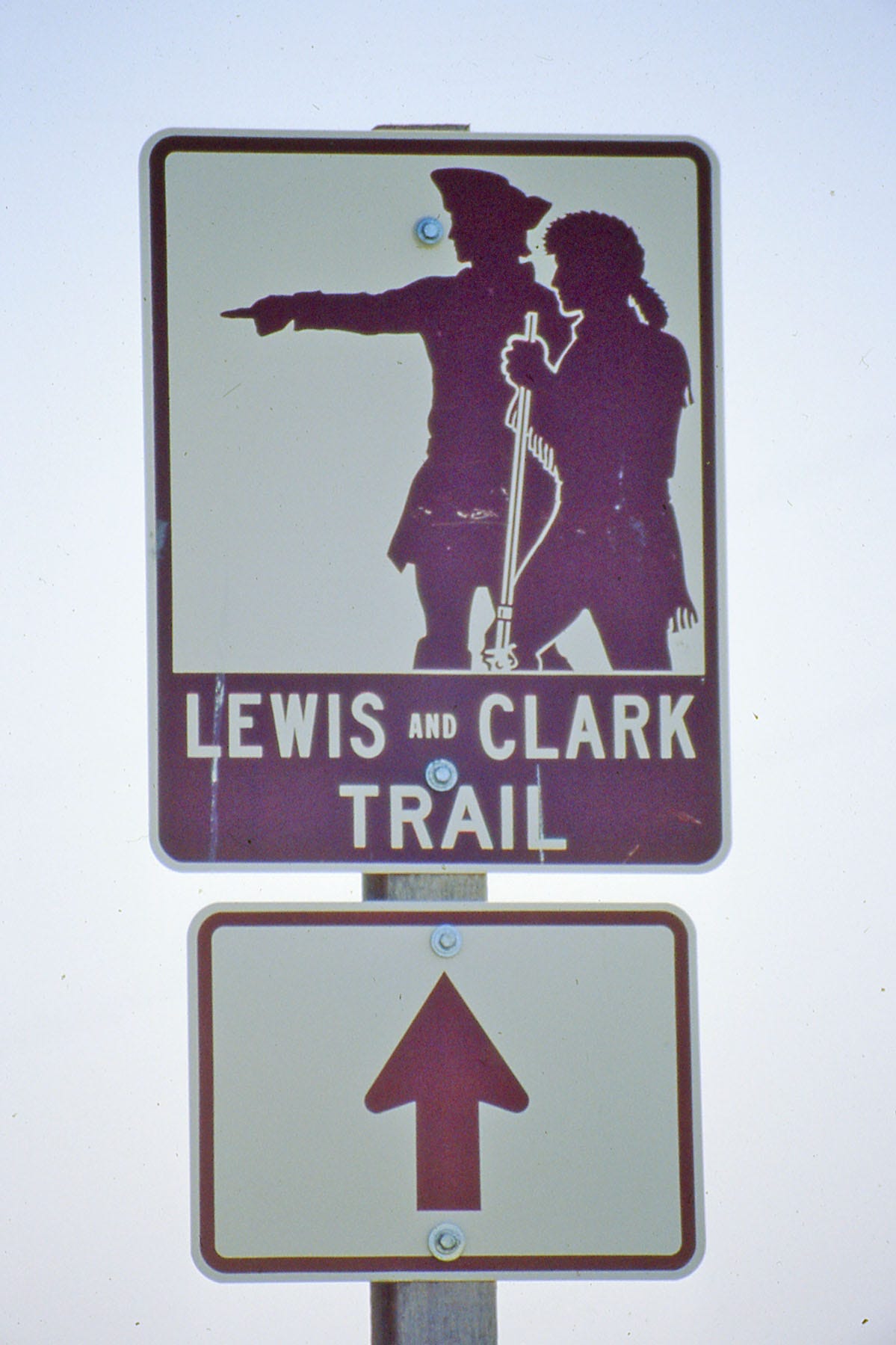
Along the way, on the lonely ION Highway in largely empty countryside, we passed a sign that at first glance might seem remarkably out of place: a Lewis and Clark Trail marker, one of hundreds erected along the Lewis and Clark National Historic Trail between St. Louis and the Pacific Coast to mark the route of the 1803-1806 expedition and identify points of interest. This one pointed to the ghost town of Danner, a few miles down a dirt road.
The Lewis and Clark expedition, however, never came anywhere near Danner and the Owyhee. The closest point would have been the Snake River downstream of Idaho’s Clearwater River and upstream of its confluence with the Columbia in eastern Washington — 240 air miles north of the road marker.
Although we did not detour on our recent trip, I visited Danner and the site responsible for the highway marker 20 years ago, when I was retracing the Lewis and Clark Trail for a reporting project and eventual book. That’s because Danner — specifically, a small cemetery next to the ruins of a 19th century mail drop and traveler’s lodging there called Inskip Station — is the final resting spot of the youngest member of Meriwether Lewis and William Clark’s Corps of Discovery: Jean Baptiste Charbonneau, the son of Sacagawea, a Shoshone woman, and Toussaint Charbonneau, a French-Canadian fur trader.
The child was born during the expedition’s 1804-1805 winter camp near a Hidatsa village in North Dakota. Hired during that stopover as interpreters, his parents both accompanied the expedition to the Pacific and back, bringing infant Jean Baptiste along for the transcontinental ride.
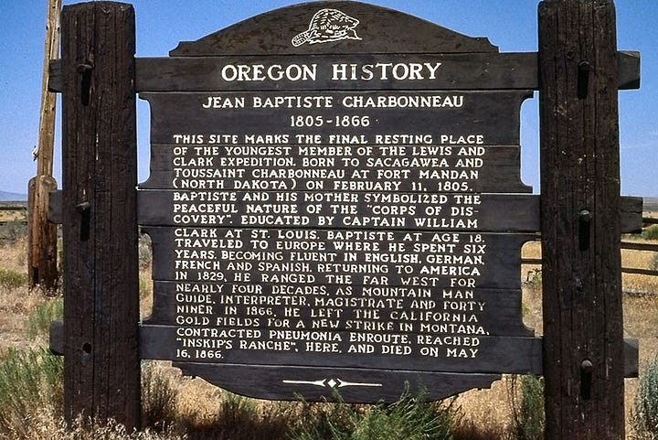
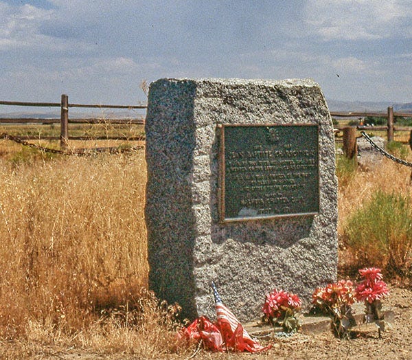
That early experience traveling across thousands of miles of uncharted wilderness seems to have been formative, for Jean Baptiste subsequently led a peripatetic life. He spent several years as a child with William Clark in St. Louis, and later traveled for years in Europe, where he hobnobbed with royalty. As an adult he ranged far and wide across the American West, becoming a skilled outdoorsman, wilderness traveler and all-around mountain man. He worked as a hunter, interpreter, trapper and scout, and helped guide the Mormon Battalion during the Mexican-American War in 1848 as it blazed the first wagon road from Santa Fe to San Diego.
Remaining in California afterward, he served as alcalde — a combination of sheriff, magistrate and lawyer — at Mission San Luis Rey de Francia (in what is today Oceanside) during the chaotic postwar transition from Mexican to American governance. He later joined the ‘49ers mining for gold in the Mother Lode, and clerked at a hotel in Auburn.
He left Auburn in 1866 at the age of 61, and headed northeast, perhaps bound for newer gold fields in Idaho or Montana. His journey took him into southeastern Oregon, where according to one biographer, he was involved in some sort of accident at a crossing of the Owyhee River near the site of today’s pinprick “town” of Rome — the same access point where our rafting trip launched. He was injured or became ill, and his fellow travelers brought him to the nearest settlement, Inskip Station. He died there, probably of pneumonia.
So this, too, is a strand in the storyline of the Other Oregon: In a remote corner of Owyhee country lies the grave of a man whose life encompassed the most remarkable journey of exploration in the history of the West, a distinctive episode in an American war of conquest against a neighboring nation, and the state-birthing tumult of the California gold rush. No landscape with a story like that can truly be considered empty.


John, you write like a river, but not the fast and furious one you just described. Rather a clear, full-throated flow that eddies in unlikely places so we can enjoy the unexpected. Thank you!
John, I "save" your Next Chapter Notes to read when I can quietly sit and absorb and appreciate. Oh my - I learn so much history while enjoying your adventures at the same time - wet, cold, wild - then followed by times a bit more warm, comfy and luxurious. And finally wrapped up in lovely historical context. Betsy described your writing perfectly. We are huge Heather Cox Richardson fans - you are the "HCR" of exploring the Western U.S.