Every River Tells a Story
Encountering conduits of life and lore in a semi-arid land
Rivers often play a starring role when Leslie and I are on a road trip, typically as the venue for whitewater rafting adventures. Bouncing around for several days in an inflatable boat as a river carries us through forests and canyons, while periodically smacking us in the face with icy waves, is one of our favorite ways to experience the outdoors.
But even when they are not serving as a vehicle for adventure, the rivers we encounter as we traverse the open spaces of the West always beckon to us, often prompting detours as we seek out the stories they have to tell. Some are big and brawny, others a mere trickle, but in a largely semi-arid region like the West all rivers are conduits of life and lore.
During our August journey to the coalfields of southeastern Colorado in our Next Chapter adventure van, we encountered two such rivers. We did not paddle on either of them, but we did pause to contemplate their place in the physical and human landscapes. Just as those waterways have shaped their geographic surroundings and influenced the cultures of their neighbors, they have in turn been modified by the people who have lived along their banks, making the history of each watershed layered and complex.
One river was familiar to us from a previous trip, while the other was a stranger we hope to get to know better in the future. First, the old friend.
An otherworldly landscape
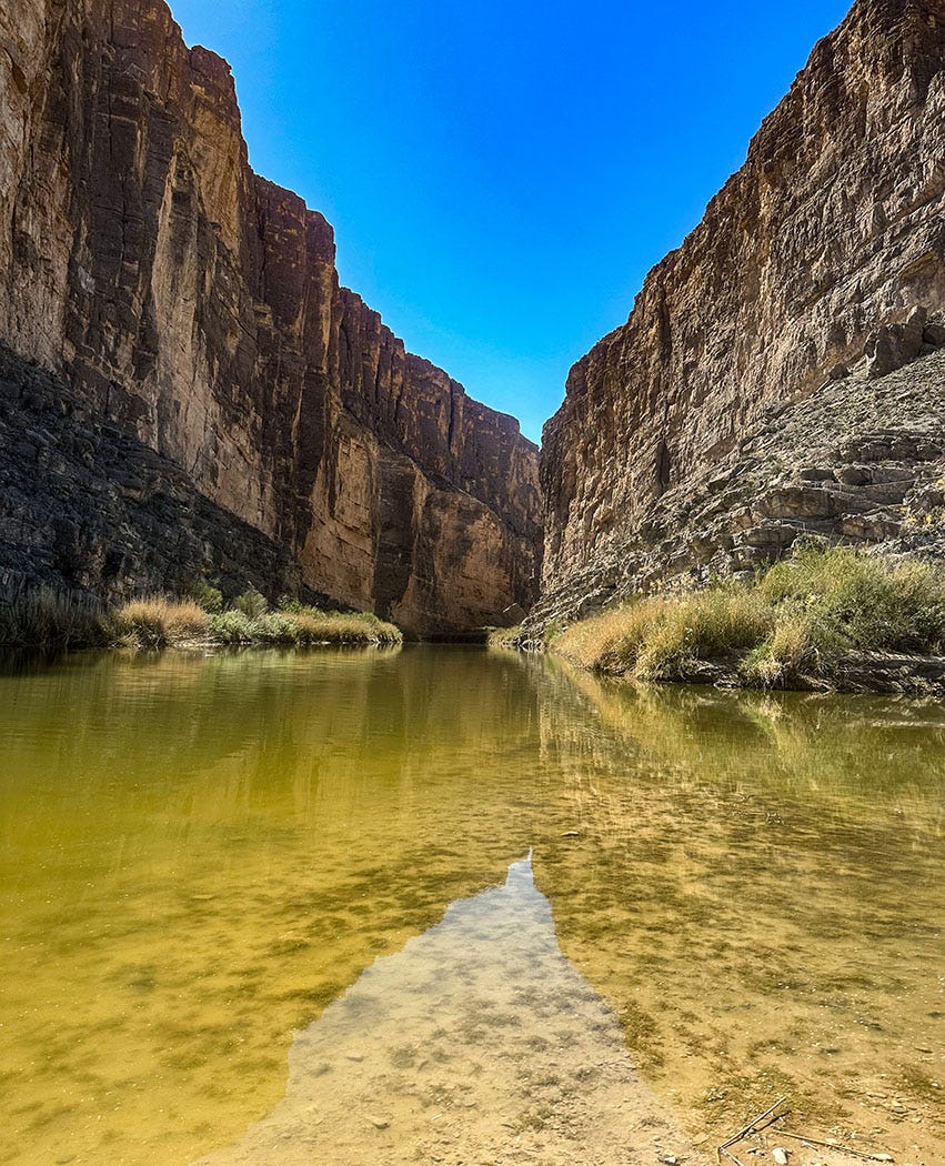
The Rio Grande is familiar to many for its role as the aqueous 1,200-mile border between the U.S. and Mexico along the southern edge of Texas. That’s where we met it back in the spring, when our travels took us to Big Bend National Park. By the time it reaches the Big Bend region, the river is a listless, enervated water body, 95 percent of its average annual flow depleted by diversions for municipal and agricultural use upstream, and the paltry remainder sapped by the harsh aridity of the Chihuahuan Desert.
Eventually it flows into the Gulf of Mexico at the border town of Brownsville. That’s where I met it for the first time, when I was visiting the Lower Rio Grande Valley in 1998 to interview cotton farmers and wildlife experts for a series of newspaper stories I was working on.
But the 1,900-mile-long river rises in alpine county, high in the San Juan Range of the Colorado Rockies. Long before it becomes a desert river it is a mountain stream — clear, cold, fast-flowing, popular with whitewater rafting and kayaking enthusiasts. From its headwaters in southwestern Colorado, it bisects New Mexico from north to south on its way to Texas, and it supports a robust commercial guiding industry in the small towns along its course.
New Mexico is where we crossed its path for the second time this year, during our August road trip in search of family history around Walsenburg, Colo. We stopped for two nights in Taos, and spent a day exploring the area on a drive that took us up into the Sangre de Cristo range — a welcome refuge from the heat of the lower elevation in town — and then to Rio Grande del Norte National Monument.
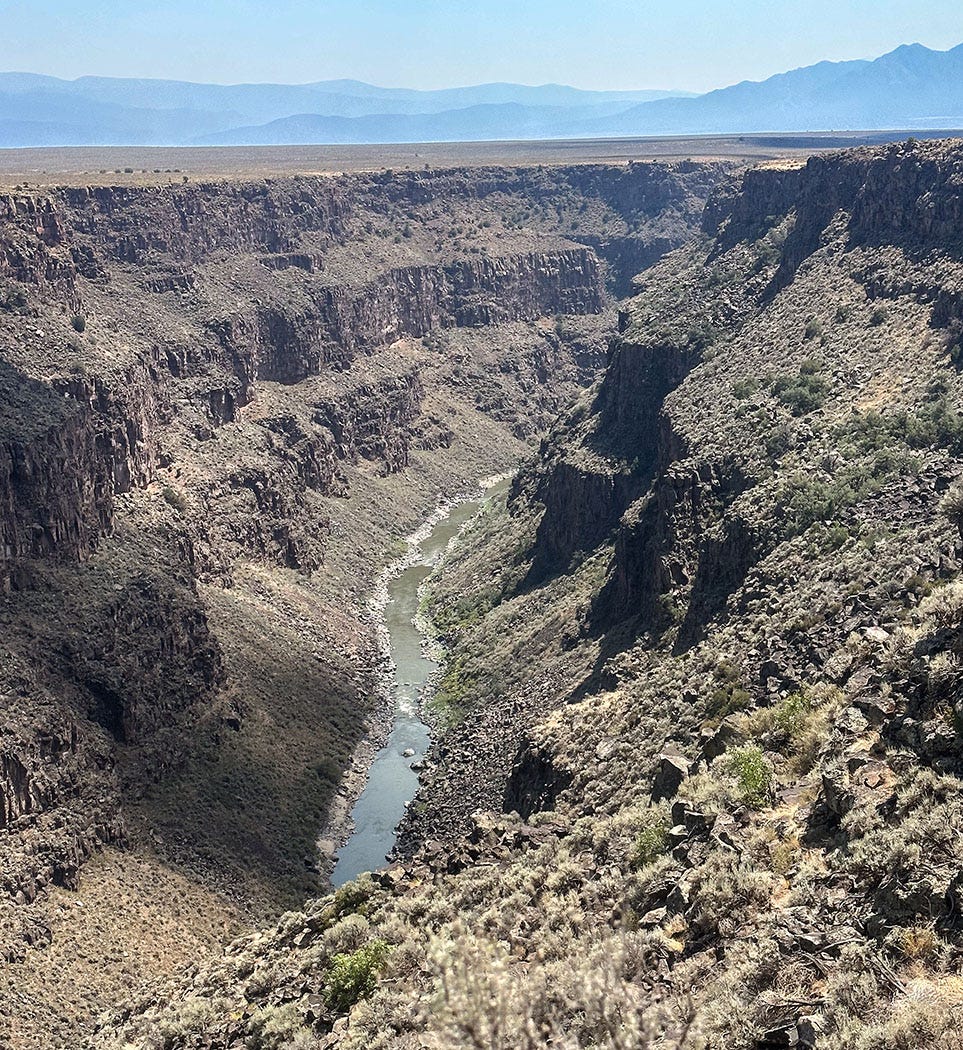
The highway crosses the river there on one of the highest bridges in the United States, a graceful steel span 1,280 feet long that soars 650 feet above the river. The reason for the seemingly exaggerated dimensions — the river itself is a very modest one this high in its watershed — is that the Rio Grande flows there at the bottom of a sheer-walled gorge nearly a thousand feet deep, one of the most spectacular natural sights in New Mexico.
Besides being an impediment to travel, the gorge is a dramatic geological oddity.
The river didn’t carve it all by itself. Rather, this part of New Mexico — like the entire Basin and Range province of North America — is slowly being pulled apart, stretched east to west like a clump of continental taffy by forces not fully understood. This has caused the earth’s crust in this region to thin and fracture into blocks separated by faults, with many of the blocks sinking and forming troughs or basins. Some of those faults reach all the way down to the earth’s mantle, and the fractures have allowed molten rock there to rise to the surface, producing a host of volcanic features — cinder cones, lava flows, calderas, hot springs — throughout the region.
The Rio Grande Gorge is in one of those troughs, part of what geologists refer to as the Rio Grande Rift, where an enormous block of continental crust has dropped thousands of feet between two major faults. The sinking basin complex eventually “captured” and redirected the flows of numerous streams draining off the surrounding mountains, including the young Rio Grande, which subsequently etched its own channel in the gorge.
That stretching and thinning of the Basin and Range Country bears watching, in a deep-time sort of way. A similar process preceded the divergence of North and South America from Europe and Africa, rifting that opened the way for the formation of the Atlantic Ocean. Some day, North America may itself cleave, and the sea find a way back into the dry lands of Nevada, Utah and New Mexico.
Some of the geology around Taos is otherworldly, and I am not alone in that judgment. Through a partnership with the New Mexico Bureau of Geology and Natural Resources, NASA has used it as a training ground for astronaut candidates in the geophysical research techniques that might someday come in handy on Mars or other planets.
It might be a great place to do geology, but I’m pretty sure the Red Planet’s whitewater opportunities will be disappointing.
A tie to the Mighty Miss
On the same summer trip that delivered us a close-up look at the upper Rio Grande, we explored the headwaters of another of America’s longest rivers: the Arkansas, which originates in the same general area of the Colorado Rockies as the Rio Grande. As the Arkansas emerges from the mountains, however, instead of diving due south through New Mexico it veers southeast for 1,500 miles across Colorado, Kansas, Oklahoma and Arkansas to meet the mighty Mississippi River, which drains 40 percent of the continental United States. Although it takes a very different path, the Arkansas’ waters end up in the same Gulf of Mexico that is the destiny of the Rio Grande.
Although its true headwaters lie far upstream and uphill, where the tendrils of its tributaries originate, the Arkansas by that name officially begins at the confluence of Tennessee Creek and the East Fork Arkansas River just outside Leadville, Colo. We passed the confluence while on our way south from the area around Longmont, where we’d visited with family after our exploration of Walsenburg.
It was a day of spectacular scenery. Our route wound along the spine of the Rockies, repeatedly dipping into canyons and climbing over sun-washed summits, passing through old towns perched in precarious absurdity on near-vertical slopes dotted with piles of mining waste, and running alongside streams that tumbled musically through aspen-shaded declivities. Eventually one of those highways delivered us into a broad valley, its floor dotted with crop circles birthed by center-pivot irrigation systems, its flanking hills clothed in junipers and pinyon pines. Towering above it to the west was the Sawatch Range of the Rockies, five of its peaks rising above 14,000 feet. Winding through it all was the boisterous Arkansas River.
The Arkansas Valley represents the northern end of the Rio Grande Rift, which we had met earlier in the trip during our exploration of the Taos area. As we continued south along the river’s course, we passed the boundary of Browns Canyon National Monument and made our way to the Arkansas Headwaters Recreation Area, which claims to host “the most commercially rafted river in the United States.” (It’s a contested claim; the American Outdoors Association typically bestows that label on Tennessee’s Ocoee River. Unlike the rather remote Arkansas, the Ocoee is close to major cities in Tennessee, Georgia, Alabama and North Carolina, and it is located on the doorstep of Great Smoky Mountains National Park, the most-visited unit in the National Park system.)
The Browns Canyon monument was established in 2015 to protect the area’s scenic, cultural, historical and biological resources, which include a 13,000-year history of human habitation. The most recent indigenous inhabitants were members of the Ute and Jicarilla Apache tribes, but as was the case throughout so much of the region, they were largely displaced after gold was discovered near the Arkansas in 1859, triggering an influx of white prospectors and settlers. Displacement accelerated when the Denver and Rio Grande Railroad arrived in 1880, supercharging a population boom in the silver, zinc and lead mining area around Leadville.
Like the Rio Grande, the Arkansas suffers numerous indignities on its course to the Mississippi and the Gulf: contaminated by mine runoff in its upper reaches and agricultural runoff in its lower, dammed and diverted, occasionally dewatered entirely by over-allocation in Kansas. But its nonetheless noble journey knits together the Continental Divide, the Great Plains, and the enormous web of tributaries in the Mississippi watershed that reach all the way into Great Lakes country, the Appalachians, Canada. Put your hand in the Arkansas current and you are making a tactile connection with much of North America.
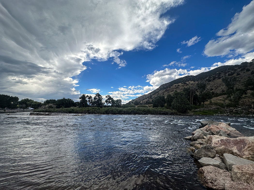
Just outside of the small town of Salida, we pulled into a riverside campground for the night. It was hot, and the scraggly pines and junipers provided little cover, so we deployed our van’s awning and waited in its instant shade for the sun to set. At one end of the campground there was a launch ramp for rafts and other small craft, and after it had cooled down a bit we wandered over to get closer to the river.
At water’s edge, I felt that familiar tug of longing. The river flashed silver in the fading sunlight, reflecting a mass of thunderclouds gathered overhead. The current swooped around a bend downstream, beckoning us to push off in a small boat and ride the river’s back through the broken countryside into unknown adventures.
But not that day. We may pass that way again, and it’s good to leave an enticing new landscape with a reason to return.


