Cacti, Crags and Cranes IV
The long and winding road home
Part 4: Big Bend to Ventura
Rural highways in the West are littered with roadside markers commemorating historical events, people and places, and if you stop to read them all you will never get anywhere. Still, it’s worthwhile to pull over occasionally and take a few moments to learn something new about a place you are traveling through.
If we had not done so on our way across Texas outside Guadalupe Mountains National Park, for example, we would not have known about a 19th century war over salt in that lonely corner of the Chihuahuan desert. The marker tells a concise tale of greed, conflict and exploitation — one all too common in regional history — in these words:
Over one million years ago a large, shallow lake occupied this area. Salt deposits left behind as the lake dried up became an extremely important resource to the people of the El Paso Valley.
Salt was considered sacred to the Apache and Tigua Indians, who used it in the tanning of animal hides and as a condiment and food preservative. Hispanic populations depended on salt to supplement their limited income from farming.
In the late 1870s, the El Paso Salt War erupted as El Paso businessmen attempted to take control of the salt beds from local Hispanic and Tigua communities. The short-lived war resulted in several deaths and injuries, loss of property, and nearly caused an armed conflict between the U.S. and Mexico. Eventually the salt flats were claimed, and Hispanic communities were forced to pay for the salt they once collected for free. Today, only the wind blowing across the barren flats remains to remind us of this turbulent time in history.
There were bullet holes in the sign, but no evidence that anyone covets the salt deposits any longer, much less considers them worth killing over. The countryside is silent and largely empty as far as you can see in every direction.
These roadside markers (Texas has more than 15,000, California more than a thousand) are also reminders that what — and how — we choose to remember and commemorate about our history are just that: choices. So is the manner in which the historical account is framed within a cultural context, whose perspective is represented, and how the story accounts for changes in the community’s moral and ethical values over time.
Later on the last leg of our first road trip of 2023, Leslie and I would encounter another historical marker telling a much less honest story about the past than the one about the El Paso Salt War.
Perils of the shortcut
When we left Big Bend National Park (described in the previous installment of Next Chapter Notes), we stopped for lunch in the strange little community of Terlingua, once a rowdy mercury mining town and now a sturdy repository of Western weirdness with the oxymoronic status of lively ghost town. It was a good place for a beer and a burger, and we moved on after that to the volcanic sky island of Davis Mountains State Park, where we camped for the night.
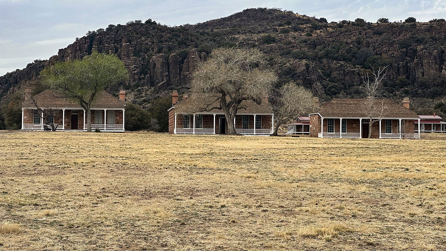
The next day, we explored the nearby Fort Davis National Historic Site, a partially reconstructed military post occupied by federal troops beginning in 1854. The troops spent much of their time chasing after Commanches, Kiowas and Apaches, who had taken to raiding traveling groups on the nearby San Antonio-El Paso Road. The native tribes were largely driven from the area by 1880, during military campaigns that forced them onto reservations and culminated with the final band of Apaches in the area being driven into Mexico, where they were killed by Mexican soldiers.
So it was somewhat jarring to encounter a marker near the visitor center that blithely recounts the fort’s role in history this way: “Named in honor of the then Secretary of War, Jefferson Davis, it was abandoned by federal troops in April 1861, reoccupied in 1867. Troops from the post helped to bring about the peaceful settlement and development of the region.”
Members of the Commanche, Apache and Kiowa tribes would dispute characterization of that process as “peaceful,” but they were clearly not consulted. There’s no identification of who’s responsible for the bronze marker, although it is almost certainly not the National Park Service, which administers the site and generally makes its authorship of interpretive materials clear. It’s more likely the product of a local historical society, perhaps several decades old, and reflects the perspective of the settler descendants who remain on the landscape, not the indigenous people whose ancestors were displaced from it at gunpoint.
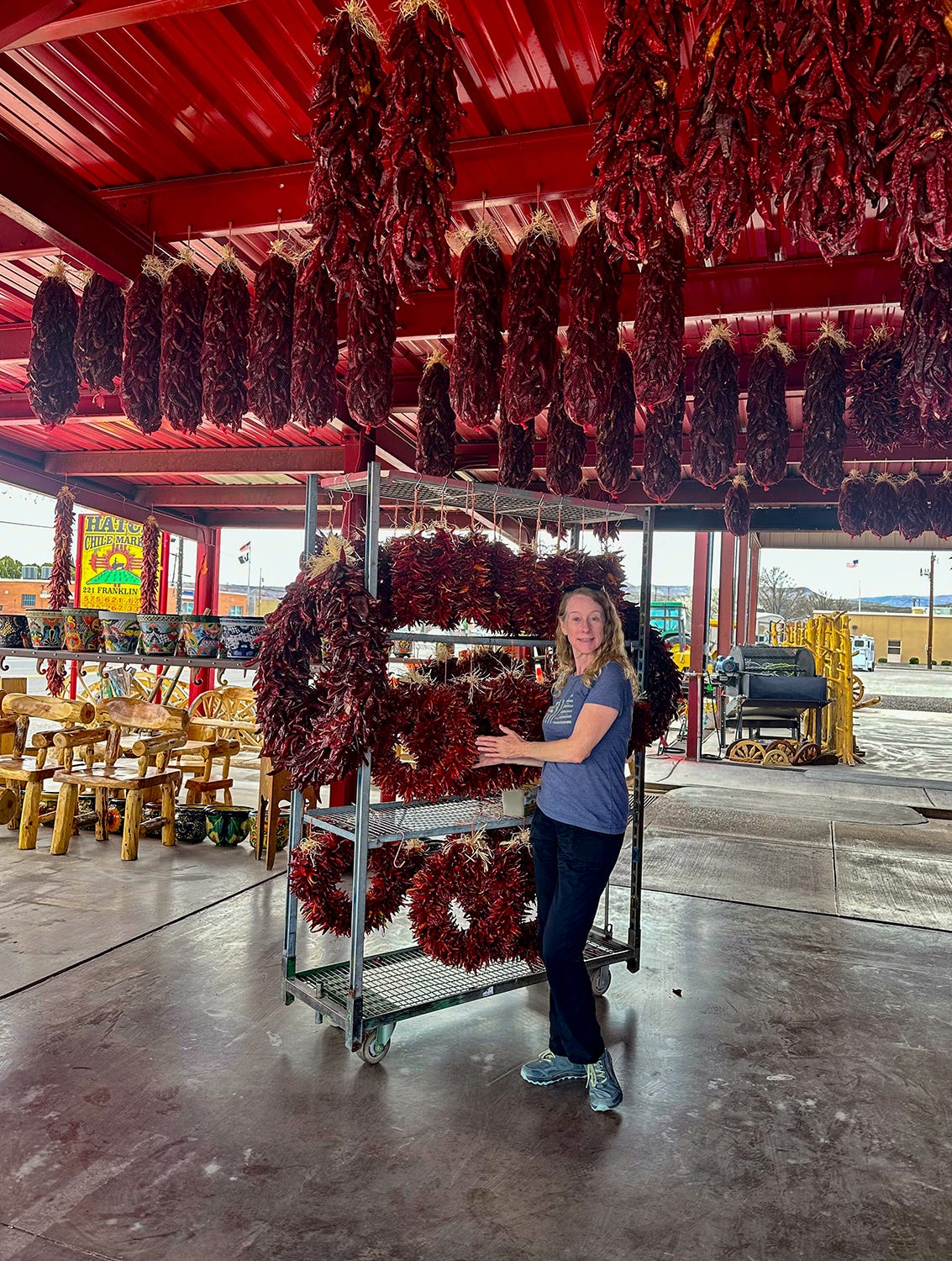
After we left Fort Davis, we drove to Las Cruces, New Mexico, for a night in an Airbnb rental and a much-needed shower. The next day, we intended to make our way to Gila Cliff Dwellings National Monument, and I had plotted a route that would enable us to drive north through the Hatch Valley (famous among chile-pepper connoisseurs) and west through the scenic Black Range Mountains, avoiding what my research indicated was a more tortuous approach from the south.
The drive through the Hatch Valley was pleasant, but not long after we began our ascent into the Black Range I realized my research had been incomplete and my “shortcut” would be anything but. Highway 152, the road through the mountains, is only about 50 miles long, but it is steep, narrow, and chock full of blind hairpin curves, with sometimes terrifying drops over the side, as it climbs over Emory Pass at nearly 9,000 feet. The journey took nearly three hours. The landscape was spectacular, but the drive was nerve-wracking — I am not at my best either as a driver or as a passenger on skinny roads in vertical terrain with lots of exposure and few if any guardrails.
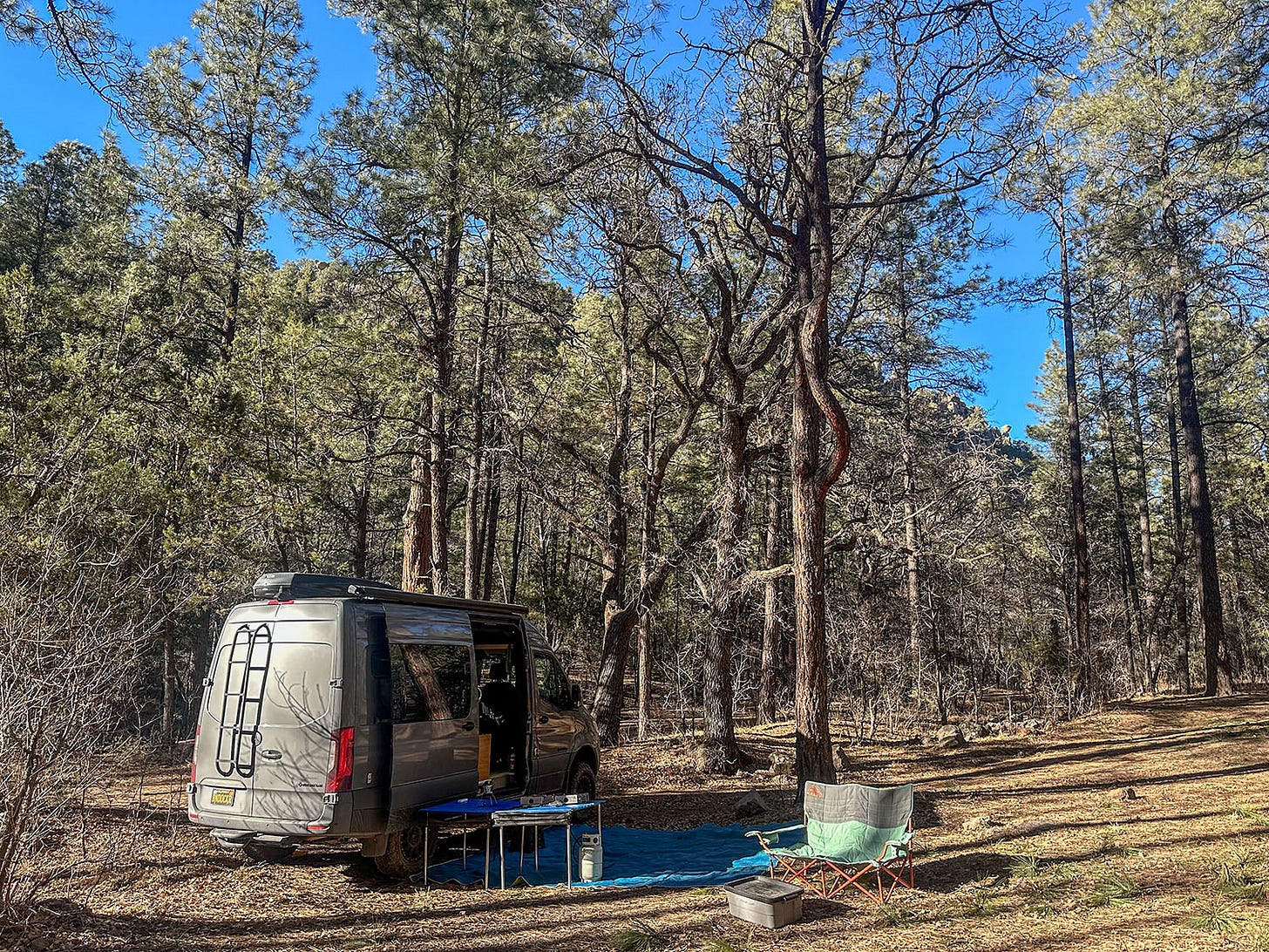
When we finally made our way back down to flat ground in the Mimbres River Valley, and I could loosen my sweaty death grip on the steering wheel, it was clearly too late in the day for us to continue on to Gila Cliff Dwellings. We instead plotted a course for Silver City, and then drove a few miles north of town into the Gila National Forest, where we found a lovely camp for the night along babbling Cherry Creek. The cliff dwellings would have to wait for another trip.
A crossroads in time
Before embarking on the final leg of the journey, we stopped in Silver City at the Western New Mexico University Museum, which has the largest collection of Mimbres pottery and artifacts in the world. The Mimbres culture flourished in the upper Gila River watershed in southwestern New Mexico between 800 and 1250 A.D., and is best known for stunningly beautiful, elaborately decorated pottery. Many of the items have fantastical human, animal or imaginary figures painted on them, and we spent a long morning examining the museum displays.
After lunch in Silver City, another old mining town, we hit the road again, heading for what would be our final camp in Next Chapter on this trip: An ancient travel crossroads in southwestern Arizona, where evidence of people’s passage spans more than 9,000 years.
Compared to the white-knuckle traverse of the Black Range Mountains the day before, our Day 19 drive was a cakewalk. We dropped south and picked up Interstate 10 in Lordsburg, skirted Tucson and merged onto Interstate 8 south of Phoenix. Apparently you do not want to drive through the sprawling urban mess that is Phoenix and its suburbs; official signs along I-8 refer to it as the “Phoenix Bypass” although the city itself is still 50 miles to the north where the two interstates diverge, and I-8 terminates in San Diego. That’s a hell of a bypass.
We rolled into the Bureau of Land Management’s Painted Rock Campground a few hours before sunset, and found a spot for the night. It’s not a great campground — barren sand and gravel, mostly, with picnic tables and fire rings in its 59 sites, plus vault toilets and trash collection — but it is adjacent to a volcanic rock outcropping bearing hundreds of petroglyphs carved or pecked into the basalt (“Painted Rock” is not a reference to the art but to the nearby Painted Rock Mountains).
The petroglyphs reflect a variety of cultures and time periods, some of them in the Western Archaic tradition and attributed to hunter-gatherer groups who visited seasonally between 7500 B.C. and about 1 A.D., and others to the Hohokam, agriculturalists who farmed the Gila River Valley from about 300 B.C. to 1450 A.D. (Their descendants, the O’odham, continue to live in southern Arizona today.) The older art consists mainly of geometric designs; the later works include human, animal and insect figures.
The site is located along a travel and trade corridor used for thousands of years by those indigenous groups. It subsequently was used also by Spanish colonial explorers (the 1777 De Anza expedition), American settlers (the Mormon Battalion in 1846), U.S. military forces (1846-1848 during the war with Mexico), and government-subsidized entrepreneurs (the Butterfield Overland Stage beginning in 1858, and the Southern Pacific Railroad, which pushed its transcontinental route through the area in 1879 and put the stage line out of business). And now Interstate 8.
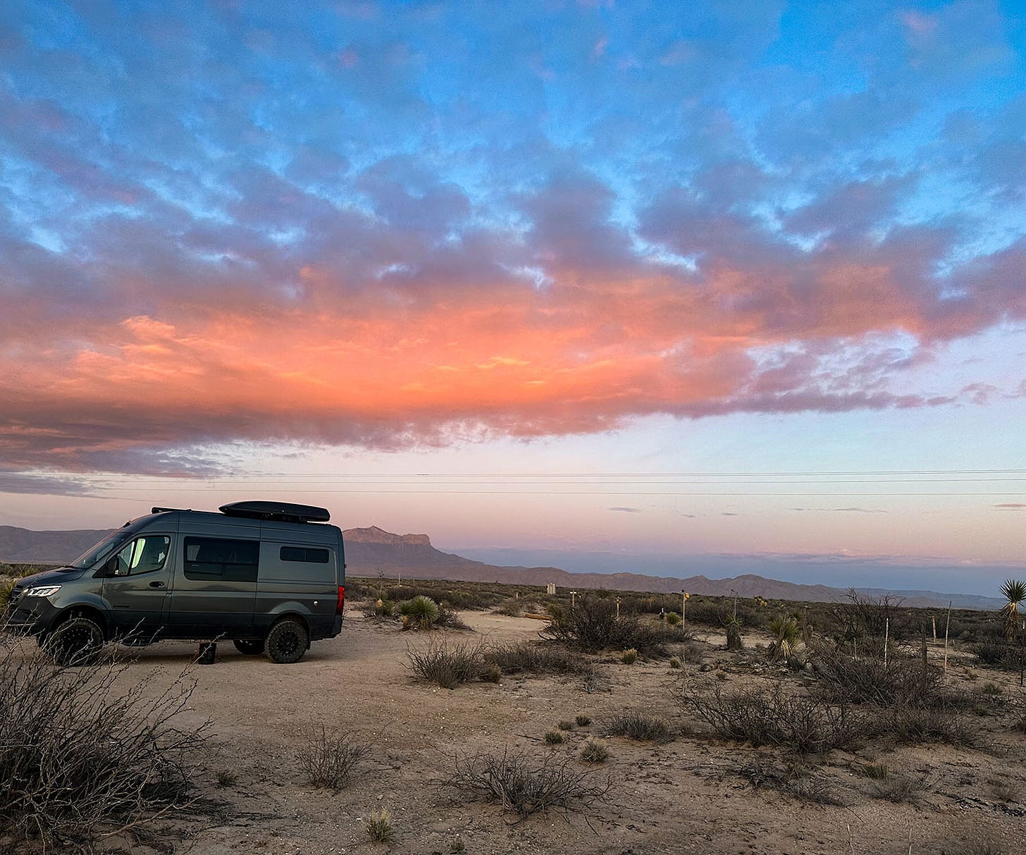
After examining the petroglyphs and historical interpretive displays, we settled in to watch a glorious sunset paint the Sonoran desert sky orange and crimson, and to reflect on the three-week adventure now drawing to an end. It would take us about 9 hours of driving to cover the remaining 500 miles between our camp and home, along a route that at various times in the past 9,000 years would have required travelers days or weeks to cross, under conditions considerably less comfortable than ours.
As twilight deepened, we could almost feel the presence of those who had traveled our path long before us. Wherever Next Chapter takes us, we know that we follow in the footsteps and wagon tracks of others, and the faint traces they have left on the land urge us always to keep exploring. There’s a new vista and a new story around every bend.


Ahhh, thanks for the wonderful history lessen, great photos and truths about scary roads and passes! Until the next time! Jill
Great stories from the road, John and Leslie. Makes me a little homesick. not that I love narrow, winding roads either.