


A Symphony in Stone
Exploring the lithic heart of Utah's canyon country

In the canyons and cliffs of the Colorado Plateau, a vast layer-cake of predominantly sedimentary stone that sprawls over four southwestern states, the sun transforms into a painter as the day draws to an end.
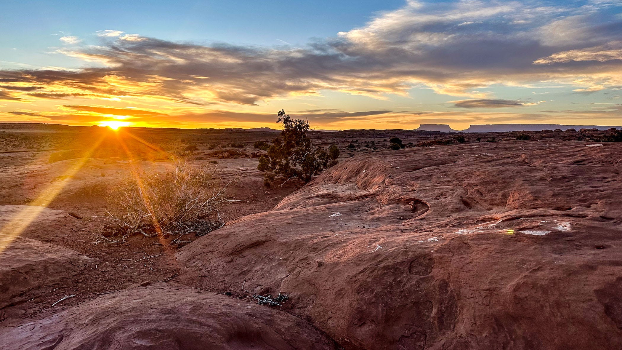
As it descends toward the horizon, our home star’s slanting light seems to brush the redrock landscape with vivid strokes of magenta and vermillion, intensifying colors that are present but washed out by overhead glare at midday. The ruddy hues deepen, then deepen again as shadows lengthen, until the glowing cliffs seem lit from within.
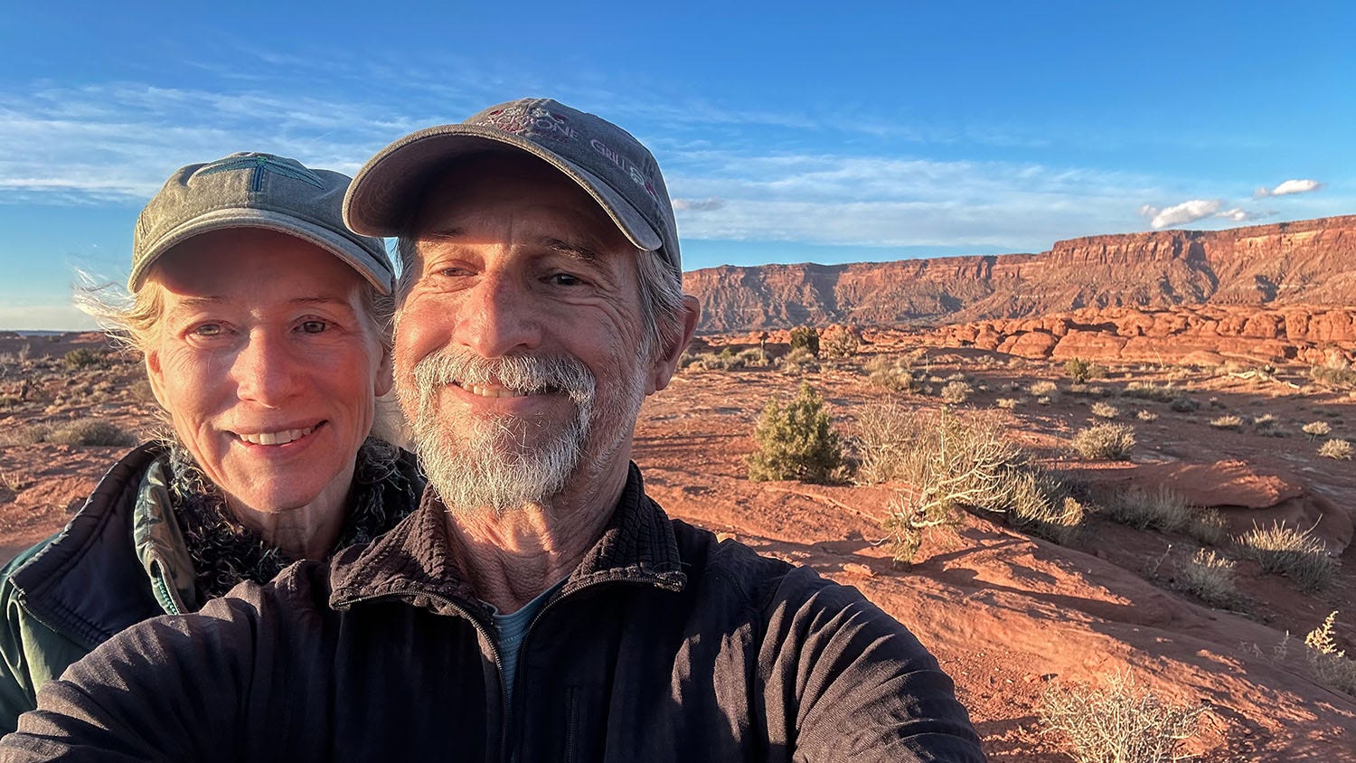
This spectacle never grows old, no matter how many times I have witnessed it over the four decades that I have been visiting the Four Corners region. And during the most recent road trip my partner Leslie and I took in our camper van, Next Chapter, we had a peerless sunset vantage point during three nights we spent outside the centerpiece of our 11-day journey: The Needles District of Canyonlands National Park.
Canyonlands is one of the “Mighty Five” national parks in Utah, promoted as such on hyperventilating billboards by state and local tourism boosters. (The others are Zion, Bryce Canyon, Capitol Reef and Arches.) They are not that far from each other, about a day’s drive apart in the southern half of the state, and it is possible to string them all together on a single looping trip of a week or so.
That is not something I recommend. You can conduct your visit as a series of quick hopscotches, but this is a landscape that deserves to be savored.
Three of those parks — Zion, Arches and Bryce — are classic “windshield” parks. They were established first as national monuments by presidential proclamation early in the 20th century, a time when the National Park Service (NPS) tended to prioritize visitor accessibility over preservation of wilderness character and ecosystem integrity. To enable newly automobile-borne tourists to enjoy the most spectacular scenic park features with ease and comfort, the NPS paved extensive networks of roads, pullouts and parking lots throughout those parks in the 1930s, ‘40s and ‘50s. If so inclined, visitors could enjoy the scenery without ever leaving their cars.
I have visited all five Utah parks multiple times over the past 40 years, and although they are all beautiful, increasingly I find myself drawn back to Canyonlands. It is by far the most expansive of Utah’s parks (at 338,000 acres, it is nearly 10 times the size of Bryce, the smallest, and 40 percent bigger than Capitol Reef, the second largest), and provisions for vehicle access and visitor convenience are pretty much the opposite of those in the smaller and older parks. Distances are vast in Canyonlands, trails are rugged if they exist at all, pavement is rare, and if you visit in late winter or early spring, so are people.
That’s why I like it. As a bonus, it is the lithic heart of a landscape imbued with thousands of years of human stories and millions of years of Earth history. It’s a place where you can lose yourself in both space and time.
J-Tree without the crowds
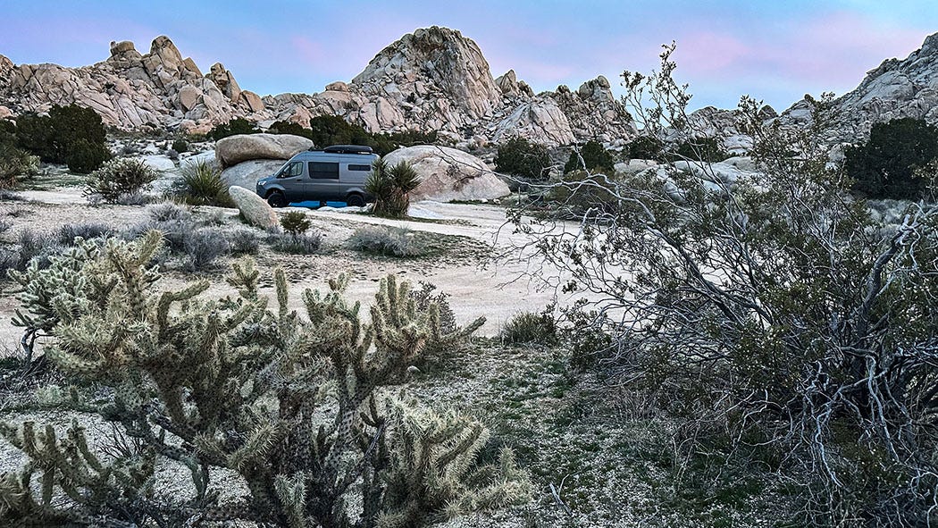
We left Ventura on Feb. 25, and aimed initially for the Granite Mountains in Mojave National Preserve. I have wanted to visit that neighborhood of the California desert since I first learned about it during research for one of the hiking guides I wrote for Wilderness Press in the 1990s, but because there aren’t really any hiking trails there, I never made it a priority, even though some old desert guides described the Granite range as scenic and ecologically significant.
But on this trip, it had one important advantage besides scenery and wildlife to recommend it: The Granite Mountains are only 246 miles from home, meaning it would take about four hours of driving to reach our first campsite. This is considerably shorter than our usual first day on the road to Utah (typically a 9-hour marathon), but we’d been forced to rethink our customary itinerary when Leslie had surgery to repair a fractured right wrist a week before our departure. Residual pain and the relative immobility imposed by a splint meant she could not comfortably drive Next Chapter.
Normally we split that task 50-50, alternating short driving days and switching off on long ones. Because I no longer am willing to drive solo for eight or nine hours straight, we reconfigured this trip to cover fewer miles each day and to visit fewer destinations along the way. This limitation turned out to be a blessing in disguise. Taking the journey in small bites made for relaxing travel, and allowed us to delve more deeply into some of our stops along the way.
After several hours driving east across California into the desert, we exited Interstate 40, headed north on Kelbaker Road — one of the few paved arteries crossing the Mojave Preserve — and turned onto a rough unpaved road just past Granite Pass. We followed it into a maze of informal dirt tracks and dispersed camping sites, set among spectacular rock outcrops.
The Granite Mountains landscape is reminiscent of nearby Joshua Tree National Park, and with good reason: Both share a common geologic ancestry, their bones the faulted, fractured and eroded remnants of massive subterranean magma deposits formed more than 100 million years ago. The once-buried rock has been revealed through uplift and erosion, and is a type known as quartz monzonite or monzogranite. The University of California maintains a research station there, which has documented a wide array of plants and animals in the Granite Mountains, including the relatively rare desert subspecies of bighorn sheep.
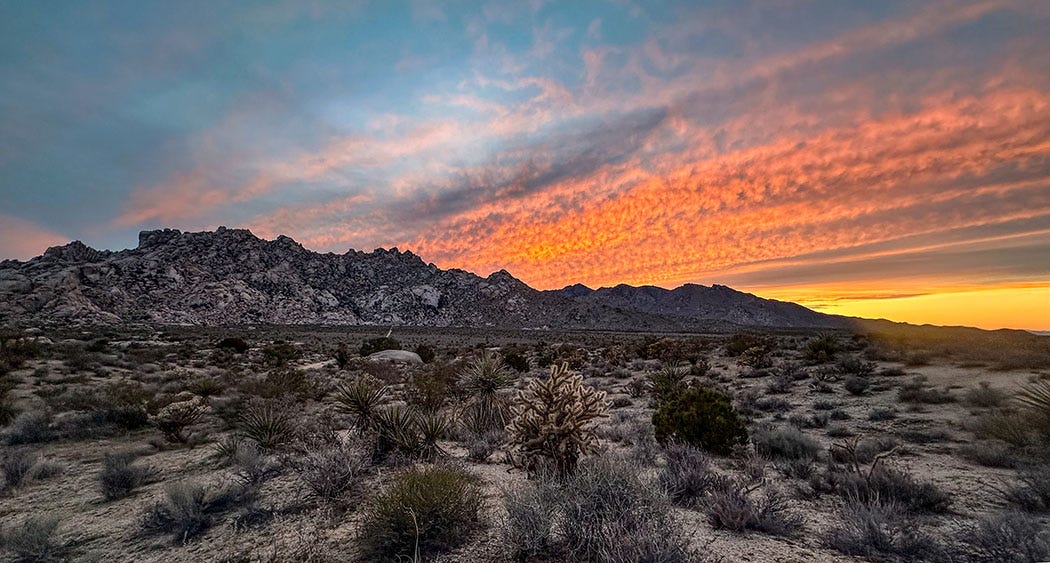
Our campsite in Mojave Preserve had many of the scenic advantages of Joshua Tree, but lacked the crowds that in recent years have made visiting that more famous landscape a bit of an ordeal. Silence, a plentitude of rocks, a paucity of people, a colorful sunset — the first evening of our adventure offered good omens for the journey to follow.
In the shadow of the Comb
Our next day took us to Flagstaff, Ariz., where we spent the night in an Airbnb rental. The following day we made our way northeast across the vast Navajo reservation, through Monument Valley into Utah, and over Comb Ridge — one of the spectacular escarpments, sometimes known as “reefs,” that rear skyward in southern Utah. (See also the San Rafael Reef and the Waterpocket Fold in Capitol Reef National Park.)
Comb Ridge is a giant mass of layered rock, tilted at a 20-degree angle, that runs north-south across 80 miles of Arizona and Utah. Its vertical west face is a scalloped cliff 800 feet high; on the east the slanting layers dip into the surrounding terrain and are cut here and there by narrow canyons. Sandy drainages parallel the hogback ridge on both sides, Comb Wash on the west and Butler Wash on the east. Both contain countless archaeological sites, including the remains of ancestral pueblo dwellings, granaries and rock art.
Turning off the highway a few miles outside of the tiny town of Bluff, we followed a good dirt road a few miles north into Butler Wash, where we found a secluded campsite amid winter-bare cottonwood trees and tattered sagebrush. It was a place of great silence, broken only by the occasional croak of a raven and the clatter of dead leaves stirred by the breeze.
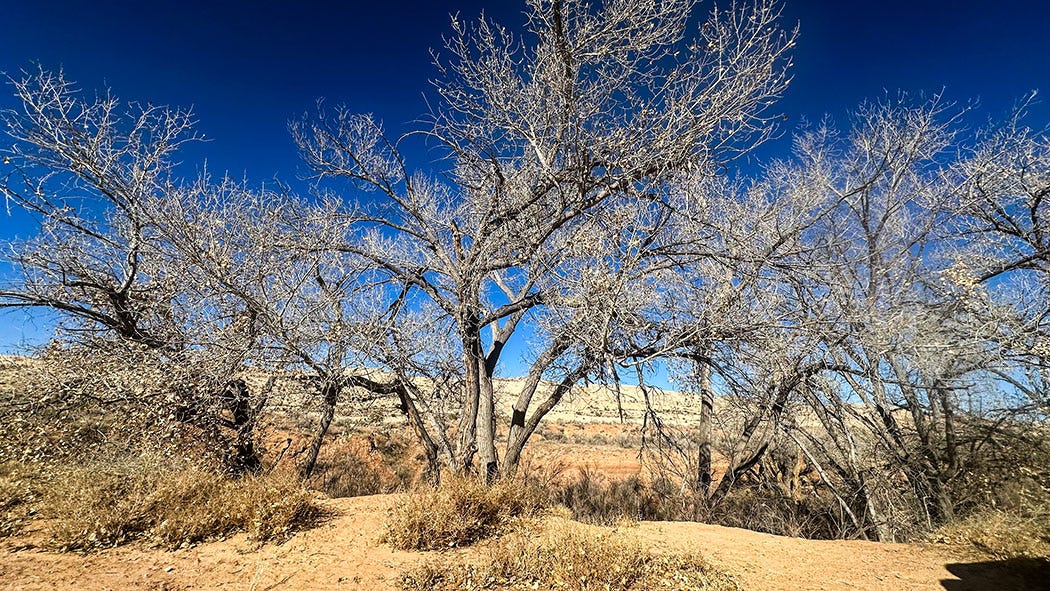
That night, the temperature dropped precipitously. At 1 a.m., it hit 18 degrees, and the battery in our external thermometer sensor died, so we do not know how much lower it fell before sunrise. Let’s just say it was cold when we awoke, and we enjoyed morning coffee inside our heated van.
Yes, we’ve become coddled weather wimps. After decades spent camping oftentimes in frigid wind-flapping tents, I figure we’ve earned it.
The contrast with our initial foray into Butler could not have been more stark. The first time we attempted to explore there, on a trip in early June 2019, we were driven away by temperatures in the 90s, too hot for safe hiking or even comfortable camping. Instead we sought refuge in the alpine cool of the Abajo Mountains, an isolated range of volcanic peaks not far to the north, where we camped in the piney shade of the Manti-La Sal National Forest.
From Butler Wash our route took us north again, this time a mere 100 miles. It was a slow 100 miles, though, much of it driven at 30-40 mph owing to the narrow and frequently sinuous nature of the roads. Our destination was an undeveloped camp spot we’d found in September 2020 during Next Chapter’s memorable shakedown cruise, after we picked it up from its birthplace at Outside Van in Portland, Ore.
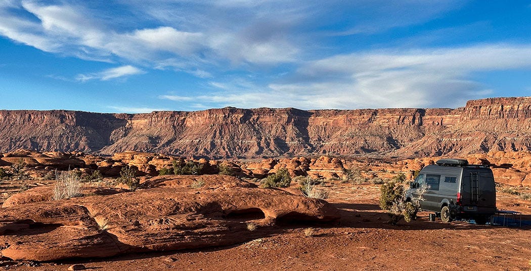
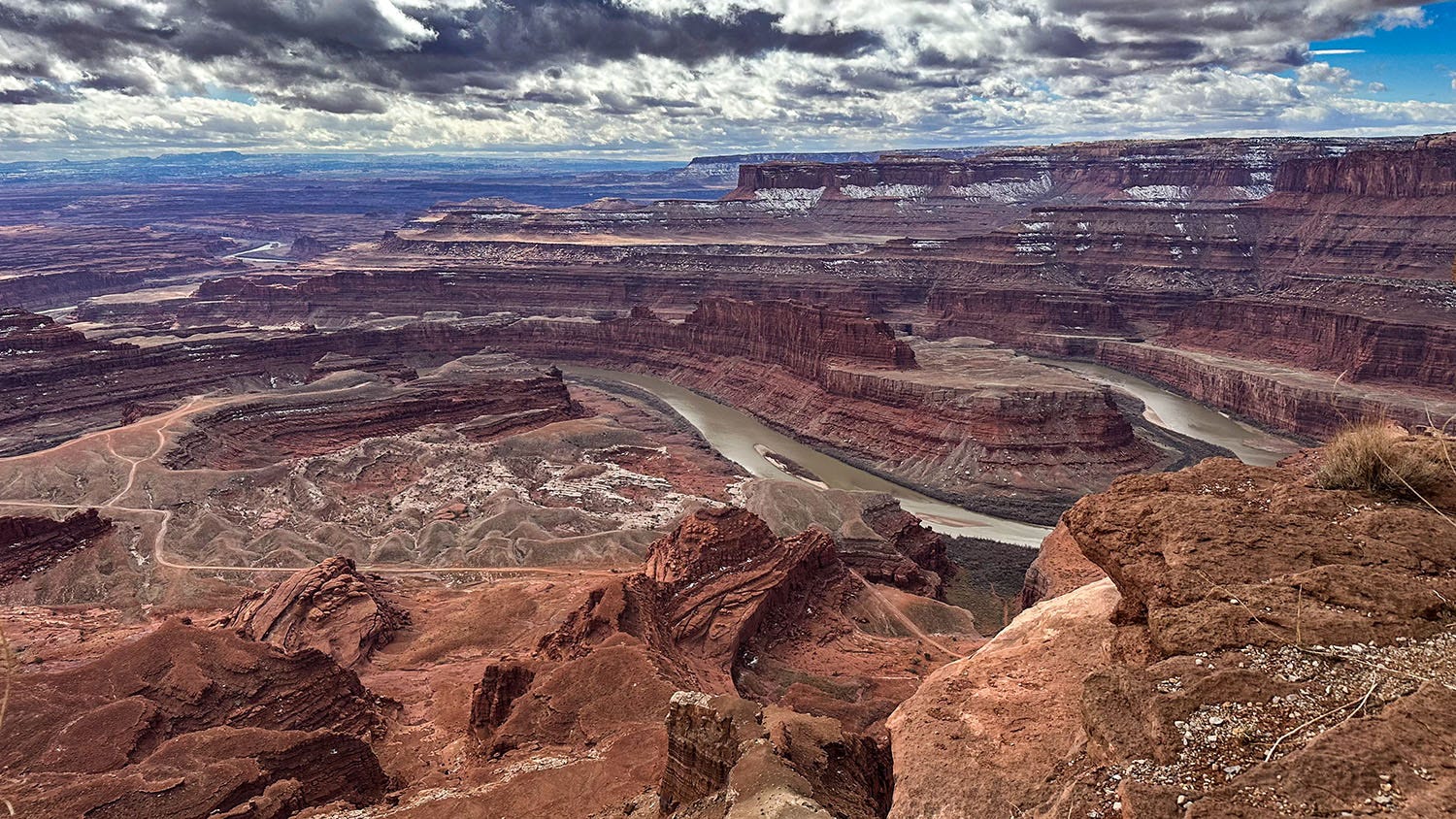
The site is off a dirt road just outside of Canyonlands National Park’s Needles District, one of three regions into which the park is divided by the deep canyons of the Green and Colorado rivers. (The other two districts are Island in the Sky and The Maze). The rivers meet inside the park, and almost immediately plunge into a maelstrom of whitewater known as Cataract Canyon, which Leslie and I had the pleasure of rafting on a 5-day adventure in 2015 (photos from that trip are on my website). Because the rivers— which administratively constitute a fourth district of the park — are impossible to cross without a boat, there’s no way to drive or hike directly between the park’s three main regions. Each requires its own approach.
(Technically, there also is a fifth district: Horseshoe Canyon, a small detached unit added to the park in 1971 to protect one of the most remarkable rock art displays in North America. It’s west of the main body of the park, and 30 miles of dirt road and 3.5 miles of trail away from pavement, a journey Leslie and I made in 2019.)
Although Canyonlands does not have much in the way of paved roads, it has quite a network of unpaved ones, some passable in a conventional passenger car, others requiring serious off-highway equipment and skills. By and large, they are the legacy of an often-overlooked chapter in the history of this region: the uranium boom of 1947-1964. Spurred by the U.S. Atomic Energy Commission’s guarantee of a fixed price for uranium to support the Cold War expansion of the nation’s doomsday arsenal, thousands of prospectors flooded into the countryside centered around the old ranching town of Moab. In their rush to exploit the only known domestic deposits of uranium, they bulldozed primitive tracks into every nook and cranny of the landscape. The NPS inherited that informal travel network when the park was established in 1964.
The legacy of the uranium prospectors is but one chapter in the human story of the Canyonlands region, layered among those written by 10,000 years of habitation by indigenous hunters, gatherers and agriculturalists; the persistence of 19th and 20th century cowboys and cowgirls; and a more recent flood of entrepreneurs seeking to capitalize on today’s outdoor recreation boom. The mining bonanza is now only a toxic memory, but 25 indigenous communities still maintain a cultural connection to the landscape, and descendants of pioneer ranchers still run cattle on the park’s outskirts, sometimes in partnership with conservationists.


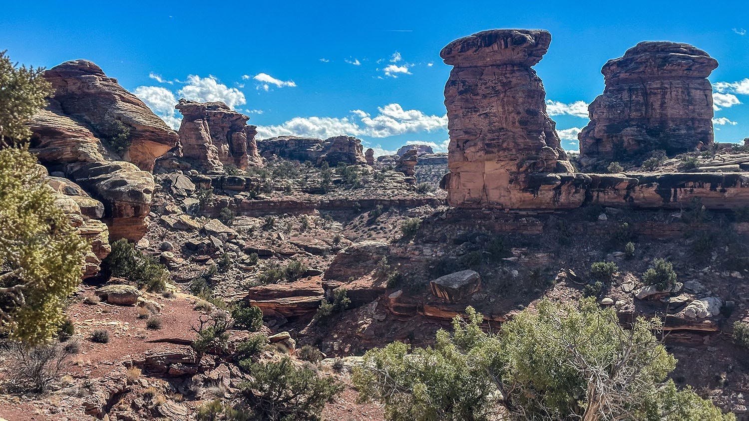
Although the network of four-wheel-drive tracks draws significant attention from off-roaders, most Canyonlands visitors end up at Island in the Sky, which has the most pavement and visitor amenities. Hardly anyone visits the trackless Maze except hardy four-wheelers and rafters who wander into it from the Colorado. In popularity, the Needles District lies somewhere in between, having a small developed campground and a network of marked hiking trails that lead into the spectacularly eroded rock towers and pinnacles that give the area its name. We stayed only a single night on our inaugural visit to that district four years ago; this time we planned three nights in the same campsite and two full days of hiking and exploration.
To reach the site, we followed a paved highway that leads to the park, turned onto a graded dirt road a few miles before the park boundary, and then shifted into four-wheel drive to climb a rugged slope on a fainter vehicle track used mostly by mountain bikes. It led a few hundred feet to a slickrock plateau, with a couple of crude fire pits and a 360-degree view of hundreds of square miles of empty beauty. We settled in and toasted another spectacular sunset.
Slickrock symphony
I hear music when I scan the great cliffs of the Grand Staircase region of the American Southwest, for the names geologists have given many of the exposed rock layers across that vast area seem to me melodic, almost incantatory: Moenkopi, Chinle, Moenave, Kayenta, Tapeats, Muav, Bright Angel, Coconino, Toroweap, Kaibab. In the Canyonlands area, the layers of ancient rock reflect a 300-million-year history of sediment deposition in shallow seas, coastal swamps, beaches, tidal mudflats, dunes and river deltas, occasionally interrupted by episodes of volcanic violence. They’ve been exposed, and an incalculable volume of the former landscape removed, by erosion over the past 10 million years — a demonstration of how much faster Earth can tear things down than build them up.
We enjoyed the music of stone during our stay on the slickrock plateau, and on hiking forays into The Needles. In the evenings, we watched the setting sun work its artistry on those glowing Technicolor cliffs. In the mornings, we admired the silence and allowed it to seep into our bones.
In the end, we were driven too soon from the countryside by Next Chapter’s nemesis: The wind.
As we prepared to move on to our next destination, a storm was forecast to sweep into the canyon country with steady winds of 20-plus mph and gusts to 60 or more. It is exhausting to drive our high-profile van in even a moderate wind, and it can be dangerous in gusts that strong — especially on narrow roads with little margin for steering error. We recalculated distances, and decided to head for Moab, 70 miles away. We found a hotel room there, and visited the fine Moab history museum that afternoon while the predicted windstorm roared through town, uprooting traffic signs and hurling them down the streets.
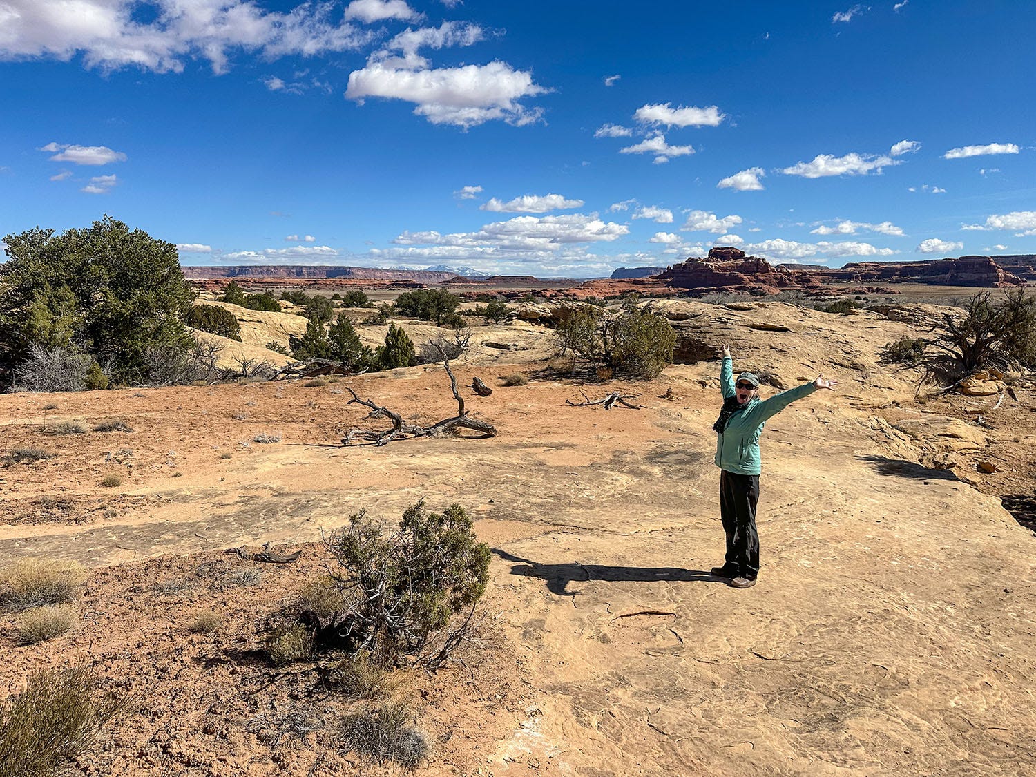
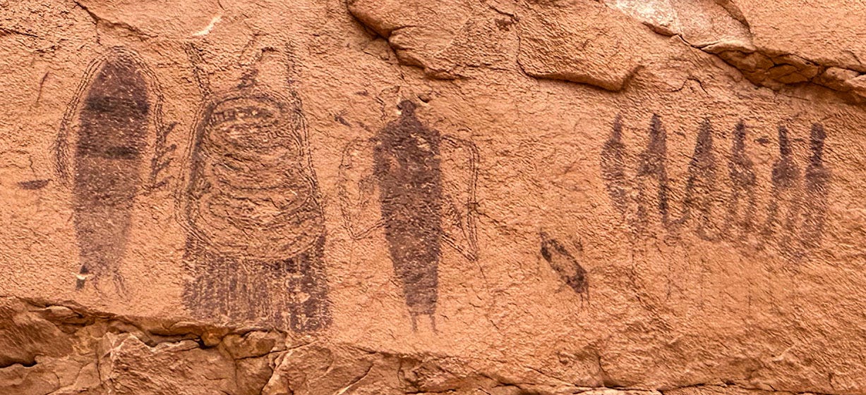
After taking refuge in Moab overnight, we left the next morning for Torrey, a small town 157 miles away on the outskirts of Capitol Reef National Park. Battling diminishing gusts along the way, we detoured to Dead Horse Point State Park, where we examined an enigmatic roadside panel of petroglyphs and took in a view of the Colorado in its meandering canyon.
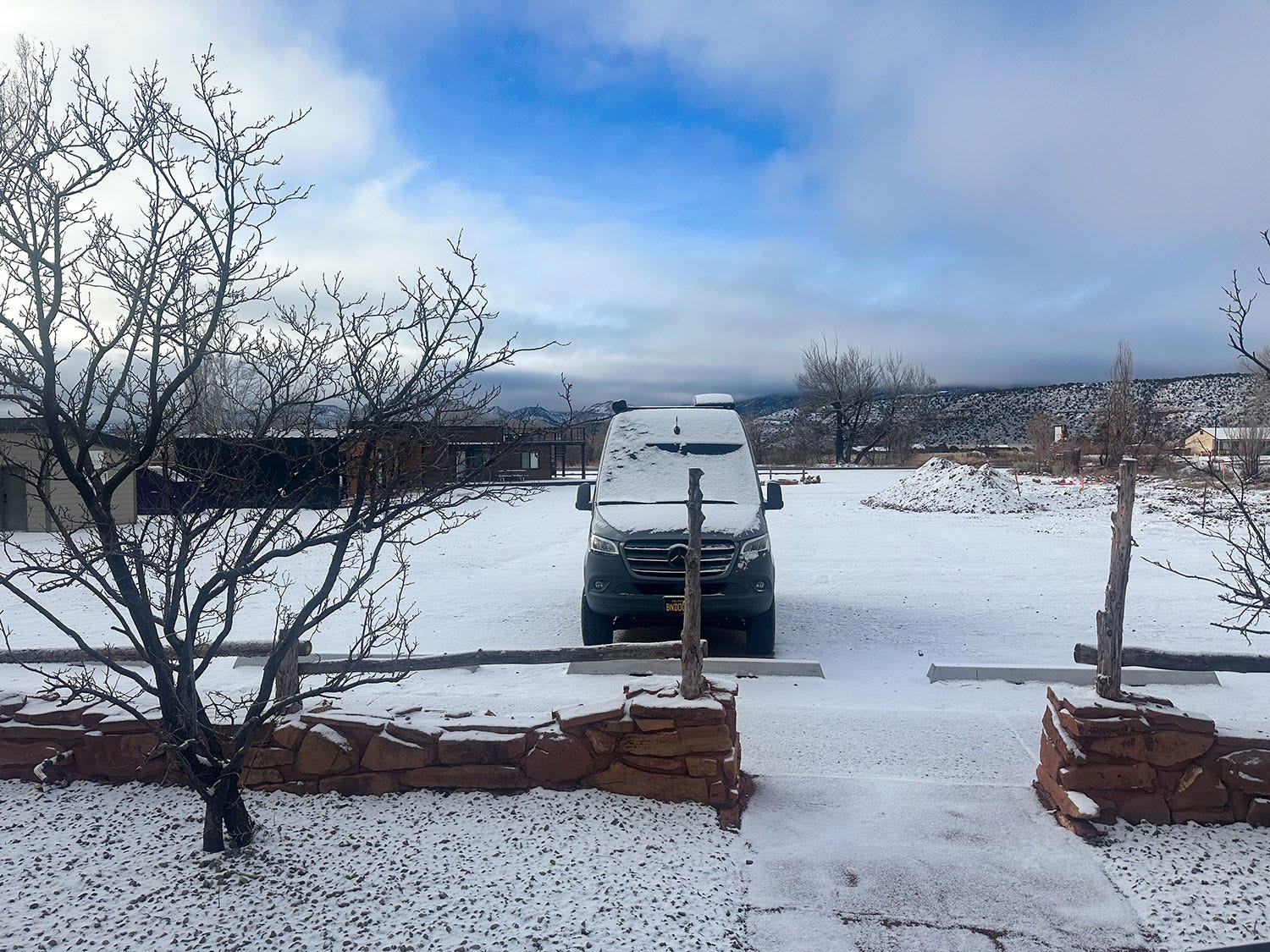
In Torrey, we holed up in a lodge near the foot of Boulder Mountain, and were greeted the next morning by a light accumulation of snow — proof that winter had not yet relaxed its grip on the Colorado Plateau. After a stop in nearby Capitol Reef for a hike to a natural bridge and views of another roadside petroglyph panel, we spent most of the day making our way through rural countryside to Zion National Park, where we had reserved one of the lodge’s historic cabins for the night.


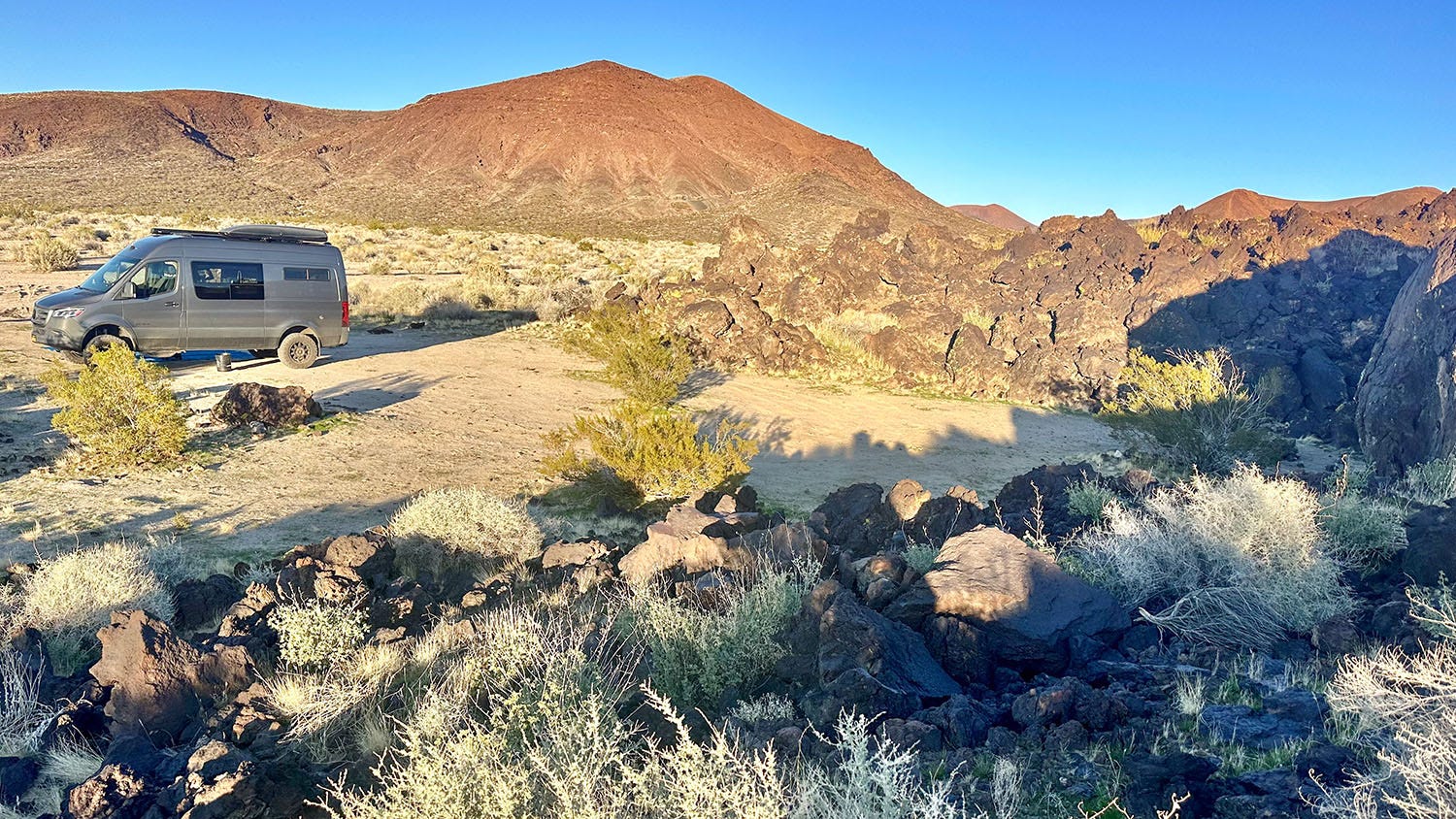
For our next and final night on the road, we made our way back to Mojave National Preserve, this time to a different dispersed camping area we had scouted using satellite imagery before we left home. From Interstate 15 in Baker, we headed south into the preserve, again on Kelbaker Road, and navigated sandy tracks to a campsite in the jagged embrace of a lava flow and the shadow of several cinder cones. Much younger than the ancient monzogranite of our outbound campsite in the preserve — some of the lava flows near us were a mere 10,000 years old — the volcanic setting of our final inbound camp was similarly uncrowded. In fact, we had it all to ourselves.
Blessedly, the wind had quieted, and at the end of the day we again found ourselves bathed in silence — broken from time to time by the liquid calls of rock wrens and black-throated sparrows — and lit by the shimmering glow of a desert sunset. Those never get old no matter where we are.
While John's writing is always top notch, the photos of this trip stole the show. Not like any I've seen - they make the desert look beautiful, mysterious and cozy all at the same time. Kudos, John and Les!
Yeah, that's what I figured that you'd have a house sitter. Well, happy preparation for your trip!