


Tales of Trade, Migration and Conquest
Part 5: Across the Great Divide

Most Californians are likely aware of the fate of the Donner party, perhaps the only group of travelers along the American emigrant trails in the 19th century whose demise during the journey has been a story taught to schoolchildren in their lessons about state history.
The Donners were part of the tide of westward migration between 1841 and 1870 along what are today referred to as the Oregon, California and Mormon Pioneer National Historic Trails. They began their 1846 journey in Springfield, Mo., and joined a large wagon train in Independence. From there, they followed the Oregon Trail to Fort Laramie in Wyoming, where the larger group split, one party continuing on to Oregon and the other heading for California.
The Donners were part of the California-bound group, which made the critical mistake of following a “shortcut” recommended by the notoriously unreliable trail-guide author Lansford Hastings, which led them into the Great Basin desert south of the Great Salt Lake in Utah. (Although he claimed it was 300 miles shorter than the established trail, Hastings’ cutoff was actually 125 miles longer and led through some of the most inhospitable terrain in the West.) Hardships led to delays, the result being that by the time the Donner party reached California’s Sierra Nevada and attempted to cross, it was late October and they found their way forward (and then back) blocked by deep snow.
The group spent the winter trapped near what is known today as Donner Lake. By the time their ordeal was over, 42 of the 89 emigrants in the group were dead from starvation or exposure, and some had resorted to cannibalism to survive. The Encyclopedia Britannica calls it “the worst disaster of the overland migration to California.”
That is, at best, misleading. By far the greatest single disaster on the 19th century westward emigrant trails occurred not in the mountains, and not in California. It happened on the high plains in western Wyoming, and it lacked the lurid feature of cannibalism that drew so much attention to the Donner party’s ordeal. It also involved members of the most persecuted religious minority in 19th century America, groups of whom were impoverished emigrants fresh off the boat from England. These factors may also help explain why their fate is largely absent from American history books.
Leslie and I stopped near a site of that tragedy on the final stage of our 25-day spring adventure this year, following the route of the Santa Fe Trail east and then that of the Oregon Trail west. It was a disquieting interlude on a journey that offered many lessons about the complex skein of individual motivations, desires and destinies — those of both emigrants and the indigenous people they encountered — contained within the larger story of the great westward migration.
High-plains ordeal
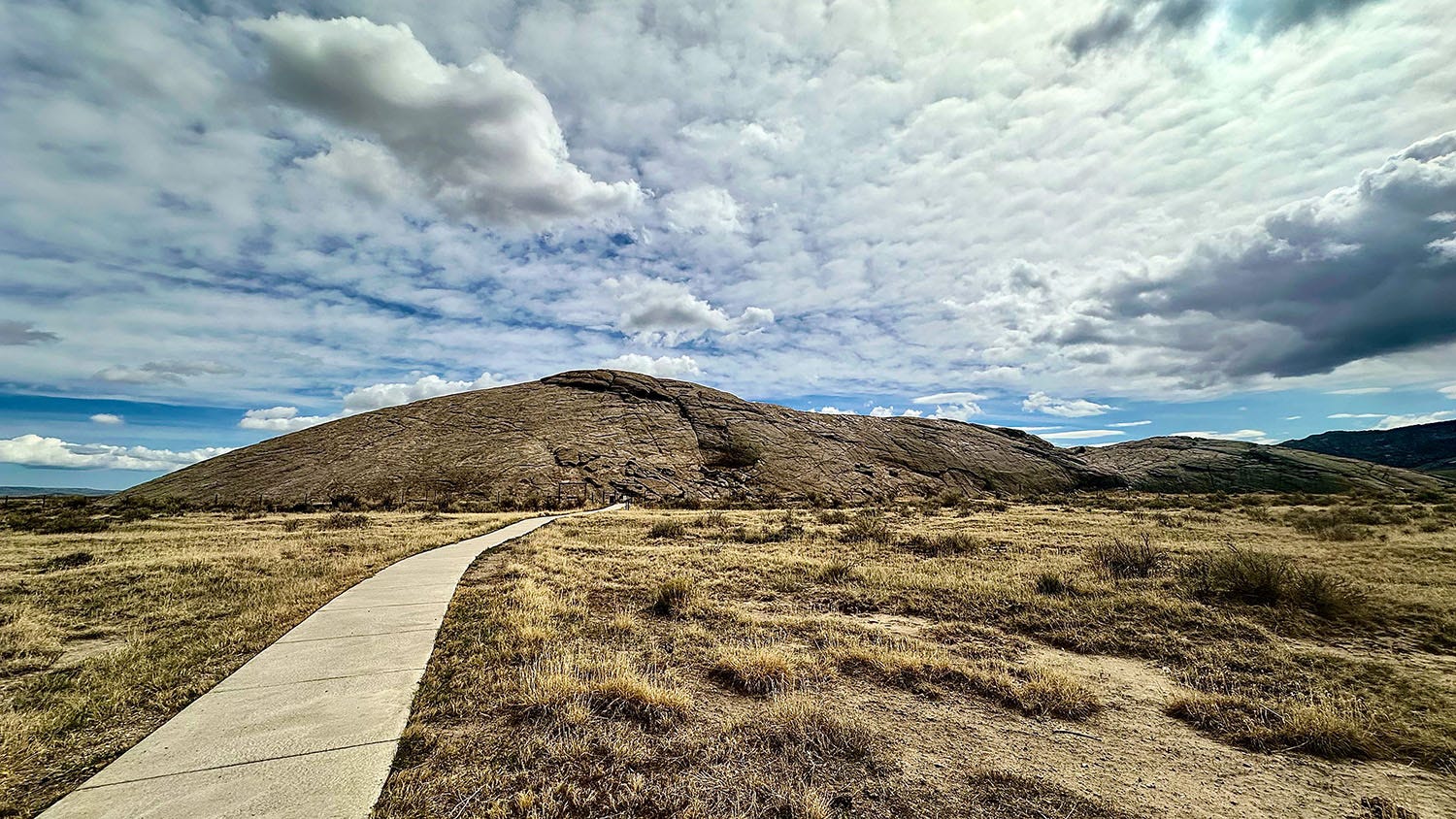
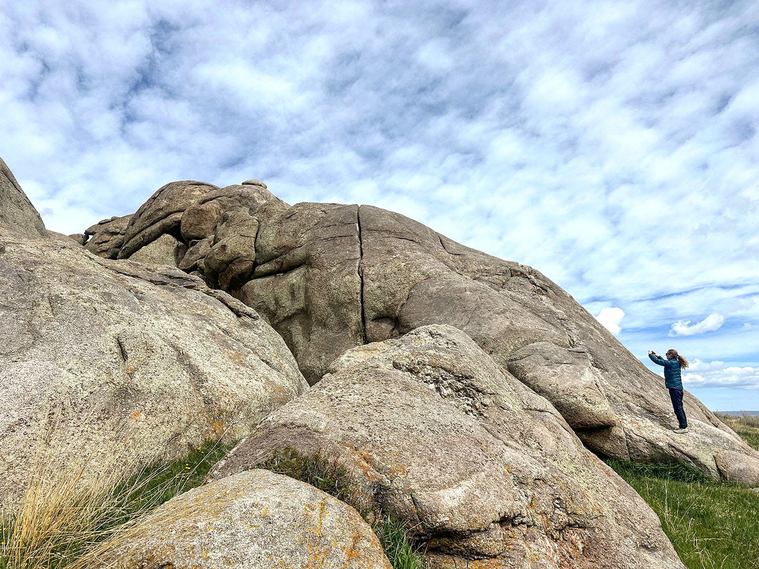
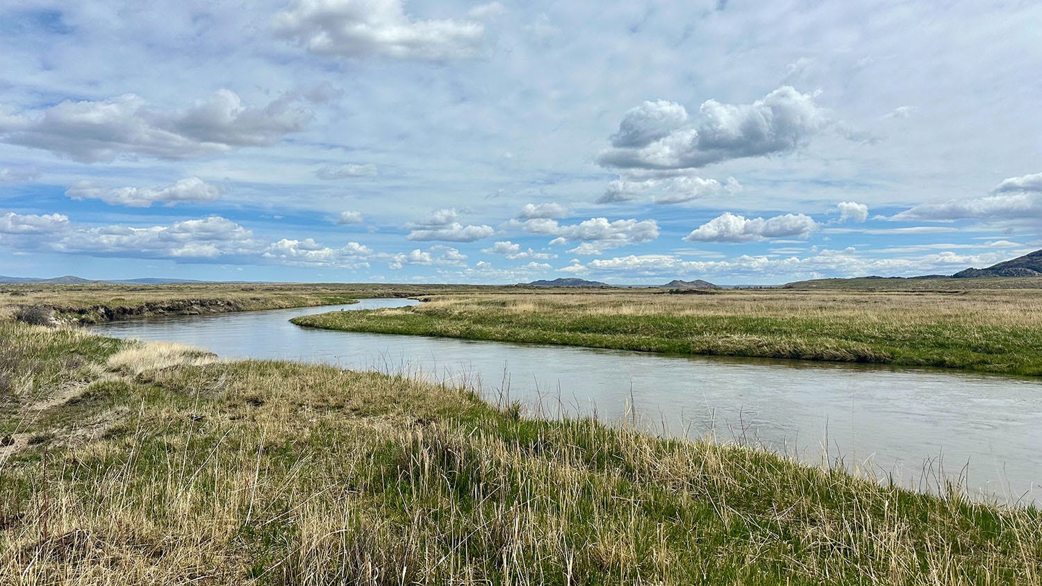
Following our entertaining stay at the Cloud Peak Llama and Alpaca Ranch, an account of which concluded the previous installment of Next Chapter Notes, we pressed on into Wyoming. Our first stop was at Independence Rock State Historic Site, where an enormous rounded outcrop of granite bulges from the prairie grassland like a surfacing whale. It was a notable landmark and camp spot for travelers on the Oregon, California and Mormon trails, and bears the inscriptions left by thousands of them, chiseled into the stone or scrawled upon it using paint, charcoal or axle grease. It’s also where emigrants left the broad, flat Platte River Valley and began following the Sweetwater River into the Rocky Mountains.
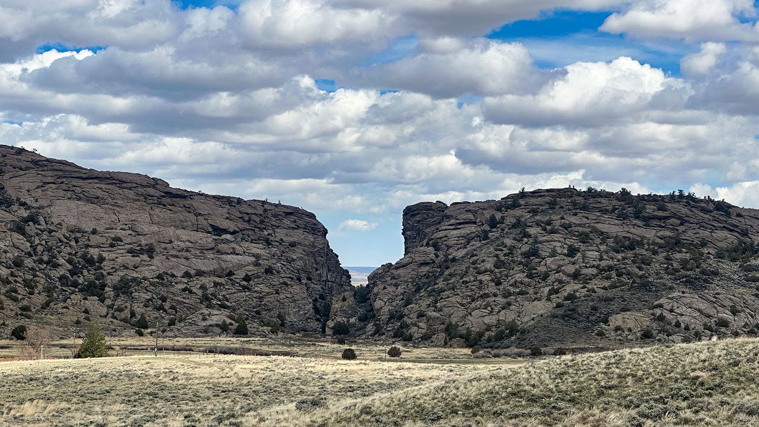
A few miles west of Independence Rock, we stopped near another noted trail landmark, Devil’s Gate, a slot canyon carved 300 feet deep by the Sweetwater through one of the granite ridges that corrugate the landscape at the foot of the Rockies. There, we toured the Mormon Handcart Historic Site & Visitor Center, operated by The Church of Jesus Christ of Latter-day Saints (LDS).
The site, near a topographic feature known as Martin’s Cove, commemorates a disastrous sequence of events that occurred in 1856, when a poorly equipped and ill-prepared group of Mormon emigrants from England — whose journey across the Atlantic and overland to the Midwest had been underwritten and organized by the LDS church — started their trek from Iowa to Utah in September. As all informed travelers knew, this was far too late in the year, and the Mormons bogged down on the high Wyoming plains in mid-October when winter blizzards struck.
Over several weeks, until rescue parties dispatched by LDS church leaders in Salt Lake City could reach them, the 500 members of what became known as the Martin Handcart Company suffered from severe cold, ran out of food, grew ill, and died by the score. The final death toll, including those who made it to Utah but succumbed later to their injuries, is estimated at 135 to 150 in that one company alone. Add those in the other Mormon group similarly caught on the Wyoming segment of trail that year without warm clothes, adequate food or protection from the early winter conditions, and the toll rises to more than 200, according to Pulitzer-Prize-winning author Wallace Stegner’s The Gathering of Zion, the definitive account of the Mormon Trail’s role in the history of western settlement.
That’s five times as many as died in 1846 on the snowy shore of Donner Lake in the Sierra.
Displays in the church-run visitor center focus on the rescue efforts in 1856, and they were indeed remarkable, a display of courage, selflessness and organization that inspires awe. Those brave deeds do not, however, mitigate the deadly sequence of bad decisions by church leaders that produced the tragedy: allowing the final two parties of that year’s migration to proceed into the teeth of winter on the approach to the Rockies instead of ordering them to hunker down in the relative safety of the lower-elevation Platte River Valley; and the money-driven decision to forego ox-drawn wagons and equip the travelers instead with poorly built wooden handcarts they would have to push or pull themselves, loaded with their meager belongings and provisions, for a thousand rugged miles.

Leslie and I had our own date with South Pass, the emigrants’ way across the Continental Divide, but a high wind was blowing, making travel that afternoon dangerous. (And yes, it feels a bit silly to say that after describing what real disaster on the trail looked like in 1856.) From Devil’s Gate and the LDS museum we detoured to the small outdoorsy town of Lander, and spent the night in a charming log cabin on the bank of a lively creek chuckling with springtime snowmelt. The weather forecast for the next day predicted gusts of more than 60 mph on the pass in the afternoon, which would close the highway to high-profile vehicles like ours. Mornings in the region had generally been calm, though, so we planned on an early start, hoping to beat the gales.
A road over the Rockies
We were on our way early the next morning. Well, early for us anyway; first we thought it necessary to linger a bit for coffee in the brilliant sunshine on the cabin’s front porch. Then we were back on the highway, bound for the most important landscape feature on the westward emigrant trail.
The first American explorers to cross the Rocky Mountains from the east were Meriwether Lewis, William Clark and their Corps of Discovery in 1805. From St. Louis they had followed the Missouri River by boat to its headwaters, abandoned their watercraft, and procured horses from the Shoshone for the trek across what they erroneously assumed would be a western analogue of the tame Appalachians in their home state of Virginia. On the other side of that imagined low mountain range, they anticipated gliding down a great river to the Pacific.
Instead of a gentle range of hills and valleys, however, they confronted a topographic chaos of steep gorges and rugged mountains, their soaring peaks snowcapped and reaching thousands of feet into the sky. The explorers’ route would take them 170 miles across the Bitterroot Range, crossing Lemhi, Lost Trail and Lolo passes, in some places following a faint track so steep and narrow that their horses occasionally fell off it and tumbled down the densely wooded slopes. Game was nonexistent, and winter weather arrived early. The 12-day traverse nearly killed them.
Although native tribes used that route to travel across the Rockies from the prairies of central Idaho to the Great Plains, it was obvious that no significant traffic of emigration or commerce could follow that path. Settlers and commercial traders would need wagons. And wagons would need more than a single-file track to follow.
South Pass offered that route. If it did not exist, neither would the Oregon Trail.
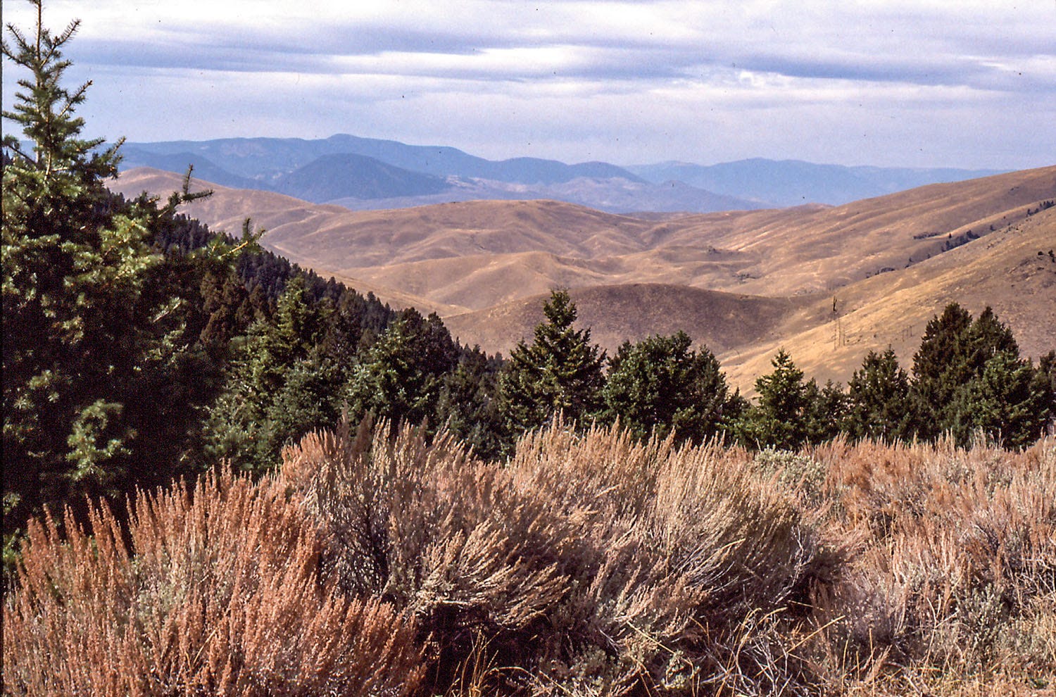
It is unlike any mountain pass I have ever crossed. From Lander, we followed State Route 28 to the southwest, climbing a few hundred feet and then entering a wide valley, more of a sloping plateau than a cleft between mountains. The pass is bounded on the north by the Wind River Range, with peaks 14,000 feet high, and on the south by the more modestly proportioned Oregon Buttes. The two ranges are more than 20 miles apart. The broad terrain of South Pass is treeless, clothed in sagebrush and grasses, the grade so gentle that travelers found it difficult to identify the 7,550-foot summit where they passed from the Atlantic drainage to that of the Pacific.
During more than 10,000 years of residence in the West, indigenous people had figured out the most favorable passages through its mountainous topography, using them to establish a complex web of travel and trading routes that reached from the western sea to the Midwest and beyond. Probably relying on native advice, the first non-indigenous party known to have crossed the Rockies via South Pass was a group of fur trappers and traders working for John Jacob Astor’s Pacific Fur Company, who passed that way in 1812 traveling from west to east. Outbreak of the war between Great Britain and the United States that year overshadowed news of the existence of South Pass (named that to distinguish it from the Lewis and Clark expedition’s tortuous northern route through the Bitterroots), and disrupted the Rocky Mountain fur trade for years.
It was not until 1824 that another group of fur trappers and traders, working for the Rocky Mountain Fur Company, happened across the pass — also likely acting on tips from Native Americans — and broadly disseminated word of its existence back in the East. Until that time, the conventional wisdom among the mountain men of the fur trade had been that although there were many places to cross the mountains on foot or on horseback, the journeys were difficult and dangerous, and the trails were not suitable for wagons or women. South Pass upended that narrative.
The first party to cross South Pass with wagons was not motivated by profit or a pioneering urge. It was a group of Presbyterian missionaries from New England, including Marcus and Narcissa Whitman, and Henry and Eliza Spaulding. They had been assigned by church leaders to bring the Christian gospel to Indians in the Oregon Country (which at the time encompassed today’s Oregon, Washington and part of Idaho). The Whitmans established a mission among the Cayuse in what is now the Walla Walla Valley of southeastern Washington.
Although their story ends tragically for all concerned (more about that in the next and final installment of “Tales of Trade”), their 1836 journey on the Oregon Trail over South Pass was vivid proof that married couples traveling in wagons could make their way from Missouri and over the Rockies to a new home in the Far West. More followed, a trickle at first. But in 1843, a wagon train of more than 1,000 pioneers, mostly families, would follow the missionaries’ trail to Oregon. The rush to the Pacific Northwest was on in earnest.
For travelers on the Oregon Trail, South Pass was not just a symbolically important landmark — the literal high point on the trek, and roughly halfway from Independence, Missouri, to Oregon City, Oregon — but a politically potent one as well. For when they crossed the Continental Divide into the watershed of rivers flowing to the Pacific, the pioneers also left their home country.
Up to that point, they’d mostly been crossing territory acquired by the United States from France in 1803 through the Louisiana Purchase. But the western boundary of that gigantic hunk of real estate was defined by the watershed of the Missouri River and its tributaries, all of which arose on the eastern flank of the Rockies. Beyond the divide, the emigrants were traveling through country to which both the U.S. and Great Britain had laid claim, but had agreed to occupy jointly through an 1818 treaty that settled territorial disputes between the two countries arising from the War of 1812.
(The competing claims would not be settled until 1846, when the current international boundary along the 49th parallel was established. And of course neither of those colonial powers bothered to ask what the people already living there — hundreds of thousands of indigenous people whose ancestors had arrived more than a hundred centuries earlier — thought about these claims and treaties.)
Many of the emigrants remarked on the symbolic weight of the moment in their diaries.
Yesterday at noon we arrived at the “culminating point,” or dividing ridge between the Atlantic and Pacific ... Thus the great daydream of my youth and of my riper years is accomplished. I have seen the Rocky Mountains — have crossed the Rubicon, and am now on the waters that flow to the Pacific! It seems as if I had left the old world behind and that a new one is dawning upon me.
— Diary of Charles Stanton (July 19, 1846)
Preserved in stone
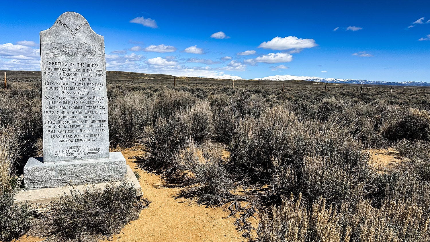
It was windy as we crossed the pass, but not dangerously so. We didn’t want to press our luck, however, so we had decided to forego a tempting detour to the sites of South Pass City and Atlantic City, mining settlements that sprang up in the 1860s after gold was discovered there. Just west of the South Pass summit, we came to a pullout near a monument marking “The Parting of the Ways” — one of many such bifurcations along the course of the braided westward trails. This one was more definitive than the others, for it was here that travelers bound for Oregon took the right-hand fork in the road and continued northwest, whereas those headed to California or the Mormon settlements in Utah took the left fork and angled southwest.
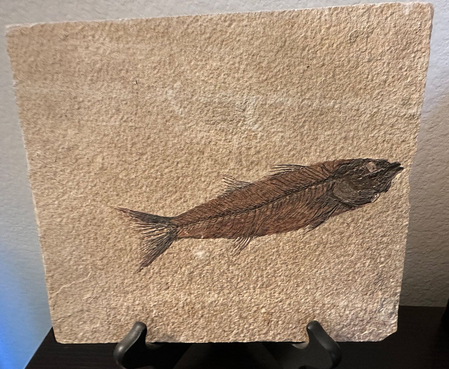
Leaving the pass behind, we continued on to Fossil Butte National Monument, just outside the old coal town of Kemmerer. Two branches of the Oregon Trail bracket the monument, although neither passes directly through it. But it is well worth a stop if you find yourself in the neighborhood, for its eponymous butte is a treasure house of, well, fossils. Specifically, the remarkably well-preserved remains of billions of organisms — from fish to crocodilians, lizards, snakes, birds, bats, small horses, amphibians, gastropods, crustaceans, plants and insects — that lived in and around an Eocene lake on that site 52 million years ago. The fossils are contained in a layer-cake of limestone, volcanic ash and mudstone known as the Green River Formation; similar fossil-rich deposits may be found on former Eocene lake beds elsewhere in Wyoming as well as in Utah and Colorado.

The fossils’ unusually complete state of preservation is the result of Fossil Lake’s unique water chemistry, and a complex set of circumstances and physical processes the National Park Service describes in great detail on the monument website. Thousands of specimens have been quarried from the fossiliferous layers of the former lakebed, each painstakingly revealed within its slim matrix of stone, and placed on display in the visitor center.
The recovered fossils are scientifically important evidence that makes it possible for paleontologists and geologists to reconstruct an ancient environment. But they also are beautiful, works of art produced by a collaboration between nature, which crafted them, and skilled technicians who liberated them from their lithic burial vaults with delicate tools. On a visit to a nearby commercial fossil gallery more than two decades ago, I purchased a specimen — the skeleton of a small fish that finned its way around a freshwater lake in the time when mammals first supplanted dinosaurs as the dominant terrestrial life form — and it has been prominently displayed on a bookcase in my home office ever since.
We spent that night camped just outside the national monument in a high-desert meadow ringed by sagebrush, with a striking view of Fossil Butte. As the sun dipped toward the western horizon, its warm light ignited the butte’s colorful rock layers, within which were hidden a fossilized testament to the impressive diversity of life that flourished there so long ago.
It was a fine place to reflect on the ancient past, as well as the much more recent past — the adventures we’d had over the thousand miles and seven days we had traveled west since leaving Missouri. It was a good place, too, to think about what remained of our journey: Ahead of us lay Idaho and then Oregon. In five days, we would reach the Willamette Valley, the final destination of thousands of trail-worn travelers who had camped on the same sagebrush plain more than 150 years before us.
Coming in Part 6: Journey’s end.
And then there's the Mountain Meadows Massacre that is right up there in immigrant disasters
Wow