

Tales of Trade, Migration and Conquest
Digging into history along the Santa Fe and Oregon trails

Part 1: The pueblo and the fort
We rolled into Santa Fe on a sunny afternoon in mid-April, piloting our camper van down narrow streets lined by leafy trees and old adobes as we made our way toward the plaza at the city’s heart.
New Mexico’s capital is an old community. The city itself was established in the early 1600s, and it was built at the site of ancestral pueblo settlements dating back to the early 11th century. Tucked into a verdant valley at the foot of the Sangre de Cristo mountains, Santa Fe boasts of being the “oldest capital city in the United States” deriving from its role as the provincial capital of the northernmost Spanish territory in the New World. It acquired that status in 1610 when a new governor relocated the seat of local administration to Santa Fe from the first provincial capital, which had been established in 1598 about 25 miles to the north at San Juan Pueblo.
My partner Leslie and I found parking next to the downtown cathedral — a relatively modern stone structure completed in 1887, built on the site of a succession of humbler adobe Franciscan churches constructed by the Spanish in 1610, 1630 and 1714 — and walked the short distance to the plaza.
We had been on the road for three days already, but the plaza was really the symbolic start of our journey. We set out from Ventura on April 15 in Next Chapter, our adventure van, with the goal of retracing the route of the Santa Fe National Historic Trail from New Mexico to Missouri, and then following the path of the Oregon National Historic Trail from Missouri westward to Oregon’s Willamette Valley.
Unlike most of the trips we have taken in the van, our 25-day National Trails itinerary was not designed primarily to explore scenic features of the physical landscape of the West. Instead, its objective was to explore human history and the activities, dreams and desires that have shaped the region’s communities. We planned to spend more time exploring museums, historical sites and visitor centers than hiking on rugged trails, and more days in motion than at rest.
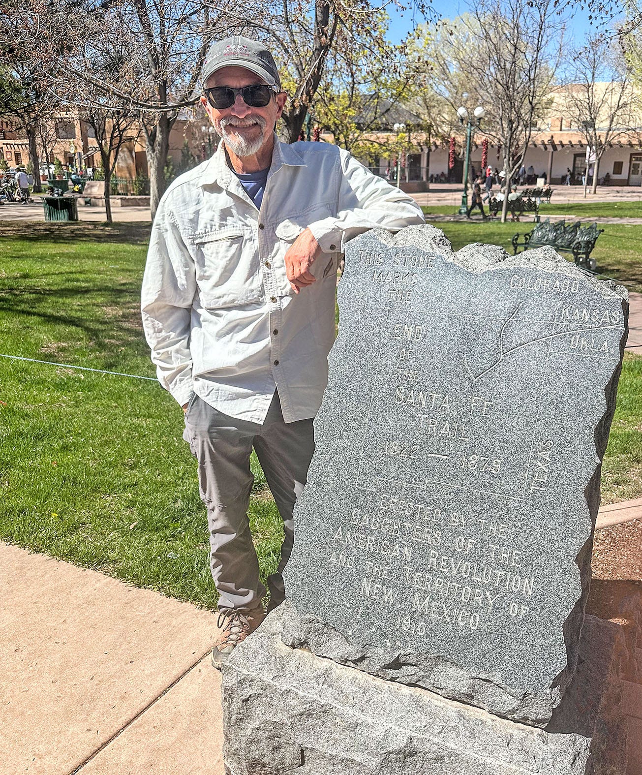
With its many-layered history reaching back a thousand years, Santa Fe was a good place to kick off this journey. On the southeast corner of the town plaza stands a granite marker, placed there in 1910 (two years before New Mexico statehood) by the Daughters of the American Revolution, denoting it “The End of the Santa Fe Trail.” Chapters of the DAR in states along the trail (New Mexico, Colorado, Kansas and Missouri) placed nearly 200 of these markers along the thousand-mile route in the early 20th century, and this one exhibits a characteristically American perspective in its brief inscription. For in reality, the Santa Fe Trail was a two-way road of commerce between the United States and Mexico. Santa Fe is only the trail’s “end” if you begin your trek in Missouri. For Mexican traders — as for us — it’s where the trail began.
Of the 21 National Historic Trails administered by the National Park Service, the Santa Fe is one of only four that have their roots in commerce rather than exploration, migration or a specific culturally or historically important event. But like many of those trails, the route we would travel from New Mexico to Missouri over the next week would lead us through a fraught landscape marked by repeated examples of cultural collision, collusion and conflict over hundreds of years.
A night in the Land of the Dead
Before we left Santa Fe, we visited the informative New Mexico History Museum, and the attached Palace of the Governors — the oldest continuously occupied public building in the country, in use for more than 400 years. Exhibits there amplified what we had learned about the region’s history during our pre-departure research, and set the stage for the deeper lessons we would learn during the next days and weeks on the road.
In bare outlines, the existence of the Santa Fe Trail long predates the existence of Santa Fe itself. For hundreds of years before Europeans or Americans arrived in that part of the continent, indigenous people used the route — which crosses a relatively low pass (now known as Glorieta) through the Sangre de Cristo range of the Southern Rockies — for trade and sometimes warfare.
The modern trail has a very specific birth date. On Sept. 1, 1821, William Becknell and four other men set out from Franklin, Mo., with a collection of trade goods and a string of pack horses, heading west. American and French traders had previously tried to establish commercial ties with the settlement at Santa Fe — then a remote Spanish colonial outpost with scant access to manufactured goods and agricultural commodities but plenty of locally mined silver — but Spain forbade foreign incursions of that sort and generally arrested the would-be traders as trespassers.
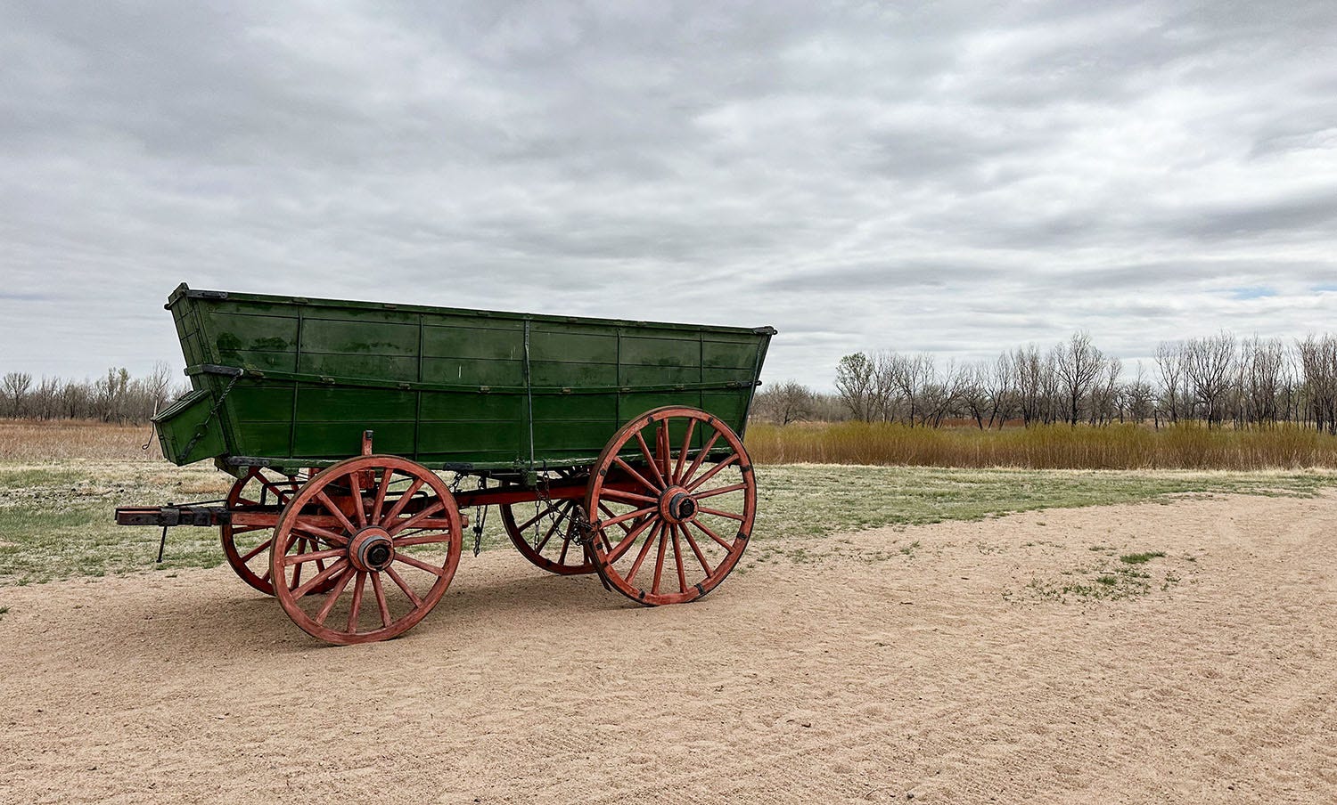
But Becknell was lucky in his timing: A few weeks after he left Franklin, Mexico won its independence from Spain and immediately opened its borders to international trade. By the time the Becknell party arrived in Santa Fe on Nov. 16, they were welcome guests not intruders, and their modest supply of goods reaped them handsome profits. This generated considerable excitement upon their return to Franklin on Jan. 29, 1822, and the floodgates of international commerce opened. Soon a steady stream of wagon trains poured through, and the Santa Fe Trail served as a significant commercial route and avenue of colonization in the Southwest for another half-century, until the railroad reached Santa Fe in 1880 and rendered wagon traffic obsolete.
After we left Santa Fe we headed southwest, aiming for our first campsite along the historic trail. It was atop a mesa overlooking the village of Madrid (locally pronounced MAD-rid), established in 1891 by the Cerrillos Coal and Iron Co., a subsidiary of the Atchison Topeka & Santa Fe Railroad. Madrid was a company-owned mining town, housing workers who tapped an unusual deposit of bituminous and anthracite coal in the surrounding mountains. It was shut down after World War II, as railroads shifted from coal to diesel fuel to power their engines, and natural gas replaced coal for home heating. Madrid’s inhabitants mostly scattered, and the town remained all but uninhabited for decades.
It was reborn in the 1970s, when the town’s newest owner began selling off parcels at affordable prices to individual buyers. Now an artsy-craftsy colony with a bohemian vibe, Madrid features colorful buildings and lots of fanciful outdoor art. Thanks to its location along state Highway 14 — the renowned Turquoise Trail National Scenic Byway between Santa Fe and Albuquerque — its cafes and galleries do a brisk business during tourist season.
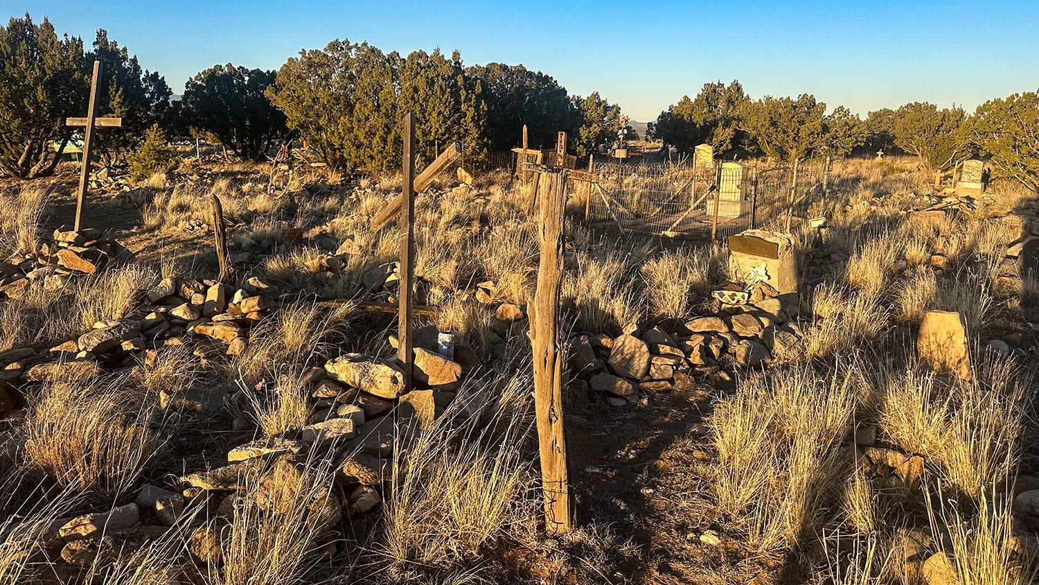
We’d reserved a Hipcamp site atop Waldo Mesa, which looms above the town, and made our way there along narrow unpaved roads that climb a steep and rocky incline. Our host’s driving directions indicated we would be passing a cemetery just before arriving at our campsite, but that did not really prepare us for what we found when we pulled in.
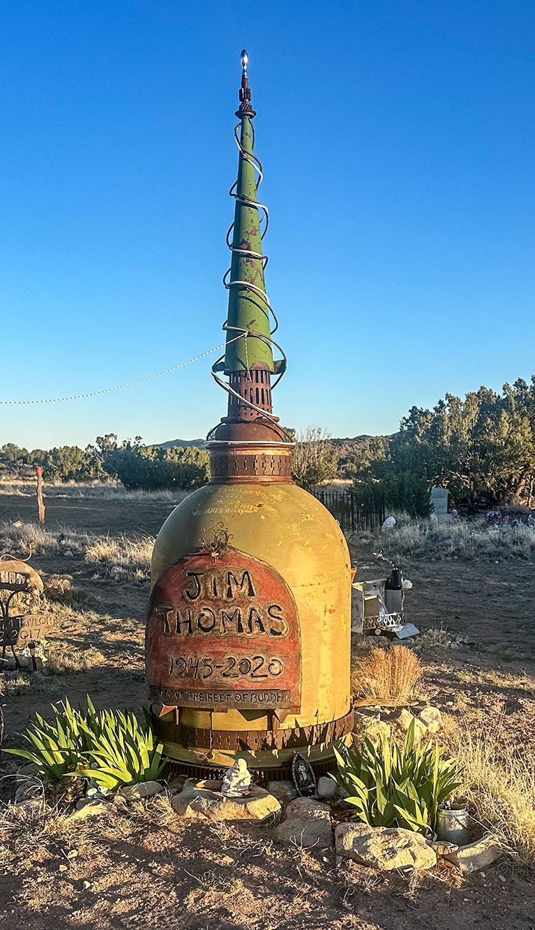
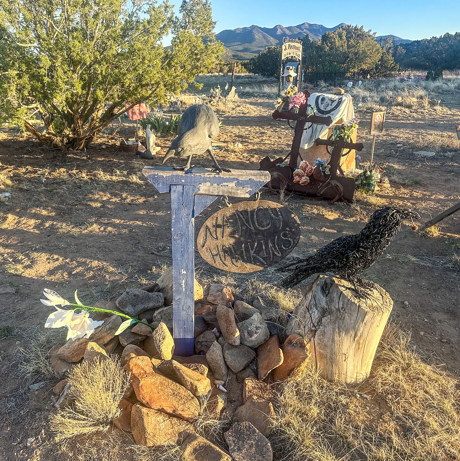
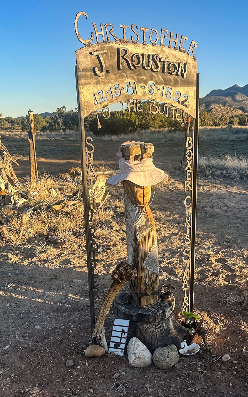
There is indeed an old town cemetery along the road to the property, a partially fenced and somewhat overgrown rectangle where Madrid residents from the coal-boom days are buried beneath rough wooden crosses and weathered stone tablets. Spilling out of it, however, is a larger cemetery of the post-1970s Madrid, a field of gloriously idiosyncratic memorials to the more recently departed that has about as much in common with a conventional cemetery as a peacock does with a house sparrow.
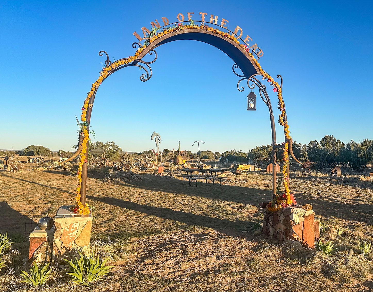
Built out of found objects, metal sculptures, natural materials, wooden figures and more, inscribed with epitaphs that range from cryptic to amusing, the memorials create a nearly indescribable field of artistic whimsy, pathos and celebration. Scattered throughout are folding chairs, sofas and picnic tables, as well as a covered event stage. At the entrance is a wrought-iron archway decorated with flowers and lights, topped by metal lettering that proclaims the plot the “Land of the Dead.”
Reached by phone after we were back home, Kim Stephens, the campsite host and owner of the 20-acre parcel that includes the cemetery, said most of the modern “gravestones” were created by two local artist-blacksmiths. She also said she didn’t realize when she agreed to buy the property 11 years ago that it came with the village burial ground, discovering that only when she read the fine print of the purchase documents. But she has embraced her role as the guardian of Madrid’s dead and their memories: arranging burials, building coffins when needed, and planning ceremonies that reflect the wishes of the deceased. These are recorded in the cemetery’s “Book of the Dead,” a sort of advance-directive catalog to which local residents can contribute before they pass.
“Nobody dies now without calling me,” she said. “I’ve literally become the cemetery lady.”
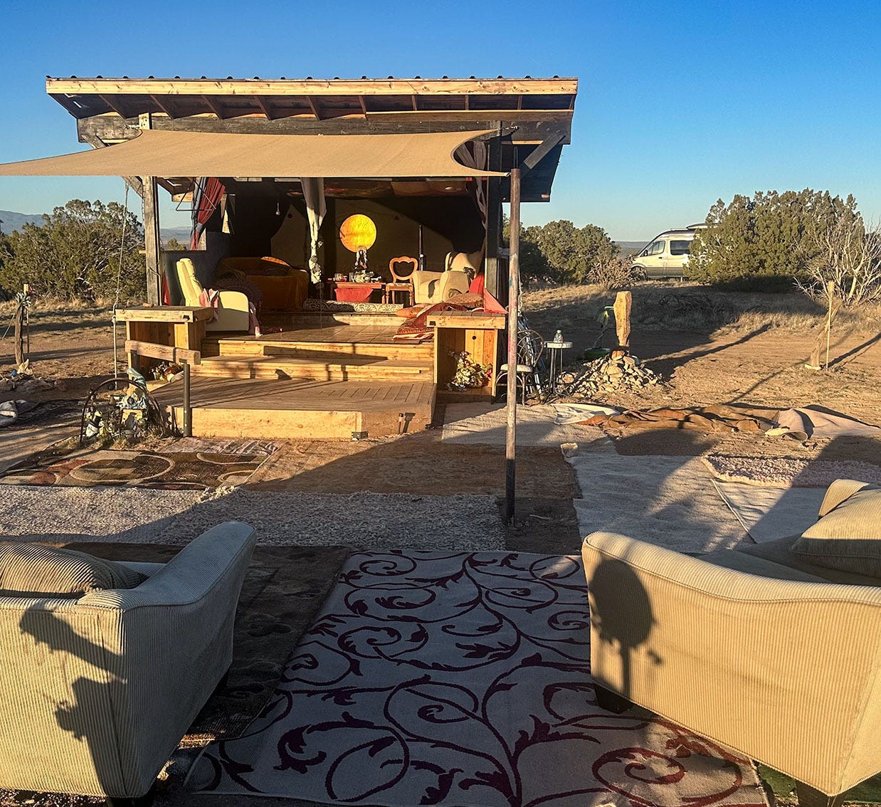
The stage is used for memorial gatherings, she said, but also for periodic musical performances and as the hub of Day of the Dead parties. In effect, the cemetery has become a community center for the 287 residents of Madrid.
We wandered among the memorials, glowing in the golden light of a setting sun, before retiring to our campsite a few yards from the cemetery’s edge. To the east, we had a panoramic view of dry, crumpled country carved by ravines and clothed in pinyon pines and junipers. Below us was the town, hidden in its narrow canyon, and over everything lay a great quiet.
One of the things we have learned in our travels around the West is that for every boomtown that vanished when its original reason for existing evaporated, there is another that has reinvented itself and adapted to the changing tides of history. Madrid was not the first of these dogged civic survivors we have encountered, and it will not be the last. But it certainly will be one of the most memorable.
War in the West
From Madrid, our road led next through one of the most historically interesting stretches of the old Santa Fe Trail route. Driving north, we picked up Interstate 25, which makes a great bend to the southeast and climbs over Glorieta Pass before crossing the Pecos River and curving back to the northeast through the old railroad town of Las Vegas.
Beyond Las Vegas the trail continues northeast to the Canadian River, where we — like traders in the 1800s on their way to Missouri — would have to make a choice between two routes. One option, called the Cimarron Route, heads east toward the Cimarron River roughly along the alignment of today’s U.S. Highway 56. This is the shortest and original Santa Fe wagon route, but there is no water in its easternmost 60 miles and in later years of the trade it was subjected to raids by restive indigenous tribes. Increasingly, traders chose a longer but safer and more well-watered option called the Mountain Route, which crosses Raton Pass on the Colorado-New Mexico border, and then gradually curves to the east and the valley of the Arkansas River, which it then follows to a junction with the Cimarron Route in Kansas.
We planned to take the Mountain Route, mainly because I wanted to visit Bent’s Old Fort National Historic Site, which is on that branch of the trail just east of La Junta, Colo. The huge adobe trading post played a critical role between 1833 and 1849 in Santa Fe Trail commerce, but was also a centerpiece of the Rocky Mountain fur trade and diplomatic relations between the American government and Southern Plains tribes.
At Glorieta Pass, we pulled off the road to examine a collection of historical markers. In March 1862, the pass was the site of a battle between Union and Confederate troops that almost no one but die-hard Civil War buffs is aware of but which may have changed the course of the conflict. It’s easy to overlook this element of that war, given that most of the fighting and dying took place in the southern and mid-Atlantic states, where the major national battlefield parks and monuments are located. But the Civil War extended its deadly tentacles into western territories as well.
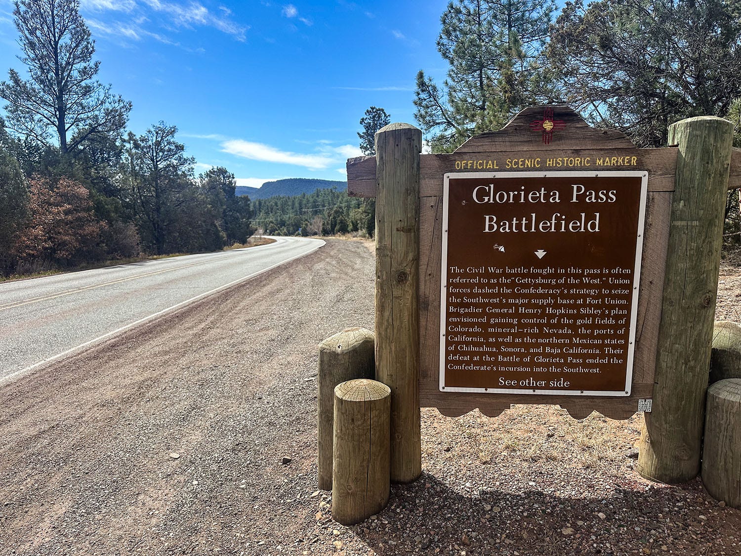
Glorieta Pass is not the westernmost Civil War battlefield — that distinction belongs to a skirmish at Pichaco Peak near Tucson, Ariz. — but it was pivotal in heading off a Confederate move to send troops north out of Texas into New Mexico, aiming ultimately to take control of Colorado’s gold fields and then sweep west to seize the California seaports of Los Angeles and San Diego. Access to the wealth of western gold might have changed the fortunes of the Confederacy, but while traveling over the Santa Fe Trail at Glorieta Pass its army — which had successfully seized and occupied Albuquerque and Santa Fe — ran into a Union force of volunteers from Colorado. In three days of battle the Confederates dislodged the Union troops, but a detachment of the Colorado volunteers had meanwhile circled behind the Texans’ front, destroyed all their supplies and equipment, spiked their cannons and run off their pack animals. The Confederates were forced to retreat, and thus ended Dixie’s western incursion.
Crossroads of commerce
A short drive from the pass led us to Pecos National Historical Park, which preserves some of the Civil War battlefield as well as remains of a once-imposing indigenous pueblo and a Spanish mission church.
Evidence of hunter-gatherer habitation in the region dates back more than 12,000 years, but it wasn’t until about 800 AD that people there began to settle into permanent communities dependent on agricultural crops, and the 1100s when they began gathering in multi-family pueblos. As the population grew, these smaller villages consolidated into a single large settlement at Pecos Pueblo around 1450. Situated on a ridge with a commanding view of the Pecos River Valley, the pueblo eventually was home to an estimated 2,000 people, living in a walled complex of stone structures four or five stories high.
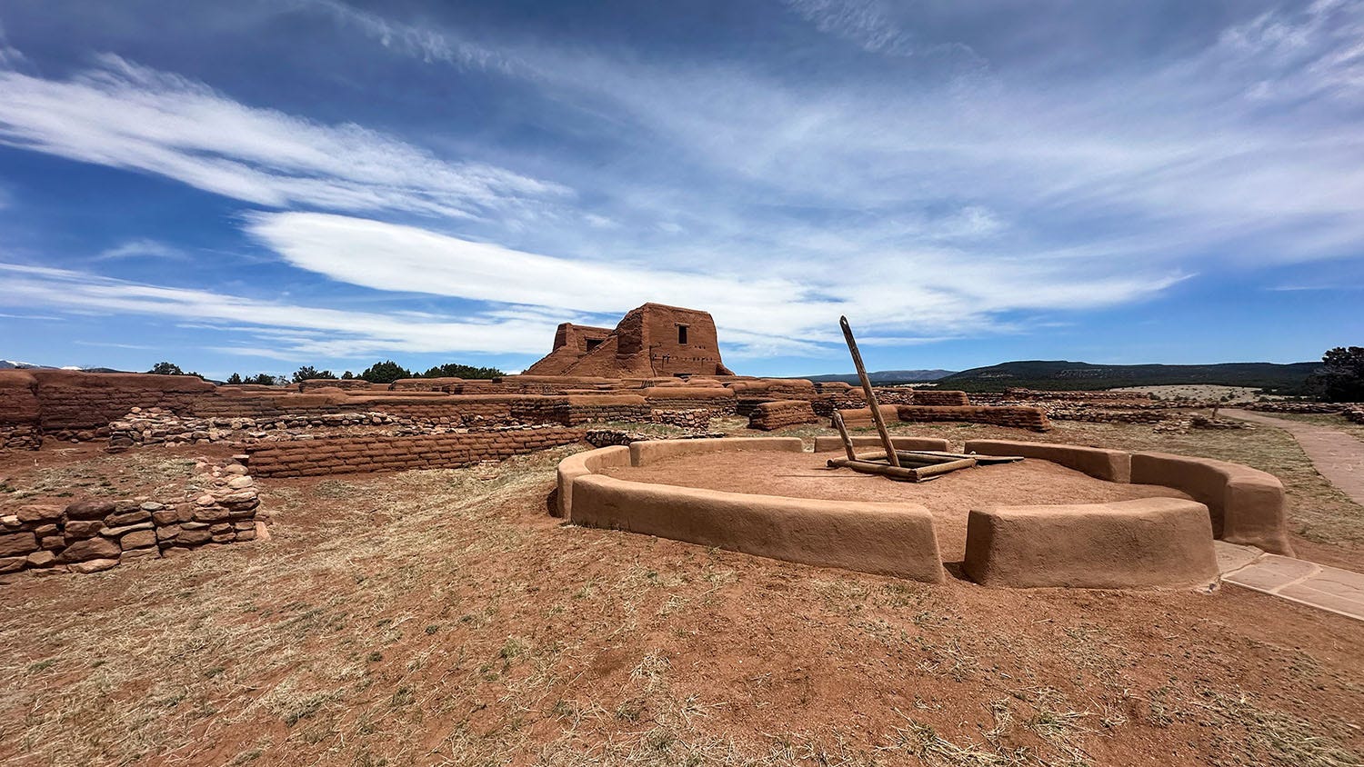
The community was located along the natural travel corridor over Glorieta Pass, which connected the Great Plains and their nomadic hunter-gatherer cultures with the Rio Grande Valley (location today of Albuquerque) and its crop-tending Pueblo dwellers. This strategic placement made Pecos a hub of transcontinental trade, and it became wealthy and powerful.
It also attracted the attention of Spanish colonizers, who arrived in the Southwest in 1541 and reached the Pecos River Valley in 1610. Predictably, this did not end well for the people of Pecos (more on that in a future installment of Next Chapter Notes), and by the time Mexico-U.S. trade traffic began moving over the Santa Fe Trail, only a small remnant population inhabited the great pueblo. In 1838, the last of them moved to Jemez Pueblo, just outside of Albuquerque, where today they maintain many of the traditions and rituals of the Pecos people.
After driving over Raton Pass into Colorado, we spent that night camping in the Comanche National Grassland, a rugged patch of former prairie where American agrarian dreams went to die in the years leading up to the great Dust Bowl of the 1920s and 1930s (more about that, too, in a future installment). We then continued through La Junta along the Santa Fe Trail’s Mountain Route on our way to Bent’s Old Fort National Historic Site, a reconstruction of a trading post active in the 1830s and 1840s, where we found an evocative echo of Pecos Pueblo but separated from it by half a millennium.
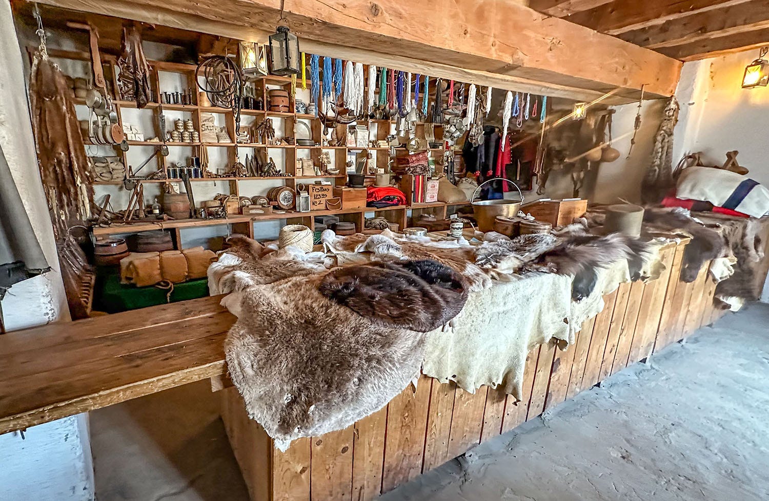
Like Pecos, Bent’s Fort — established in 1833 by brothers Charles and William Bent, and their partner Ceran St. Vrain — occupied a strategic crossroads of commerce. Located on the north bank of the Arkansas River (which then served as the international boundary between the U.S. and Mexico) it was close enough to the Rockies to attract fur trappers; near enough to the tribal hunting grounds of the Cheyenne, Kiowa, Arapaho and Comanche to facilitate trade of their buffalo robes and horses for axes, firearms and other manufactured goods; and well situated to serve as a vital resupply and repair depot for wagon trains traveling the Santa Fe Trail between Missouri and Mexico.
The fort has been meticulously rebuilt using detailed drawings made by an Army engineer in 1845 and 1846, and is thoroughly furnished with vintage tools, trade goods and other artifacts. It is one of the most spectacular reproductions of an early 19th century frontier post I have ever seen, and the National Park Service made the brilliant decision to locate the parking lot a quarter-mile away from the fort’s front gate. This means most modern visitors must approach it on foot, as many 19th century visitors would have. The pathway leads through open grassland in a largely undeveloped rural area, the site edged by a line of cottonwoods tracing the banks of the Arkansas.
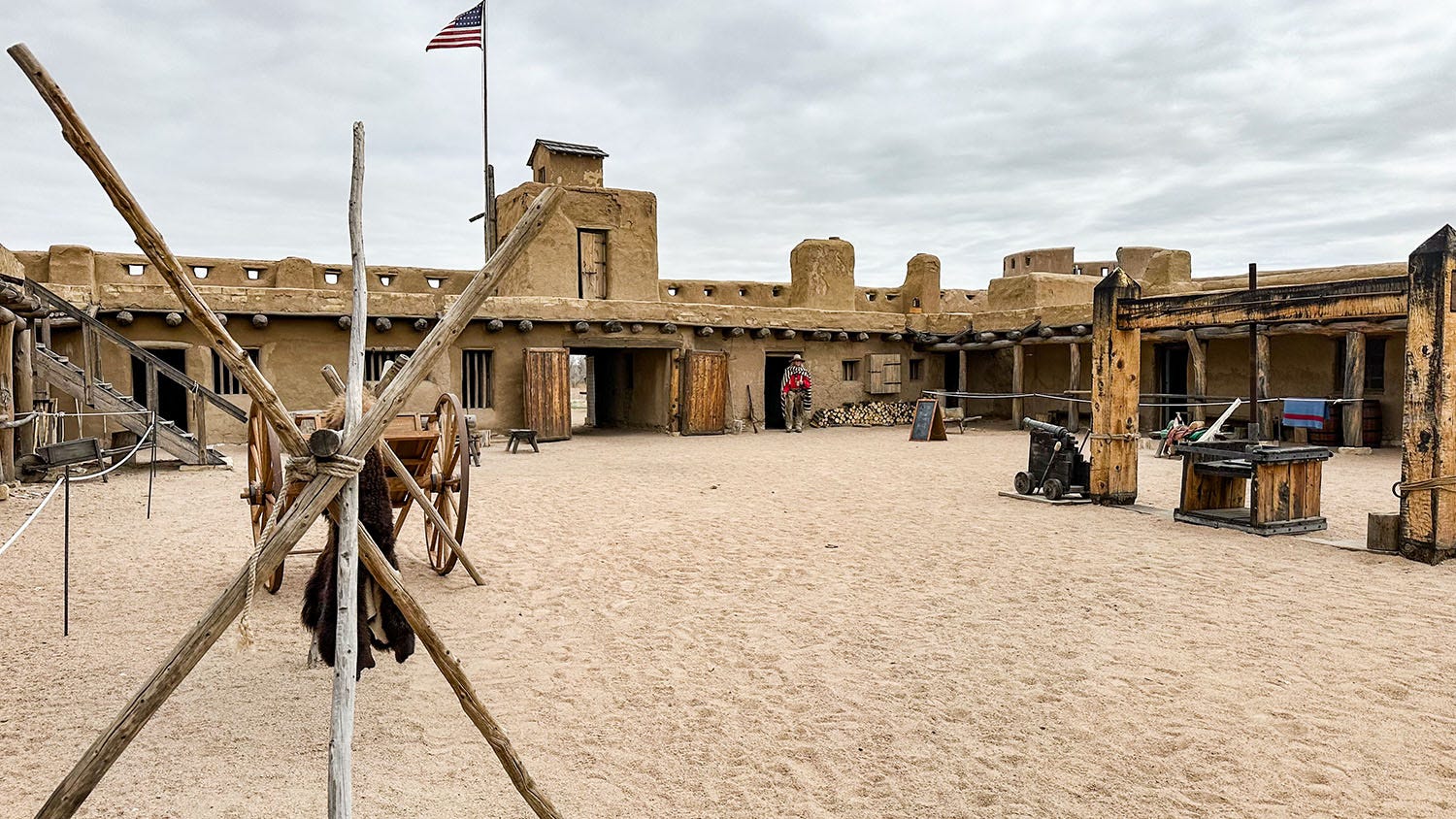
It was a brisk day when we visited, lowering clouds and a chill wind making it clear that spring was still waiting in the wings on the Southern Plains. We bundled up and followed the curving path to the fort’s big front gate. As we approached through the open ground, we could feel time reeling backward, and when we entered it was as if we had stepped through a portal into 1840.
Somewhere in the distance it seemed we could hear the creak of wooden wagon wheels, the metallic jingle of harness gear and iron spurs, the faint cries of drovers urging draft animals forward. Or was it just birdsong in the marshes and woods along the river? Whichever it was, at that moment our journey into history slipped into a deeper and more vivid phase.
Coming in Part 2: Crossing Kansas and the Great Plains.
What a wonderfully historical and cultural look at an important part of our country. Thanks, John, for taking me along vicariously!
Good stuff, John. Liz and I were in Santa Fe last month for Liz’s birthday, and we stopped for a drink in Madrid while traveling to Albuquerque. Wish we had seen the cemetery! Great dive into the area’s fascinating history- look forward to reading the next installments.