


Monumental Landscapes
Seeking solitude, art and mystery in southwestern deserts

Part 1: Petroglyphs and slot canyons
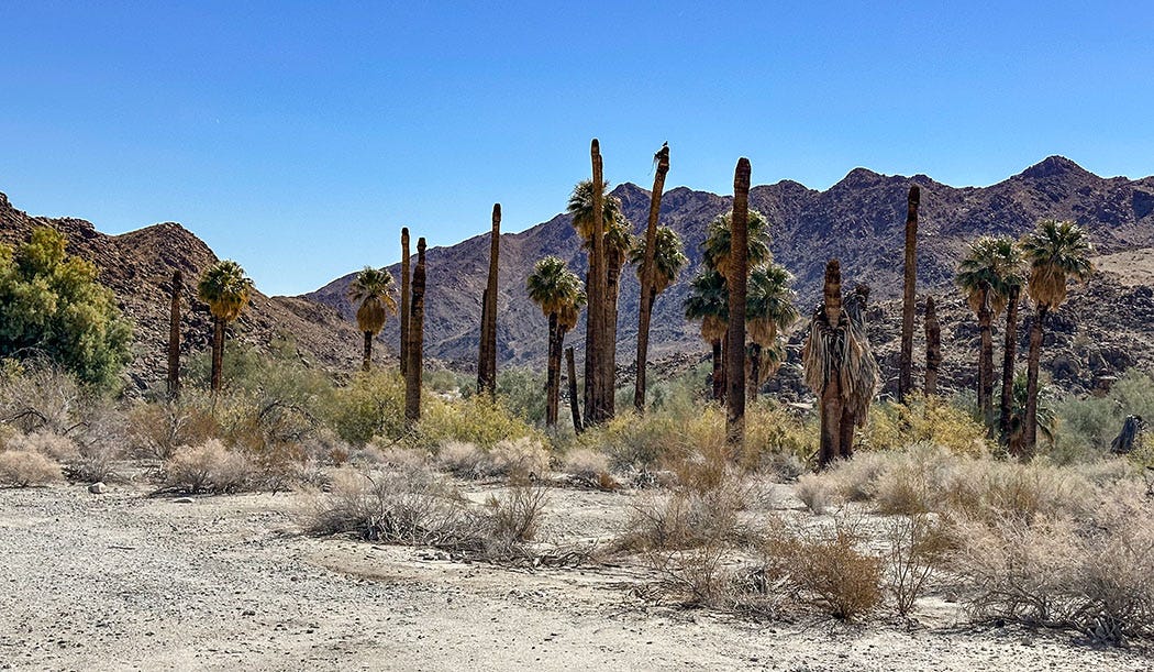
At Corn Springs Campground in California’s new Chuckwalla National Monument, you will find neither corn nor springs.
What you may find is a handful of modern-day desert rats camping in the meager shade of tattered California fan palms, many of them dead and decapitated (the palms not the campers). You may see a raptor floating the brittle desert air on patrol for unwary prey. And what you certainly will find is visual evidence of a more ancient human presence, pecked into boulders along the edges of a wash carved into the rugged Chuckwalla Mountains.
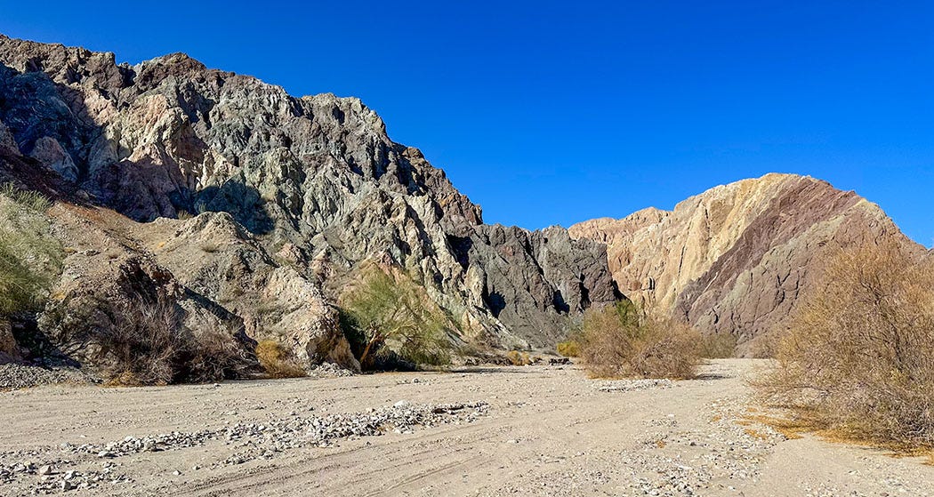
Corn Springs was the first destination of our inaugural 2025 camping trip in Next Chapter, our adventure van. To reach it, my partner Leslie and I had dodged our way though more than 200 miles of Southland traffic before turning off Interstate 10 onto a washboard dirt road not far from the Arizona border and clattering our way into the Sonoran Desert for about 7 miles. We arrived in the last fading light of day (Note to self: Do not ever again start a road trip by crossing the L.A. Basin by freeway on a Friday afternoon) and set up our boondocker camp on a roadside rise about a mile from Corn Springs.
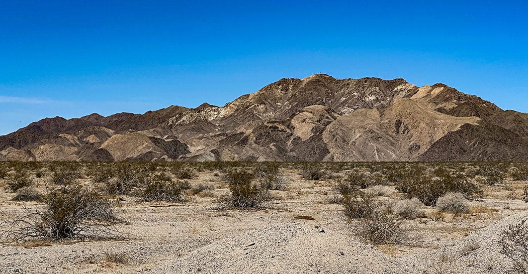
Chuckwalla National Monument is named after a species of large lizard found across a wide swath of the Mojave and Sonoran deserts, and it was created by the Antiquities Act proclamation of President Joe Biden just weeks before he left office in January. It was one of two Biden-era monuments we visited on this trip, a nearly weeklong excursion across Southern California and Nevada that brought us to remote sand dunes, colorful slot canyons, a nearly uninhabited mining town with an improbably lavish entertainment venue, and a mysterious desert hot spring inhabited by a nearly extinct fish.
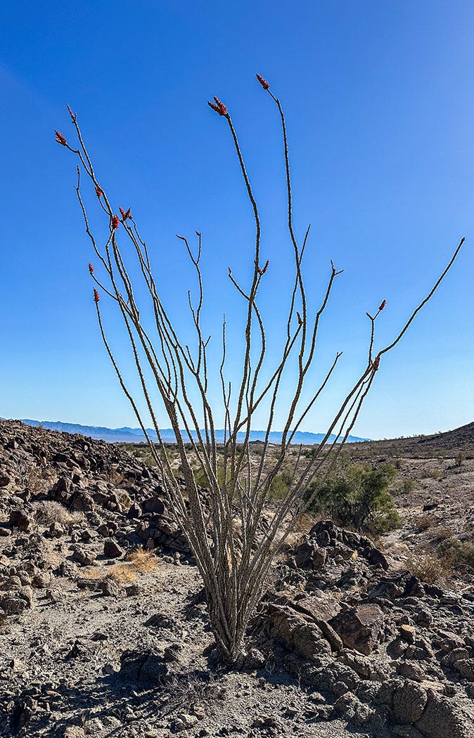
The morning after our arrival, we hiked along the unpaved road to the Corn Springs palm oasis, through a wash studded by paloverde, mesquite, and spiky clusters of ocotillo cactus bearing blooms the shape and hue of fuchsia lipsticks. As we neared the head of the canyon, we came across a bronze Riverside County historical marker cemented onto the face of a boulder, memorializing Corn Springs as not only the longtime haunt of Indigenous tribes — springs there flowed on the surface until the 1920s, and a prehistoric Native village in the vicinity was at least seasonally occupied — but also of a white prospector named Gus Lederer, who settled nearby in the early 20th century and reportedly became known as “the mayor of Corn Springs.”
It is not clear who referred to him by that title, given the remote location of his domain, but according to the U.S. Bureau of Land Management he kept a string of 18 burros around for company — referring to them as “reptiles” and making pancakes for them each morning — so perhaps they constituted his grateful citizenry. Gus lived there from 1915 until 1932, when he succumbed to a fatal black widow spider bite, which strikes me as a very desert-rat way to go.
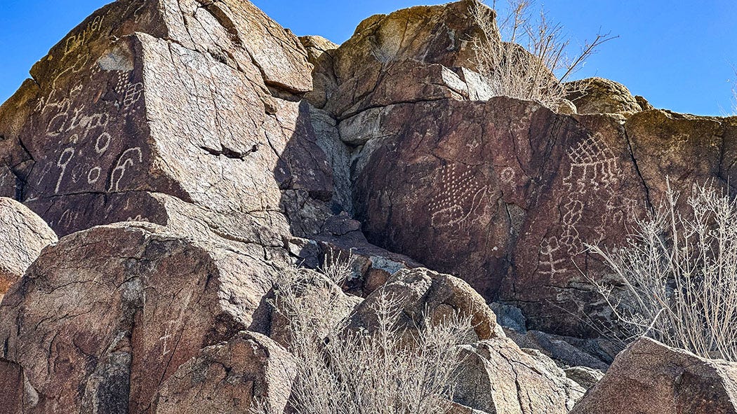
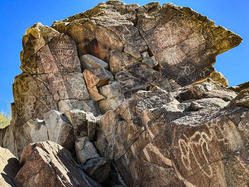
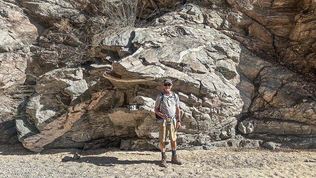
But for us the main attraction was the panels of petroglyphs pecked into dozens of boulders on the north and south sides of the wash about a hundred yards from the developed campground. Created within the past few thousand years, they are likely the work of the Cahuilla, much of whose homeland overlaps Chuckwalla National Monument. Its 740,000 acres are bounded by Interstate 10 on the north and by the Salton Sea and the Chocolate Mountain Aerial Gunnery Range on the south; west to east it reaches from the Coachella Valley to the Colorado River on the Arizona border. Detached units abut the southeast border of Joshua Tree National Park.
According to the BLM, the landscape of Chuckwalla National Monument remains important to a wide array of Indigenous groups:
The lands within the Monument have, and continue to be, home to the Iviatim (Cahuilla), Nüwü (Chemehuevi), Pipa Aha Macav (Mojave), Kwatsáan (Quechan), and Maara’yam and Marringayam (Serrano), and other Indigenous peoples and include sacred trails, sacred sites and objects, traditional cultural places, geoglyphs, petroglyphs, pictographs, and culturally important plants and wildlife.
It is a landscape that should be visited in a spirit of respect.
Land of ropes and ladders
We broke camp after lunch and drove 60 miles to the Mecca Hills, at the westernmost tip of Chuckwalla National Monument. The route followed Box Canyon Road from the I-10, dropping southwest through a landscape of eroded badlands on its way toward the tiny town of Mecca on the Salton Sea shoreline.
The Mecca Hills are primarily a layer-cake of relatively young lake sediments tortured by the convulsions of the San Andreas Fault zone and dissected by a labyrinth of canyons. Among them are Painted Canyon, and the somewhat ominously named Ladder and Rope canyons, which, indeed, require climbing up and down ladders and ropes to traverse. As you might expect from its name, Painted Canyon is a colorful place, the sheer walls of compacted silt, clay, sand and cobbles brushed with a palette of red, purple, pink, green, brown and black.
Despite the obstacles to hiking posed by numerous dry falls in the canyons, and the 5 miles of very sandy unpaved road that leads to them, the Painted Canyon trailhead during our Saturday visit was crowded with vehicles and busy with hikers. Some of this could be due simply to proximity; although it seems remote, Mecca is within a couple hours’ drive of several million people. But judging by the youthful demographic profile of most of the large groups of hikers we encountered, the Instagram- and TikTok-friendly nature of the colorful slot canyons and their network of somewhat precarious aluminum ladders likely is driving traffic both on social media and IRL.
Regardless, we parked the van and headed out to explore the main stem of the canyon complex. In short order, we found ourselves in the sort of landscape that’s familiar from our excursions into the redrock country of Utah but less so in California: towering multicolored canyon walls, enclosing a narrow wash punctuated by the occasional desert tree or shrub. The major difference between the Utah canyons and the Chuckwalla version is the geology. Unlike the great sandstone galleries of the Colorado Plateau, reflecting a fairly simple and largely maritime environment of shallow inland seas, beaches and dune fields, Painted Canyon tells a more complex story.
It is a story with several chapters. The main body of the hills and canyon walls consists of Pliocene-Pleistocene lacustrine depositions — fancy terms for lakebed sediments accumulated within the past 5 million years. But in the deeper part of the canyons, those recent strata rest directly atop basement rocks perhaps a billion years older, which had been crushed, bent, cooked and transformed by an almost unimaginable journey of subduction into the semi-molten realm beneath the Earth’s continental crust. They were then thrust up into the sunlight, to later be inundated by a lake, buried beneath sediments worn from the neighboring mountains, and revealed again by the erosive work of floodwaters carving the canyons.
The technical details are interesting, especially if you are a geology nerd like me, but the most important thing to know is that it is a landscape profoundly weird and beautiful.
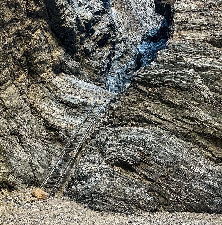
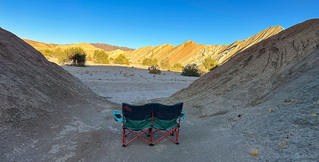
We turned back when we reached the first set of poorly anchored ladders, which provided a two-stage ascent of a 25-foot dry waterfall. I no longer tolerate vertical exposure as well as when I was young, and when my boots must leave the ground I no longer consider that to be hiking. We returned to the van, drove back to pavement, and found a secluded place to camp in a side wash off Box Canyon Road. Our perch on a small rise offered a great view of the canyon’s contorted walls, soon set aglow by the slanting amber light of sunset.
While setting up camp, our attention was drawn skyward by a faint sound sifting down through the desert quiet. Far overhead, a skein of more than 100 snow geese, roughly V-shaped but twisting and re-braiding constantly as the birds winged toward their subarctic summering grounds, was catching the last rays of sunlight. We watched silently as they passed overhead against a dimming sky, the attenuated residue of their honking cries following in their wake.
It was a fleeting gift of magic, the kind that often finds us when we live Outside.
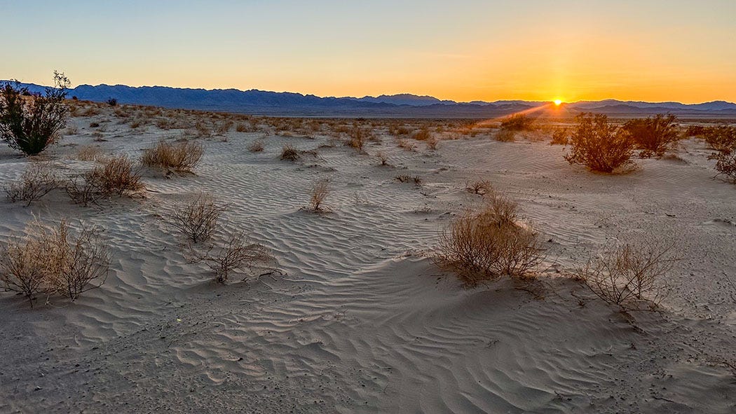
Land of sand
Our next destination was only a hundred road miles from the Mecca Hills, but it took us much of the day to get there.
We were bound for the Cadiz Dunes Wilderness, a 20,000-acre preserve established by the California Desert Protection Act of 1994. This landmark legislation affected management of more than 7 million acres in the state, including expanding and upgrading Joshua Tree and Death Valley national monuments to national parks, establishing Mojave National Preserve, and folding 70 new locations into the national wilderness system.
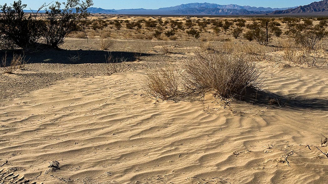
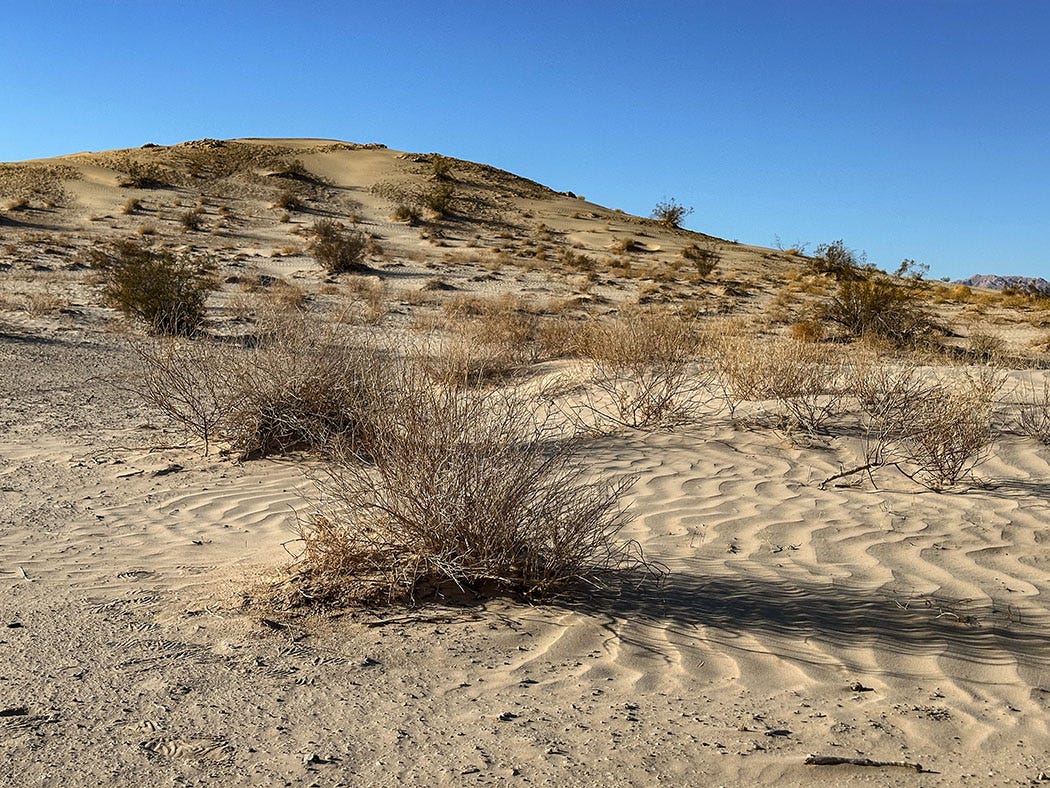
There are several dune complexes in that inventory. The Eureka Dunes in Death Valley are the highest, rising to more than 700 feet. The Kelso Dunes in Mojave National Preserve comprise the largest complex, covering 45 square miles. Cadiz is neither tall nor particularly expansive, but it does have one superlative quality: It’s the most-remote and least-visited of California’s major dune fields.
Since we were coming at it from the southwest, the most direct and practical route was to head east on I-10, north on State Route 171, and then onto the unpaved Cadiz Road, which angles northwest across Cadiz Dry Lake and skirts the edge of the dune field before running into pavement again 45 miles later at historic Route 66.
Turns out it takes a while to cover that kind of distance at an average speed of 12 mph. But it was well worth it.
There is one “official” parking lot and trailhead for hiking into the Cadiz Dunes Wilderness Area, but being the antisocial travelers that we are (when choosing campsites, anyway) we opted to avoid that. Instead, we followed Cadiz Road for about 30 miles, the unpaved surface alternating between rocky washboard and soft sand, and then turned onto an unmapped spur Leslie had identified using satellite imagery. This led us 5 miles to the wilderness boundary, where the road ended and we found a boondocking site in which to set up camp.
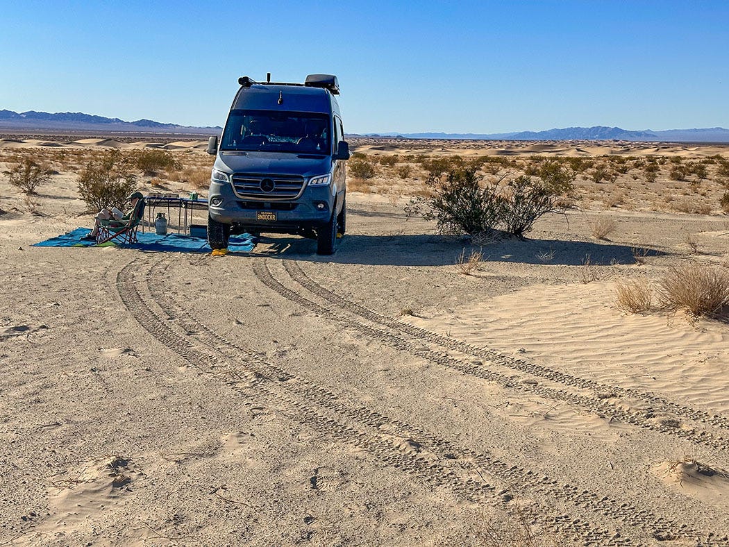
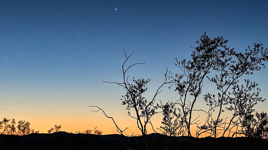
Views from there unfurled for miles in every direction. In the foreground to the west ran the scalloped line of golden dunes, topping out at about 100 feet in height, and in every direction the horizon was limned by mountain ranges, the rock of their naked slopes a mosaic of black and tan and rust. It was a still day with a bluebird sky, and in all that country we could see no visual evidence of humanity save ourselves and the stub of sand track that had led us there. We could hear no sounds but the occasional faint drone of an airliner 35,000 feet overhead.
We toasted the solitude and scenery with cocktails, ate dinner as the sun dropped, and sipped wine as the mountains became shadows and the sky filled with stars and planets and distant pinwheeling galaxies, becoming a night sky like night skies used to be everywhere and still are in the empty places on the map.
Coming in Part 2: Visiting the land of creation
John wow! Thanks for the lesson in geography and geology. Right now I’m on a girls trip and we are in Joshua Tree. We hiked in the National Park today. Amazing rock formations and I feel like I’ve learned a lot from you. Thanks for bringing all of us along with with you and Leslie on your trip.
It’s nice sharing my Saturday breakfast with a couple of desert rats.
Some 15 years ago Anita and me, Mary Alice and Joe Henderson (fellow desert rats) explored those same dry bed canyons.
Thank you John for continuing to raise awareness of special places that most people are just driving by.
Cheers,
Doug