In Praise of the Modest Epic
Love, leaves and lava flows on one of the best drives in the West

Not all epic road trips cover thousands of miles and last for weeks. Sometimes, they can unfold in as little as a day or two.
Leslie and I have just returned from one of those modest epics, an outing in our Next Chapter adventure van that packed tremendous beauty and emotional power into a relatively short span of time and distance. It was a reminder that it sometimes is the reason for the trip, not necessarily where it unfolds, that makes it remarkable — although great scenery along the way certainly doesn’t hurt.
In this case, we were bound for Reno, Nev., for the wedding of my son, Daniel, and his fiancé, Dakota. This milestone in the history of our family was to take place at the repurposed Galena Fish Hatchery in the mountains west of town, not far from the Mt. Rose ski area. For us, this occasion meant a drive up Highway 395, one of the best road-trip opportunities in the West and one that is particularly appealing in autumn, when it proves that New England has nothing on California when it comes to fall color displays.
In theory, the trip can be done in a day: It’s about 500 miles and about eight hours of drive time from Ventura to Reno. But as I have written before, we are learning to spend more time enjoying the landscape than racing across it as swiftly as possible, so we decided to take two days to cover that ground on the way north, and three days on the way back south.
We were rewarded for our patience. (Yes, that’s an understatement.)
Land of fire and ice
The drive from Ventura to Reno along this route does not began very auspiciously, although it does get off to a briefly bucolic start: a jaunt through the lovely Santa Clara River valley along Highway 126, through a rich agricultural landscape that seems little changed in 150 years. But that soon gives way to the vehicular insanity of Interstate 5 in Santa Clarita, and then to busy Highway 14, which leads through the sprawling Antelope Valley and the most distant commuter suburbs of Los Angeles.
Beyond the windblown railroad hub of Mojave, however, traffic thins and the scenic charms of the high-desert landscape begin to express themselves. Forty miles farther, the granitic ramparts of the southern Sierra Nevada rear abruptly to the west from the sere sand and gravel of the desert basins. The highway then curls north into the Owens Valley, and before long, the Inyo Range rises up in the east. Together, the monumental vertical faces of the Inyo and the Sierra form a massive pair of lithic bookends, with the valley pinched between them.
The 14 soon merges with Highway 395, which has arrived from the south and its birthplace near Cajon Pass in the mountains above San Bernardino. For the next 150 miles or so, the 395 carries travelers through a striking landscape of relatively recent volcanics (basalt flows, cinder cones), ancient dry lake beds, irrigated pastures and a series of small towns strung along the highway like beads on a string: Olancha, Lone Pine, Independence, Big Pine, Bishop.
As anyone who has driven it knows, the route can nearly overwhelm the senses. There’s nearly two miles of vertical relief between the Owens Valley floor and the Sierra summit peaks, which include pyramidal Mt. Whitney — highest in the Lower 48, looming above Lone Pine with its neighboring granite towers like the smile of a snaggle-toothed shark. Each town straddles a creek tumbling out of a canyon cut into the mountain flanks. Most of these sparkling waterways arise in ice-carved basins high in the range, and they follow paths hewn by Pleistocene glaciers as they bulldozed their way down from the crest to the valley multiple times over several hundred thousand years.
Roads poke into many of these canyons, some climbing to 9,000 feet or more until stymied by implacable topography. Others — Tioga Pass among them — cross the range entirely, leading to such pleasures as the Yosemite high country. All of them offer great opportunities for alpine adventure, delivering travelers to spiderwebs of hiking trails, crystalline lakes in which to paddle and fish, campgrounds tucked amid conifers along creekbanks.
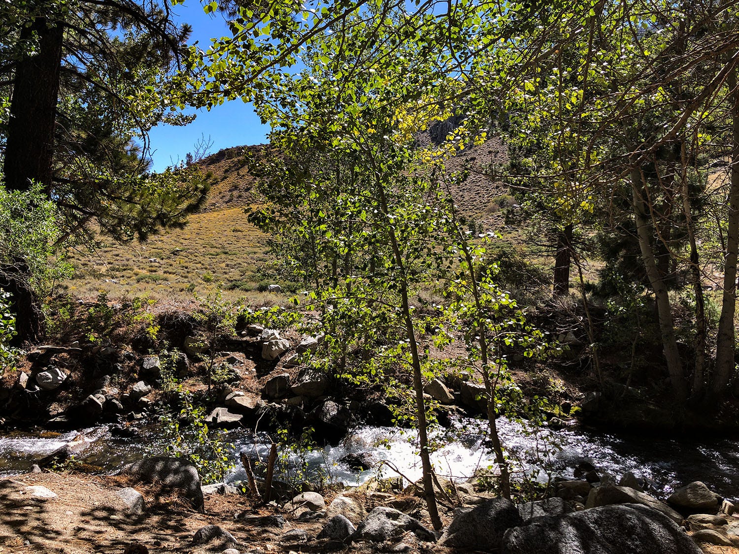
Our first-night destination was one of these camps, located at about 7,500 feet on Big Pine Creek. We’ve stayed there before, and love it for its pocket beaches and widely spaced campsites. The road to it climbs steeply from the town of Big Pine, ramping up across thick morainal deposits of boulders, cobbles and other debris chewed up and spat out by long-vanished glaciers. We arrived in mid-afternoon, and settled in to enjoy the cool, fragrant air and the song of the creek.
The next day, we continued north. Beyond Bishop, Highway 395 climbs out of the Owens Valley on a long grade that passes through and then over a vast deposit of welded volcanic ash and rock known as the Bishop tuff (pronounced “toof”). Disgorged from a volcano to the north about 750,000 years ago, the deposit is about 500 feet thick and covers hundreds of square miles — compelling evidence of the sometimes violent forces that have shaped the region’s landscape.
More such evidence follows as the road leads through Long Valley, past Crowley Lake — a reservoir in the system of dams and aqueducts built by the Los Angeles Department of Water and Power in the early 20th Century to capture Eastern Sierra snowmelt and export it to the far-away metropolis — and then into the Mono Basin. Best known for Mono Lake and its eerie formations of calcium carbonate towers called tufa (pronounced “toofa” and not to be confused with tuff), the basin is also home to the Mono-Inyo Craters, a chain of volcanic domes, explosion craters and lava flows that have carpeted the entire area in pumice and basalt.
Climbing again, Highway 395 leaves the Mono Basin, crosses Conway Summit and then descends toward the tiny town of Bridgeport (where the gas stations were advertising diesel fuel at $8 a gallon when we passed through). Another scenic stretch follows, as the highway tucks into the narrow canyon of the West Walker River for about 20 miles. After emerging from the canyon, however, the highway traverses relatively featureless countryside on its way to the exurban and urban centers of Washoe County, Nev. — Gardiner, Minden, Carson City, Reno. After what came before, that stretch of the drive is anticlimactic, to say the least.
It was late afternoon when we pulled off the Mt. Rose highway and reached the Airbnb we had rented, in a woodsy development not far from the wedding venue. We were joined there later by other members of my family to prepare for my son’s big day.
A weekend of joy
Daniel and Dakota met in a climbing gym and bonded over their shared love of the outdoors, which makes it appropriate that they wed at a fish hatchery. They’ve been together for a number of years, and have amassed a circle of friends who share their passion for hiking, climbing, kayaking, backpacking and otherwise recreating in the natural world.
Not surprisingly, they had planned a rather low-key wedding. They recruited a flashmob of family members and friends to set up the venue, accomplished in a 45-minute blitz of folding tables and chairs, beer kegs, linens, decorations and barware. (Next Chapter turned out to be a serviceable utility vehicle, transporting and disgorging seven cases of wine and bubbly, and all the floral table decorations and bouquets, as well as providing an onsite changing room.) There was a taco truck, a DJ, toasts, a towering chocolate cake, and much love, laughter and dancing. It was a magical evening, one of the emotional high points of the year, and I was sorry to see it end.
The next day was one of family gatherings and shared meals, as well as some unplanned excitement at our rental involving seared chicken, an overly sensitive smoke alarm, a feeble kitchen exhaust fan and, ultimately, an after-dark visit from a trio of concerned but good-natured firefighters. (It’s one of those stories that is more amusing to recount than to experience.)
The following day, we all went our separate ways. Leslie and I returned to Highway 395 and pointed Next Chapter south. Our rough plan was to spend the next two days taking in the display of fall color in the canyons of the Eastern Sierra, and camping wherever we found ourselves at day’s end.

In living color
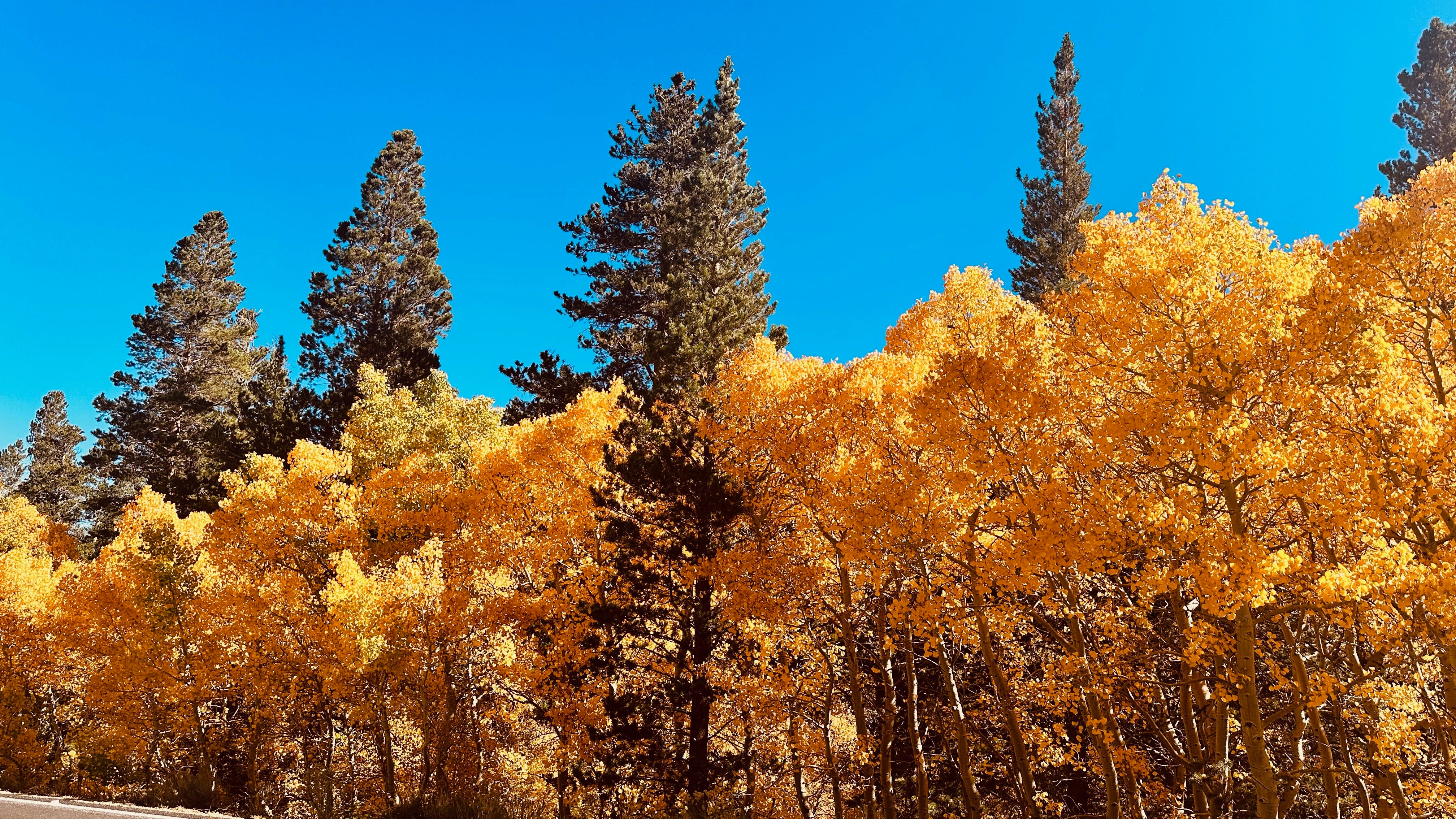
We encountered the first great example of fall foliage at Conway Summit, elevation 8,143 feet, where the rolling hills and valleys west of the highway were a riot of yellow, orange, green and red. (Generally speaking color peaks along the 395 corridor at higher elevations first, working its way downslope over the weeks as days shorten and grow cooler.)
Descending to Mono Lake, we continued on past the village of Lee Vining and the beginning — or terminus, I suppose, depending on which way you’re going (there may be a deep philosophical point in there but I’m going to speed past it) — of the Tioga Pass road to Yosemite. A few miles later, we turned onto the June Lake loop road, a 16-mile route that leads past four lakes, and several campgrounds and communities, at the foot of the Sierra. There are many stands of aspens, cottonwoods and other deciduous trees along the way, and although the colors were great, we did not stop, mainly because it was a Sunday afternoon and the traffic congestion created by day-tripping sightseers (like us) was considerable.
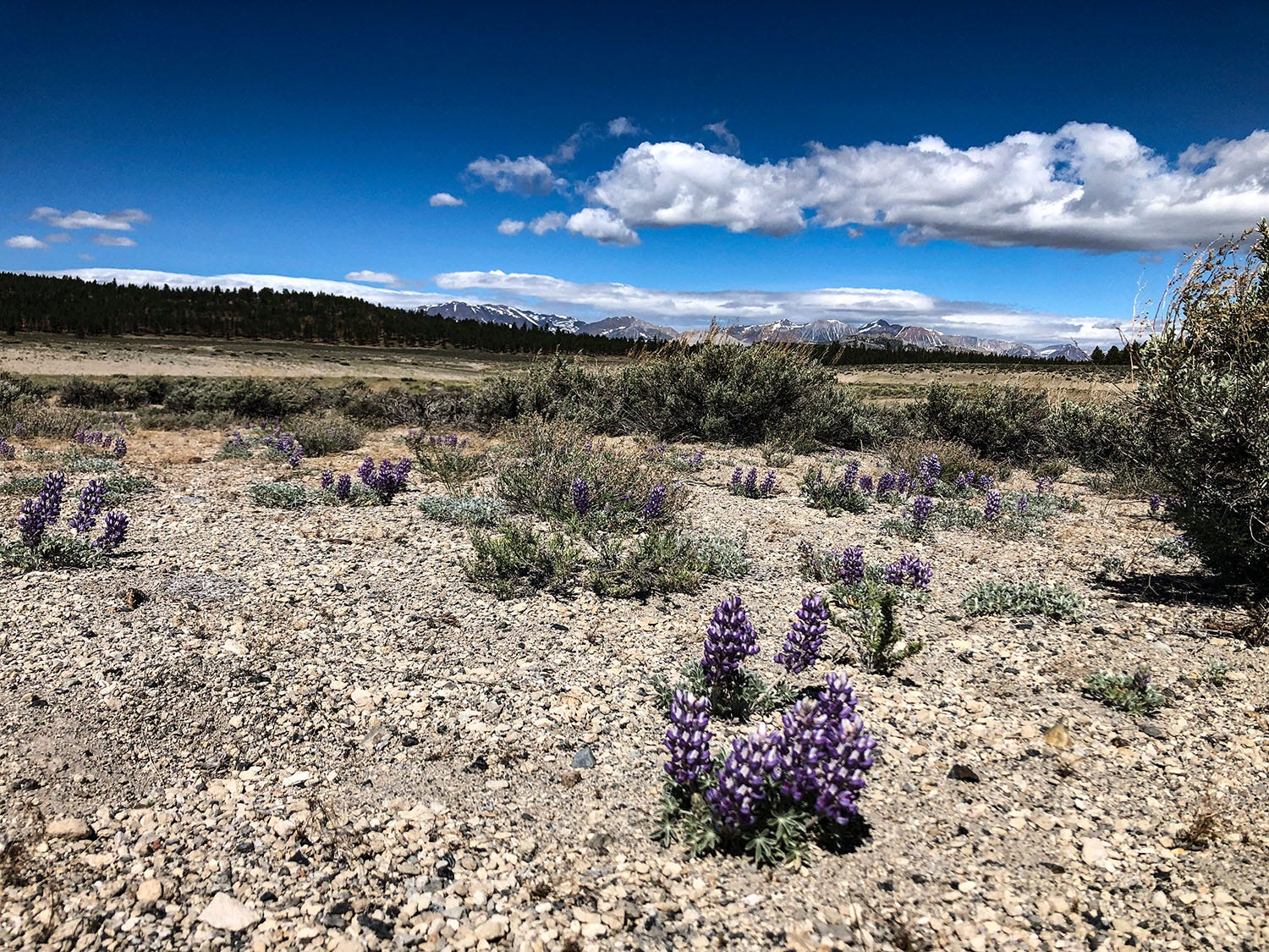
Exiting the loop, we crossed 395 and turned onto a dirt road that heads into the Inyo National Forest east of the highway. It leads to a dispersed camping area we’d scouted on the way north, featuring lava outcrops, stands of Jeffrey pine, sagebrush flats and views of the Sierra and Mono Craters. We found a shaded spot off the road to park, and set up camp.
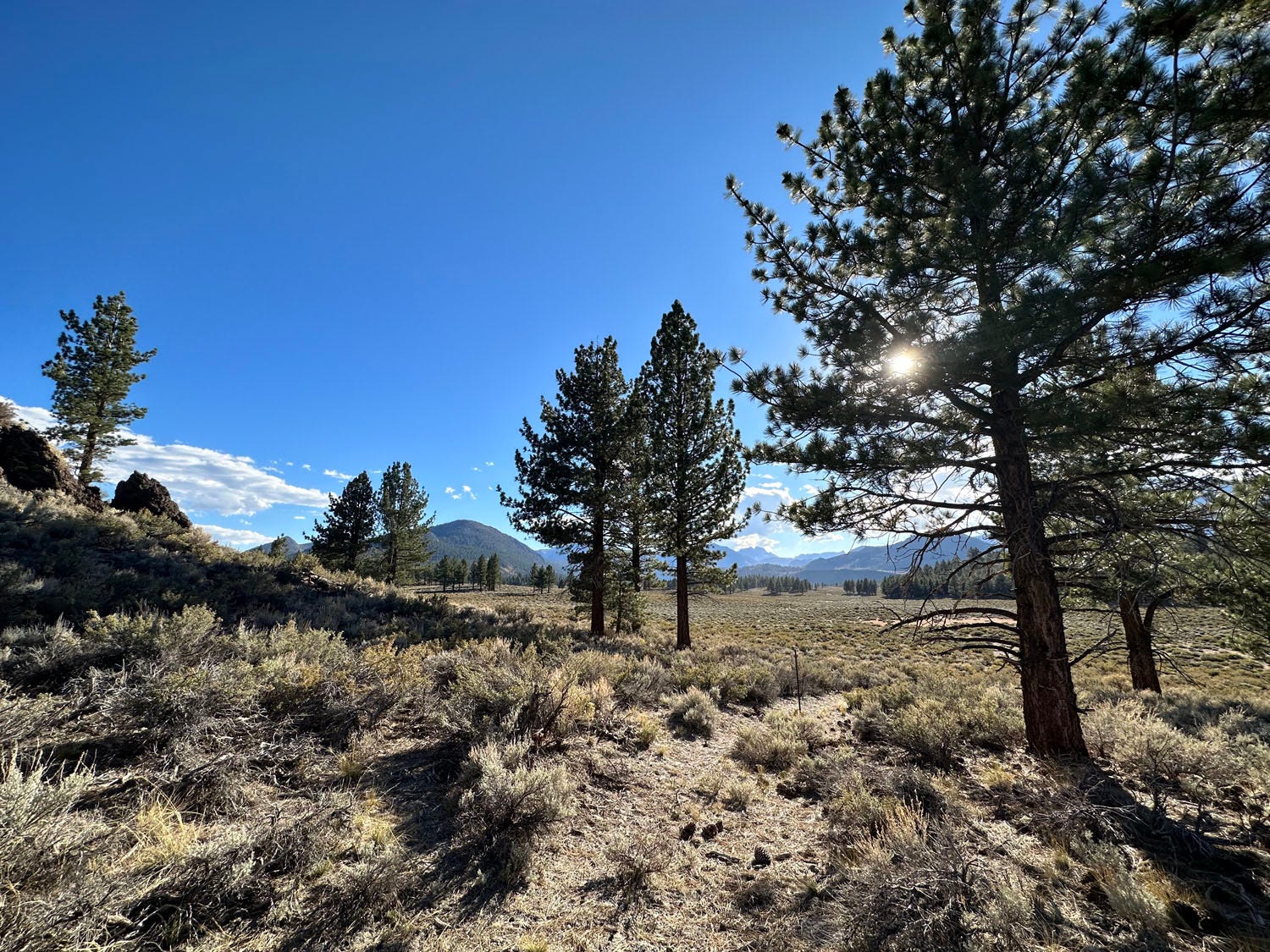
The next morning, not in much hurry, we enjoyed coffee in the morning sunlight while watching Clark’s nutcrackers flit about the forest, snagging seeds from cones clinging to the branches of Jeffrey pines. Eventually, we packed up the van, headed back to the highway and continued south.
In Long Valley, we detoured onto the spur road that leads to Convict Lake, perched in a bowl at the head of a massive moraine pushed up in the most recent glaciation. Woodland along Convict Creek and around the shore of the lake sported some color, but at 7,850 feet, it was too low to be at peak that week. We returned to the highway and drove on.
We hit the jackpot on our next detour, just a few miles south. At Tom’s Place, we headed up Rock Creek Road, which climbs for a dozen miles, and gains more than 3,000 feet in elevation, on its way to the highest spot reachable on pavement in the entire Sierra: a trailhead a mile beyond Rock Creek Lake that perches at 10,320 feet.
Along the road, particularly once we reached about 9,000 feet, the color was so intense that the trees seemed lit from within and could almost be sensed through closed eyelids. We stopped numerous times to marvel at the brilliance of aspens, willows and cottonwoods, and then parked at the lake to wander around on roads already closed for winter. When we’d had our fill, we trundled back to the van and slipped back down to the valley floor, again passing stand after stand of gold-glowing trees backed by a deep blue sky.
We stopped in Big Pine for lunch at our favorite Eastern Sierra eatery: Copper Top BBQ, legendary among travelers on the 395. I cannot say for a fact that it is the best barbecue on the highway, because I have not eaten at every possible contender, but it is damn good. (Pro tip: take home an order of the delicious vacuum-packed pork ribs for later consumption.)
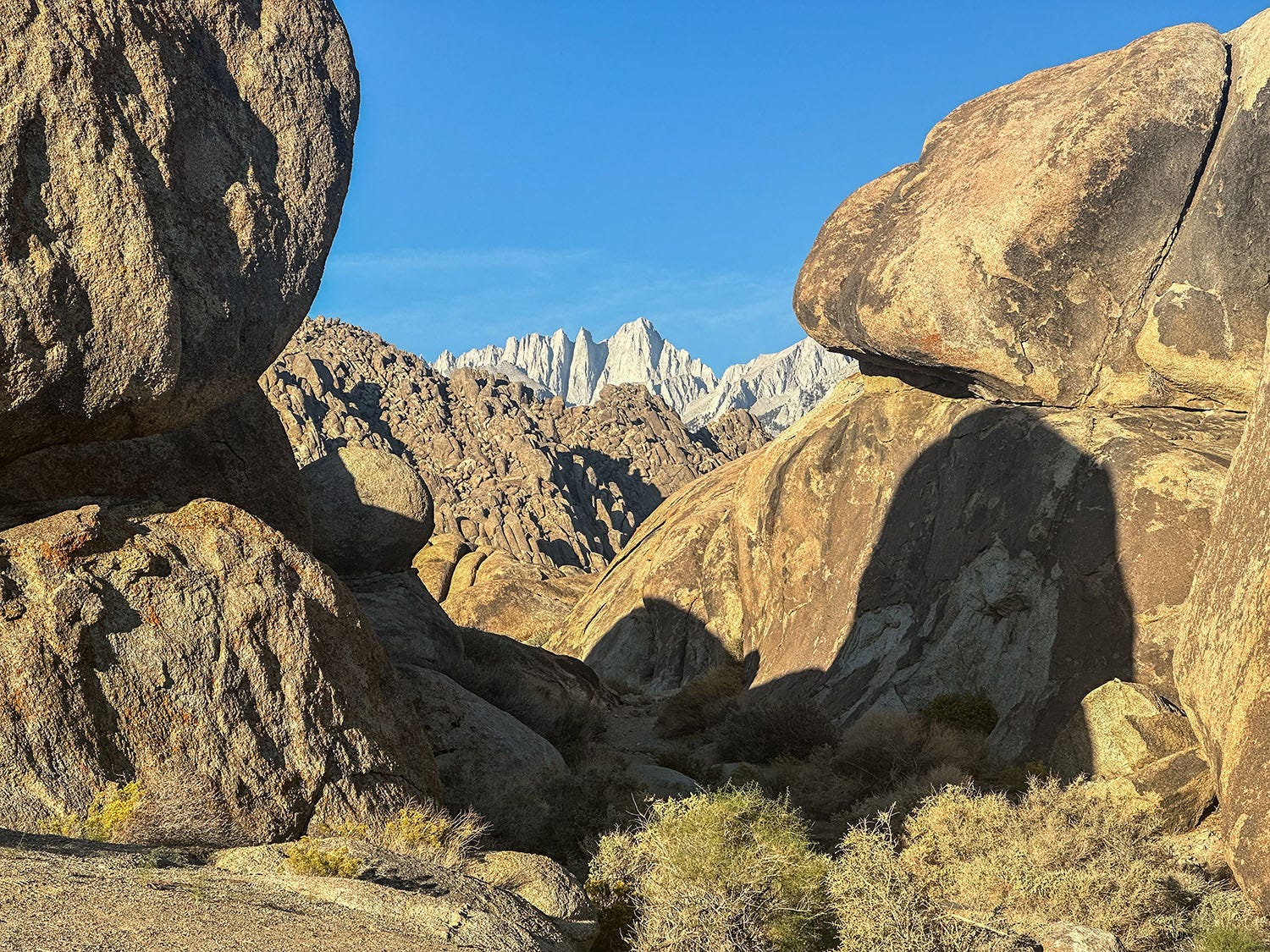
Continuing south, we turned off in Lone Pine for the Alabama Hills National Scenic Area, where we planned to spend the night. This is a relatively new status for the area, designated as such by Congress in 2019; before that, it was just the plain old Alabama Hills, popular for bouldering and dispersed camping, but lacking any amenities and only loosely managed by the U.S. Bureau of Land Management.
Yet another victim of Instagram fame, the area has been overrun in recent years by visitors with poor or nonexistent outdoor skills, with results you might expect: trampled vegetation, illegal campfires, human waste, trash. Last year, the BLM declared most of the traditional camping spots to be off limits and installed a few porta-potties, hoping to concentrate use in a smaller, less damaging and more easily managed footprint. (That effort is likely doomed to failure unless the agency dramatically ramps up enforcement and penalties for those who simply ignore the new rules.)
Despite the new restrictions, we found a stunning (and legal) camping spot tucked into a maze of boulders, featuring an up-close vantage of the Sierra front and Mt. Whitney.
The Alabama Hills are of approximately the same age as the Sierra Nevada, formed of similar granitic rock and by similar geologic forces. But its different chemical makeup causes the Alabama Hills rock to weather differently, so the formations are rounded rather than angular, and golden brown instead of off-white.
But there’s another big difference, according to my favorite field guide to Southern California geology. The Sierra and the Inyo range have been uplifted to their formidable heights by tectonic forces, rising along faults at their feet. At the same time, however, the crustal block between them — with the Alabama Hills sitting atop it — has been sinking. A lot. As a result, the Alabama Hills visible today may look like humble boulder piles, but they are actually the worn summits of a 10,000-foot-high mountain range that has been buried in more than 9,000 feet of alluvium and other erosional deposits dumped into the subsiding Owens Valley by streams and glaciers from the mountains to the east and west.
In other words, although Highway 395 through Lone Pine is at 3,727 feet above sea level, the actual floor of the Owens Valley there is at about 6,000 feet below sea level.
Pondering this type of head-spinning geological complexity is a fine thing to do at the end of a modestly epic day — especially while sitting in a camp chair, cocktail in hand, watching the sundown shadows of great mountain peaks steal across the land.