
From Wildfire to Wildflowers
A scorched national monument bounces back

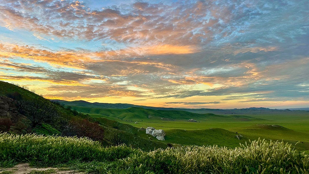
Thin sunlight slanted across the valley floor and its embracing hills, while a morning breeze made the deliriously viridescent vegetation shimmy. Wind and rising warmth were slowly dismantling the puffy bands of clouds, almost a fogbank really, that had rolled in during the night and were wedged against the slopes of the Temblor and Caliente ranges. Dislodged bits of mist drifted over the summits and vanished into the pale sky.
Our camp was in a saddle between two low hills, its surface still muddy in spots from recent rain. As we sipped our morning coffee, the view from our perch encompassed many miles of rugged mountains and rolling plains splashed by lakes of yellow and purple wildflowers. Around us the grassland offered up a symphony of birdsong, voiced mainly by western meadowlarks. We could hear their liquid calls all around us, but the birds themselves were mostly invisible in the thick vegetation.
Carrizo Plain National Monument is about 100 miles north of our home in East Ventura. We had headed up there a day earlier, and found ourselves — in a phenomenon familiar to many travelers across the grand spaces of the West —lodged in a landscape that erases the division between past and present.
The valley holds vacant remnants of 19th century ranching not far from the outbuildings of current cattle operations. In the folds of a prominent rock formation jutting out of the valley floor are colorful pictographs painted during thousands of years of occupation by the land’s original human inhabitants, the Chumash and their ancestors. At the foot of the Temblor Range, a scar visible from space marks the trace of the San Andres Fault, and offset creek beds on either side serve as evidence of the sometimes violent slippage of tectonic plates along that zone over a vast expanse of time.
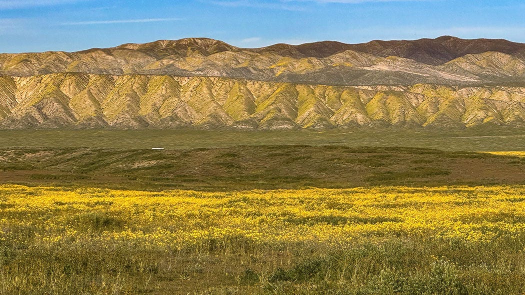
My partner Leslie and I have camped and hiked at Carrizo Plain before, drawn by the silence, the broad vistas, the solitude and the rarity of what the 250,000-acre national monument preserves: the largest nearly intact remnant of the grassland ecosystem that once filled the entire San Joaquin Valley. A stark wonderland about 50 miles long and 17 wide, it is home to such native animal species as pronghorns and tule elk (both recently reintroduced to their former home), San Joaquin kit foxes (still hanging on in their last real stronghold) and giant kangaroo rats (ditto).
This time, we were also there for the spring wildflowers, and to learn how the landscape had recovered — or not — since being charred by one of the largest California wildfires of 2025.
A long and winding road
A hundred miles does not sound like much, but that shortest highway route from Ventura to Carrizo Plain involves nearly four hours of driving on scenic but oh-so-slow State Route 33 as it winds through the mountainous Los Padres National Forest. It’s a tortuous but worthwhile journey.
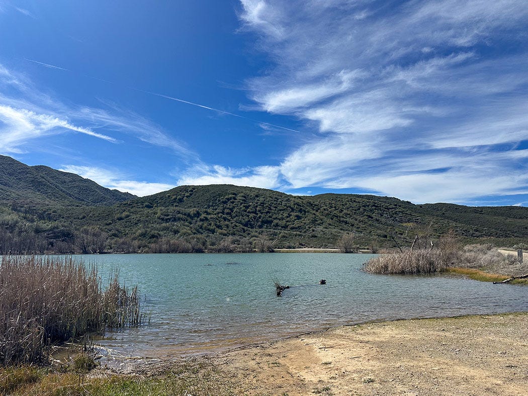
We paused about an hour into our trek for a picnic lunch on the shoreline of Lower Rose Valley Lake, where the soundtrack for our meal was supplied by the warbles of red-winged blackbirds and the grunts of pied-billed grebes. It is a too-often-overlooked benefit of living where we do that an hour of slow driving from our doorstep can transport us to another world.
Farther on, the road carried us along the banks of scenic Sespe Creek, running full and clear after this wet winter, across the wooded flank of Pine Mountain, and then down a steep grade into the arid Cuyama Valley. Improbable vineyards, and pistachio and olive orchards sprout there from the sandy soil of the Cuyama River floodplain, along with a pair of minuscule settlements, Ventucopa and New Cuyama.
Northbound Highway 33 runs into State Route 166, which links Santa Maria and Bakersfield; there the route to Carrizo requires a slight detour east and then a dogleg north onto fickle Soda Lake Road. Although it is paved in its northern and southern sections, about half its 45-mile length is dirt track that becomes impassable gumbo in wet weather.
There’s been a lot of that this year, and we timed our February visit to give the roads at least five days to dry out after the most recent storm. It paid off; although we found a few puddles, the roads generally were dry enough that the rare passing vehicles kicked up plumes of dust. Judging from the many solidified ruts recently carved into the unpaved surfaces, however, not all visitors had been as patient as we.
It was late afternoon when we entered the heart of the monument, and we headed straight to a boondocking site we used in January 2021, when we last visited. As before, we were treated to a colorful sunset, and the view was much the same as it was five years ago, with one major exception: The feathery-green stands of ancient California junipers that had previously softened the campsite’s vista were now reduced to blackened skeletons. That pattern — lush grass, dotted by countless charred junipers — continued across the slopes of the Caliente Range as far as we could see.
Burn and bloom
The Madre fire ignited in the early afternoon of July 2, 2025, on the shoulder of Highway 166 about 25 miles east of Santa Maria. The cause is still unknown but almost certainly was the result of human activity. Conditions were hot and windy that day, and within 24 hours the fire had grown to more than 35,000 acres. By the time it was fully contained a month later, it had charred more than 85,000 acres, much of it in Los Padres National Forest and Carrizo Plain National Monument, where it spread into the grassland of the valley floor after scorching its way up and over the Caliente Range from the southwest.
It held title as California’s largest wildfire of 2025 until the Gifford fire, which ignited Aug. 1 in the same general area and reached more than 131,000 acres, its burn scar partially overlapping that of the Madre fire. Gifford remains the largest wildfire of the year in the state.
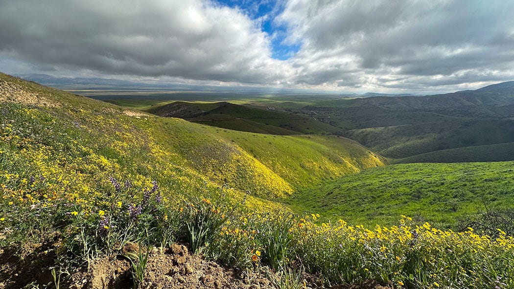
A very good post-fire analysis by Los Padres Forestwatch suggests that the Madre fire’s impacts on the plant communities in the affected area —grasslands in the valley, chaparral and oak-juniper shrubland in the mountains — varied widely across the landscape, as did fire intensity. Many of the natives are adapted to wildfire, and can re-sprout relatively quickly. Junipers, however, are not among them. It will be the work of decades for natural processes — largely birds and other creatures transporting berries and seeds from unburned survivors — to replace those big old specimens that were such a prominent feature of the pre-Madre biotic landscape.
In the meantime, fairy rings of extra-robust grasses and forbs surround the blackened stumps of incinerated junipers, bright green growth supercharged by sudden exposure to sunshine after decades of canopy-imposed shade. In fact, by clearing away the thick covering of matted old growth that previously blanketed the hillsides, the Madre fire likely helped set the stage for the wildflower extravaganza that this season’s abundant rainfall has now triggered.
And what a display it was — and may still be as you read this.
“This vast golden flower-bed”
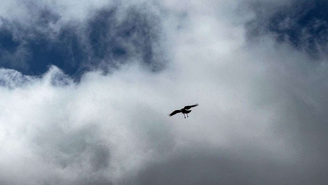
After our morning coffee amid the drifting clouds and meadowlark music, we hiked along the newly bladed Caliente Ridge Road, a bright yellow Caterpillar grader having scraped it flat and free of winter-storm mud the day we arrived. The unpaved road climbs steeply for several miles to the top of the ridge and the start of a 7-mile hiking trail along its spine, but that exceeded our ambitions. We were content to ogle the views, near and far, from the road itself on a shorter saunter toward the summit.
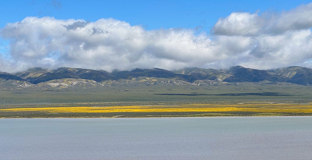
Overhead, ravens danced on the chill wind. The far vista included Soda Lake, a briny water body with an associated alkaline wetland complex — the largest of its kind in California — where all the precipitation that falls on the monument gathers and evaporates. The runoff once had an outlet, but was deprived of that about 2 million years ago by the tectonic distortions of the San Andreas fault, which wrinkled the landscape and choked off the stream that once drained the valley.
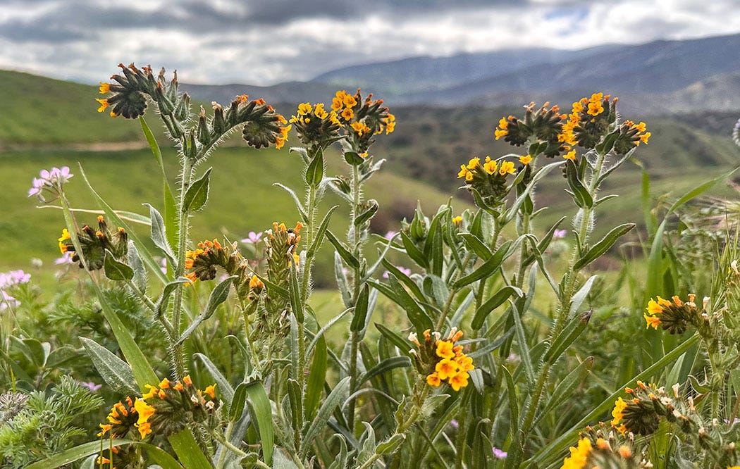
The near view was of a rich catalog of native flowering plants, including commoners found throughout California, such as poppies and varieties of lupine, but also more seldom-seen participants in the floral parade: fiddlenecks and larkspur, baby blue eyes and notch-leaved phacelia, purple owl’s clover, San Joaquin blazing star, Munz’s tidy tips and Booth’s evening primrose. Numerically most plentiful was the bright yellow hillside daisy, which massed in huge aggregations that collectively covered hundreds of acres on the slopes and the valley floor.
I do not fully understand why the simple experience of being surrounded by wildflowers should be so emotionally powerful. There’s great beauty, certainly, heightened by the knowledge that such displays are both unpredictable and ephemeral. Leslie and I were nearly overwhelmed by our immersion in the canvas that fire and rain had painted with so many delicate botanical brushstrokes, which commanded individual attention while also packing a collective sensory wallop.
At Carrizo, however, I think that some of that punch comes from knowledge of how tiny a fragment it represents of something that was once common and widespread.
Looking eastward from the summit of the Pacheco Pass one shining morning, a landscape was displayed that after all my wanderings still appears as the most beautiful I have ever beheld. At my feet lay the Great Central Valley of California, level and flowery, like a lake of pure sunshine, forty or fifty miles wide, five hundred miles long, one rich furred garden of yellow Compositœ [a large family of plants including daisies and dandelions]. And from the eastern boundary of this vast golden flower-bed rose the mighty Sierra, miles in height, and so gloriously colored and so radiant, it seemed not clothed with light, but wholly composed of it, like the wall of some celestial city.
That’s how John Muir described his approach to the Sierra Nevada from the west in 1868 on his first visit to Yosemite Valley, as recounted in his 1914 book The Yosemite. That “vast golden flower-bed” is now mostly orchards, cotton fields, tomato plantations, rice paddies, dairies and alfalfa gardens — a secular miracle of agronomy that feeds the country and the world — along with cities, suburbs and highways.
But hidden in the backcountry corner where Ventura, Santa Barbara and San Luis Obispo counties meet, lies virtually the only remaining piece of what so captivated Muir a mere century and a half ago. It should be a place of pilgrimage for all Californians.


I read this out loud during breakfast this morning. I can hear your narration in my mind. The way you weave together the beauty, biology, geology and anthropologie - fantastic and always a treat. - David Ross
Thanks for sharing your beautiful trip to the Carrizo Plain along with a bit of its history and the lovely riot of wildflowers so well photographed. Enjoyed the read! Judy Triem