


Forest Odyssey
Encountering magic and a tragic mystery in the Northwest woods

On the morning of the 2023 summer solstice, Leslie and I awoke in a dense forest of white firs and sugar pines on the slopes of Mt. Shasta. The air was a crisp 38 degrees in our campsite at 5,900 feet, and we bundled up in down and fleece to sip our coffee while listening to a chorus of woodland birds greet the year’s longest day.
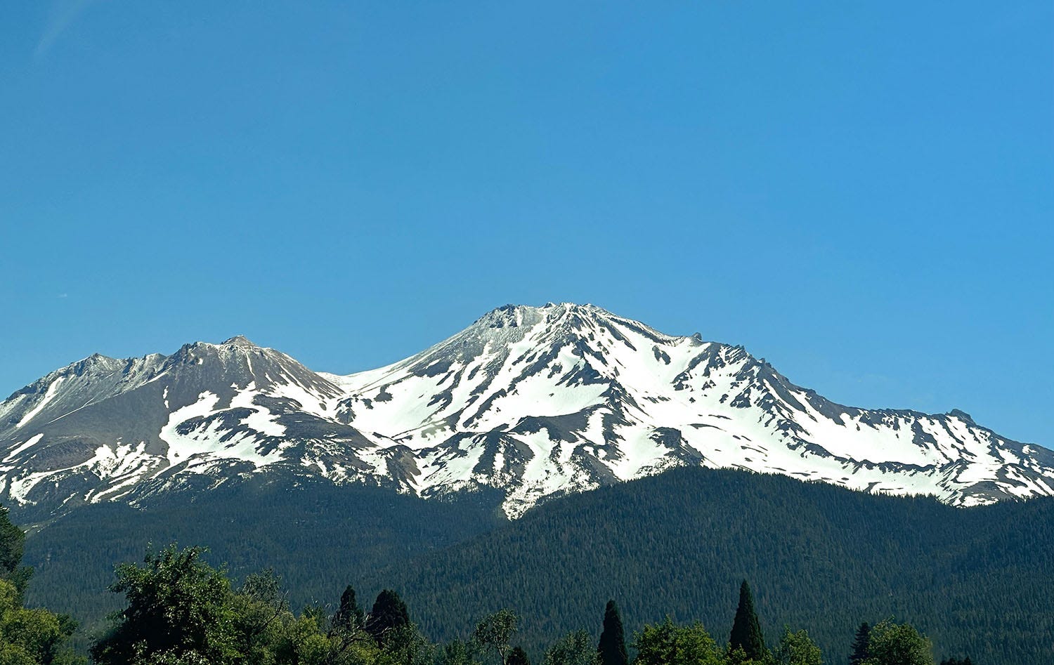
Shasta is a powerful visual presence in northeastern California, a nearly symmetrical volcanic cone 14,179 feet high that towers 10,000 feet above the surrounding landscape. Its lower flanks are swathed in dense forest, and the transition at treeline to naked rock, ice and snow is abrupt and uncompromising. On a clear day, it is visible from hundreds of miles away, a landmark for travelers as they make their way along the long trough of the great Central Valley. In the opening line of his 1873 book Life Amongst the Modocs: Unwritten History, California author and poet Joaquin Miller famously described the mountain as “lonely as God, and white as a winter moon,” and although his often turgid prose is largely dismissed today, it would be difficult for any writer to improve on that particular phrase.
Our overnight stop in Shasta’s forest was the final camp on a 16-day road trip Leslie and I took in June, hopscotching our way north into Oregon and Washington with our ultimate goal the Olympic Peninsula. Of the 10 nights we spent in our Next Chapter camper van during the journey, seven were in forests of one kind or another, and we hiked or drove among trees on most of the days.
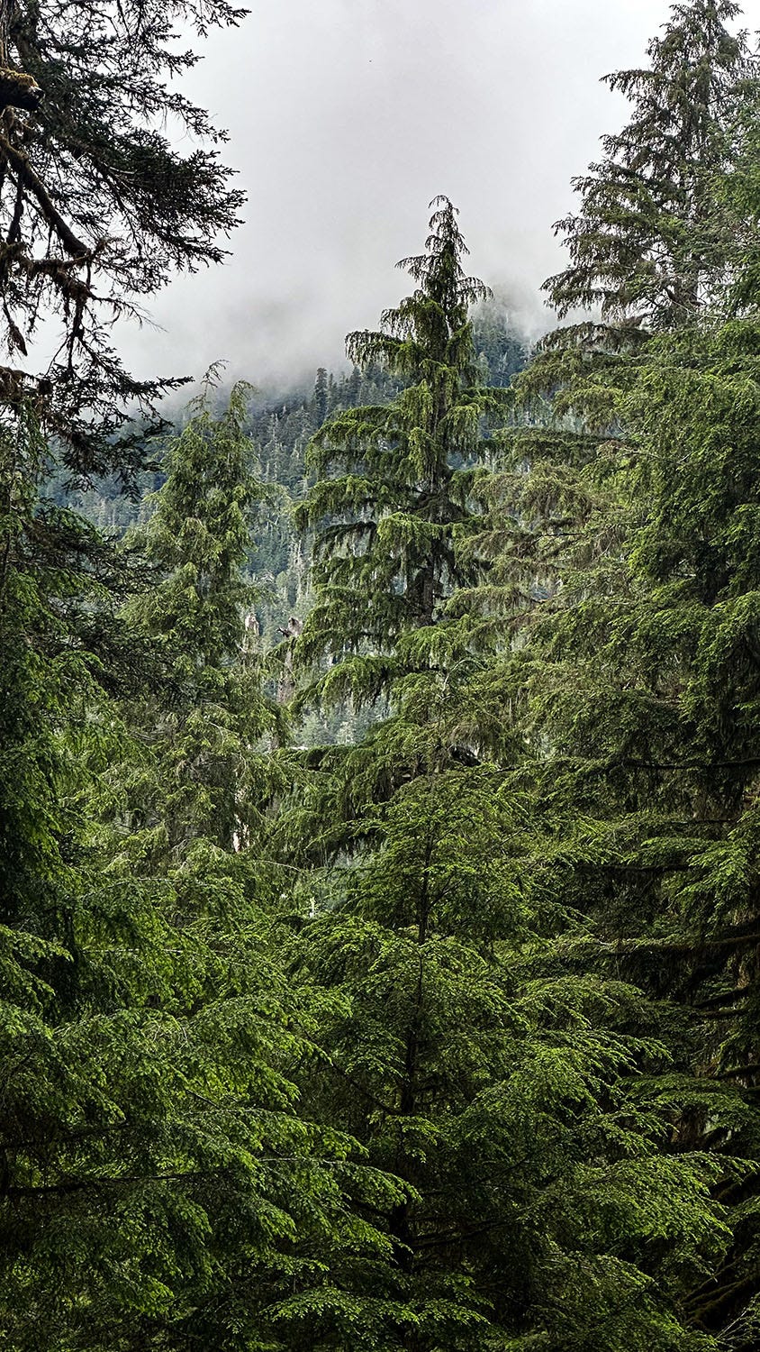
“Forest.” Such a plain word. It barely hints at the wild variety of plant communities and landscapes it encompasses: dry, wet, alpine, lowland, boreal, tropical, gloomy, sun-dappled, evergreen, deciduous. We would experience many of these during our trip. But the highlight was the three days and nights we spent camping in the temperate old-growth rain forest of Olympic National Park, where we encountered ancient botanical magic, profound stillness, and a tragic mystery that still haunts me weeks later.
Outward bound
It’s nearly 1,200 miles from our home in Ventura to the remote camping area we had chosen as our Olympic destination, and we took our time getting there.
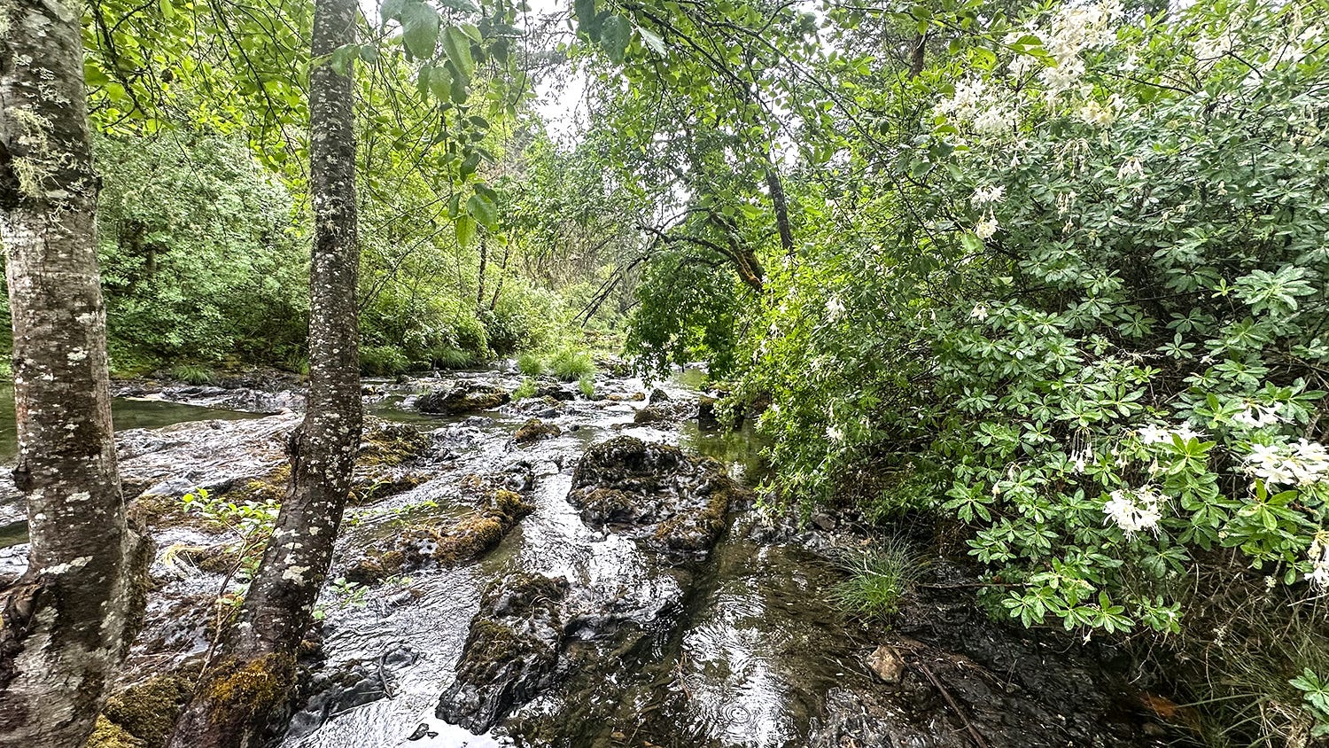
Our first long day covered 416 miles and got us as far as the Sacramento Valley town of Woodland, where we had rented a Hipcamp site in a rural homeowner’s spacious yard. Day 2 (337 miles) brought us to our first forested overnight site, another Hipcamp, this one on the banks of the delightfully named Jumpoff Joe Creek. We were shaded there by Douglas firs, cedars, and big leaf maples. Wild rhododendrons bloomed amid the lush understory along the water’s edge. Near the Rogue River and the small Oregon town of Merlin, it was beautiful and secluded, and we were sorry to leave the next morning.
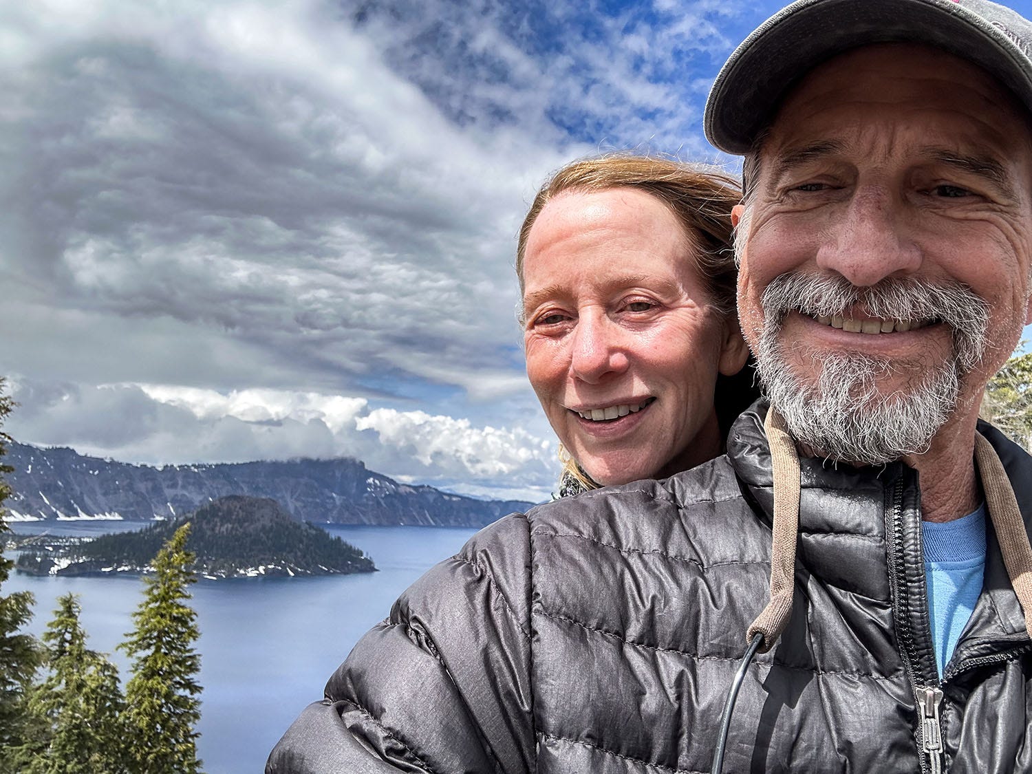
On our third day, we dialed the mileage back a bit and drove 130 miles to the Rogue River-Siskiyou National Forest (including a detour to still-snowbound Crater Lake because we were in the neighborhood), and found a great campsite near the Upper Rogue River. We spent quite a while driving along increasingly rocky, rutted and steep dirt tracks to reach it — shifting the van into four-wheel drive and stopping at one point to scout ahead on foot — only belatedly figuring out that we could have come at it from another direction and spent far less time driving on far better roads. But where would be the adventure in that?
This forest was damp and lush, with sodden meadows and standing water where rivulets worked their way down to the river from patches of melting snow. This fertile insect-breeding ground made it one of the buggiest places we have yet camped in Next Chapter, and we were happy for the mosquito-blocking screen doors we had installed by our friends at Outside Van. We also made good use of one of our best gear purchases ever: a bug-repelling gadget made by Thermacell that actually works.
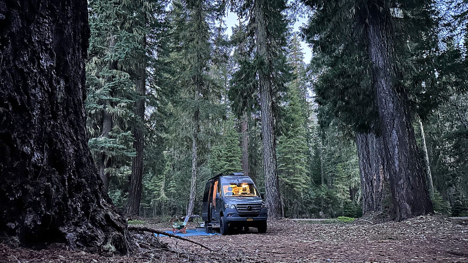
We took our time packing up the next morning before driving 100 miles to the outskirts of Bend, a booming outdoor hub in central Oregon. We camped in a boondocker site in the Deschutes National Forest, much drier owing to its location in the rain shadow of the Cascade Range. Trees in this forest were showing the effects of drought and bark beetle attack, many of them dead or dying. We reached our site, a clearing off a dirt road, following what turned out to be a very popular mountain biking trail.
When I first visited Bend, back in the early 1980s, it was a sleepy rural community of about 65,000 people. That has since ballooned to more than 200,000, an increase of 208 percent, thanks to a flood of newcomers drawn in part by the many opportunities for outdoor pursuits in the region. These include mountain biking, but also rafting and kayaking on the Deschutes River as it roils through town, backpacking and hiking in the Three Sisters Wilderness, and skiing at nearby Mt. Bachelor.
Downside to all this expansion? Traffic congestion, and the uglier architectural elements of helter-skelter suburban sprawl. Upside? For one thing, a dramatic proliferation of great craft breweries.
Whitewater interlude
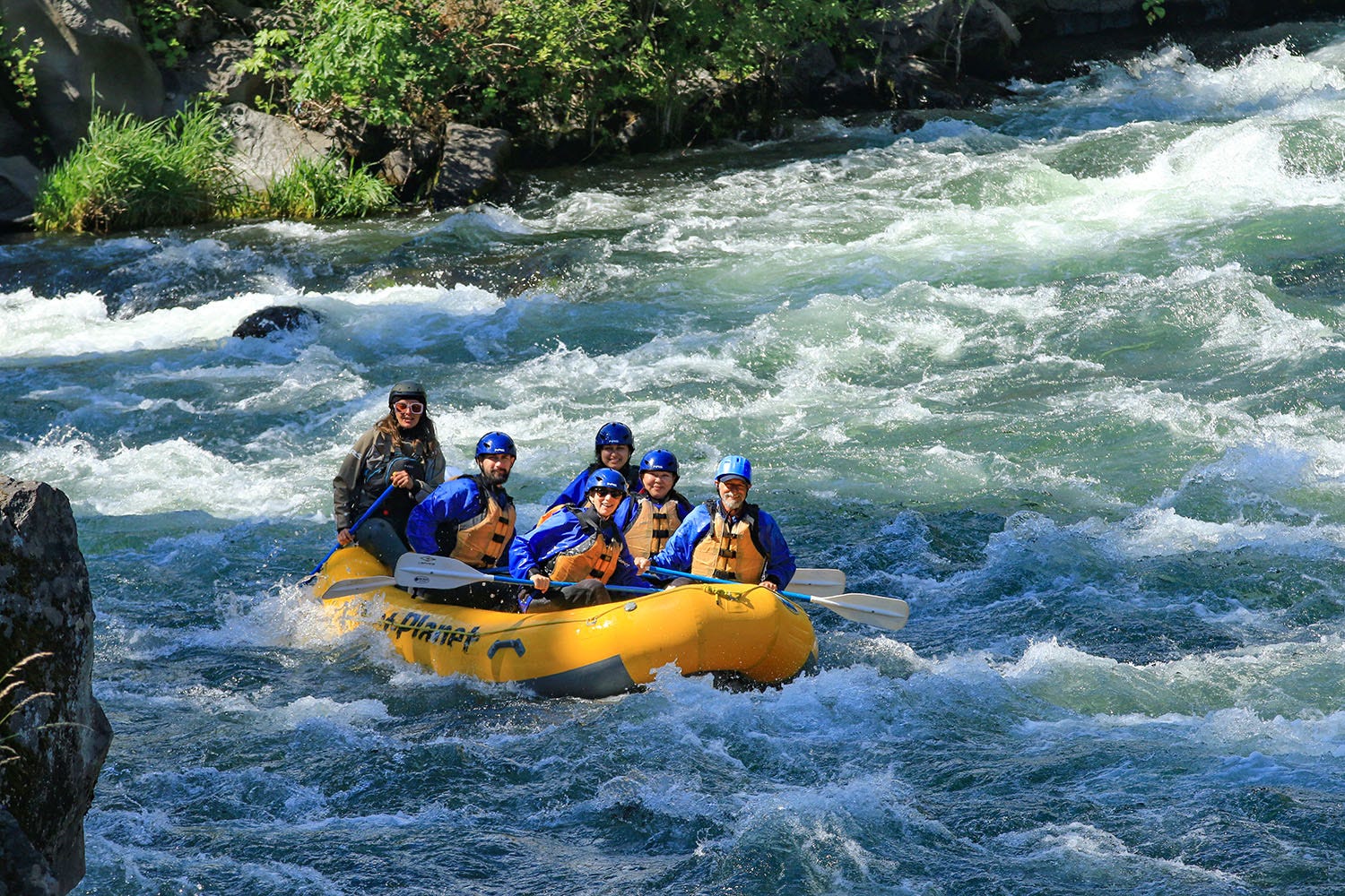
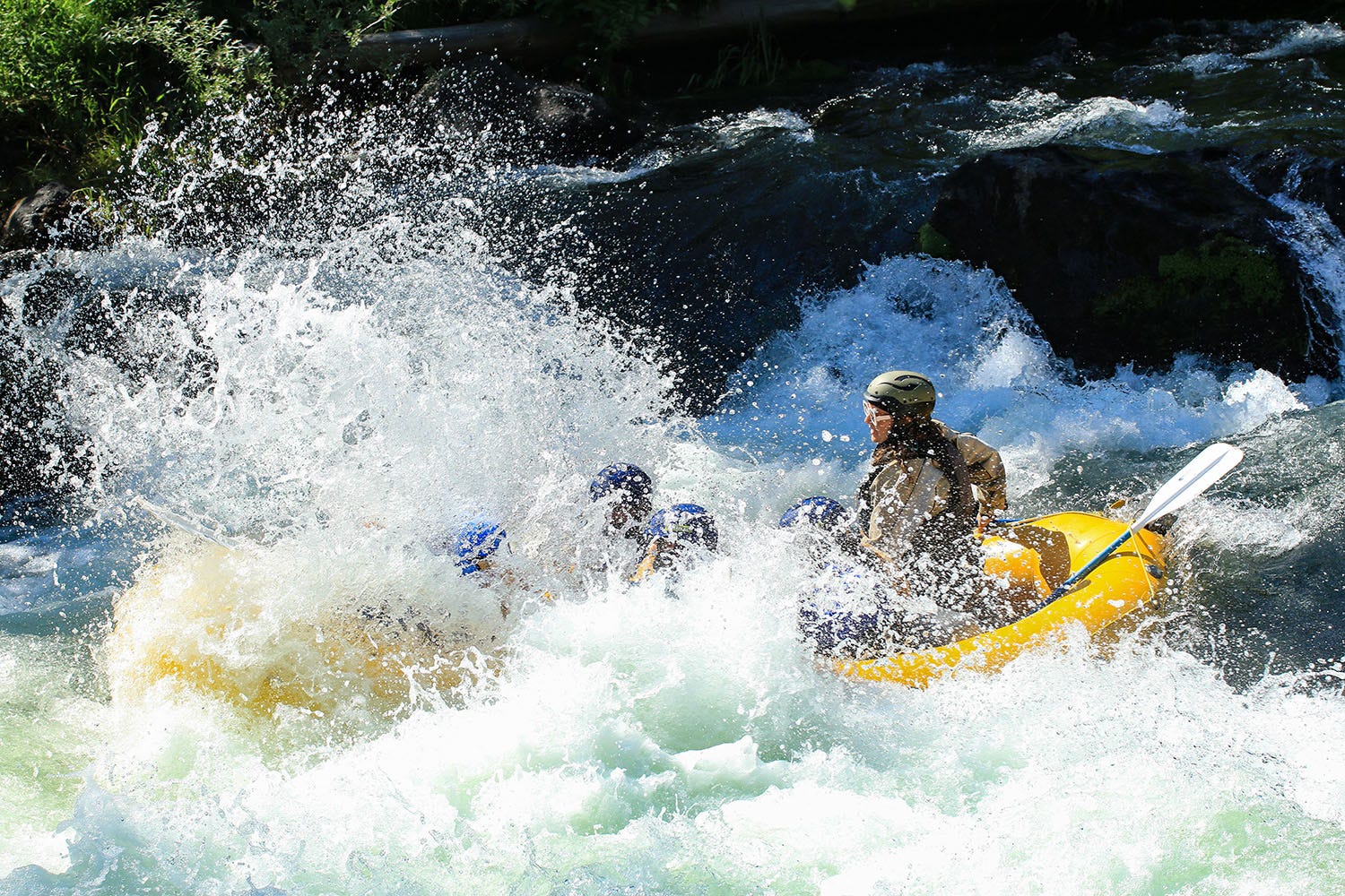
From the forest southwest of Bend, we headed north toward the Columbia River Gorge, where we camped for two nights on private land just outside the town of White Salmon, Wash. There, we joined our friends at Wet Planet Whitewater for a half-day rafting trip on the White Salmon River. It was our second outing with them this year, the first having been a multi-day run on the Owyhee River in southeastern Oregon during our April road trip. In some ways the White Salmon trip was an attempt to make up for the thrills we missed during our days on the Owyhee, where high springtime flows had basically washed out most of that river’s rapids (more on that trip in a future installment of Next Chapter Notes).
On the White Salmon, we found what we were looking for: a gorgeous tree-lined canyon, a crystalline river, and several hours of nearly nonstop class III+ rapids, which kept us busy with our paddles and drenched us in 42-degree water. Fortunately, a modest heat wave had moved into the Pacific Northwest, and the air temp that afternoon was a welcome 86 degrees. Still, the wetsuits and splash jackets were much appreciated.
The next day, we drove from White Salmon to Seattle, where we spent two days visiting with family. From Seattle, we were off to the Olympic Peninsula, our destination a primitive campground on the Quinault River in the southern corner of Olympic National Park.
Old-growth rainforest, and a family’s tragedy
Highway 101 makes a great loop encircling the 923,000-acre park and serves as the primary means of access to the interior via various spurs that inevitably dead-end when they run up against difficult topography. The road from the 101 to Graves Creek Campground hugs the south shoreline of Lake Quinault for a few miles and then plunges into the forest. It follows the meandering Quinault River for about 16 miles, the last 10 of them narrow and unpaved. It’s an hourlong drive, and yes, that works out to an average speed of 16 mph.
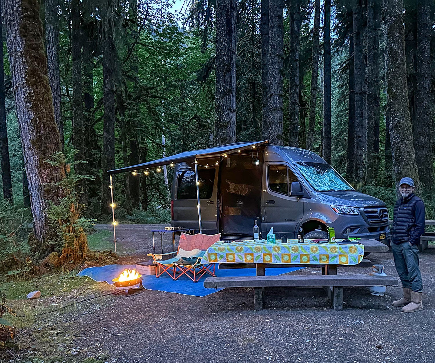
It was worth it. We found a campsite on the river bank under a canopy of enormous trees and settled in. There’s no potable water in the campground, and the long drive on a skinny road tends to discourage campers with large rigs, so it was quiet and relatively uncrowded. Our site commanded a great view of the river, flowing by only a few yards away, and as afternoon shadows lengthened, we basked in the stillness and magic of the setting.
The next day, we hiked a trail that follows the river upstream into pristine old-growth forest.
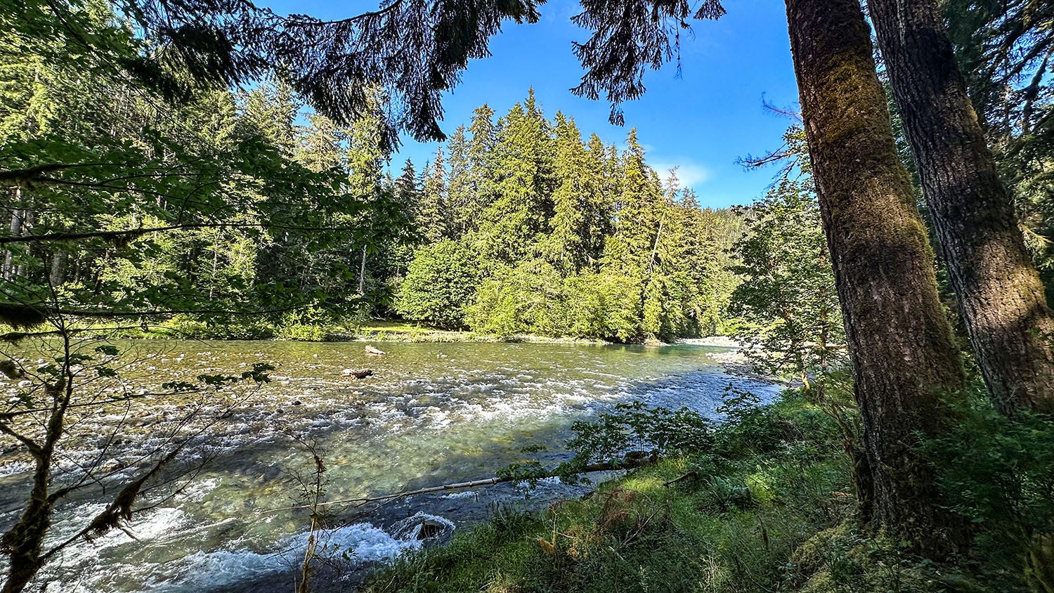
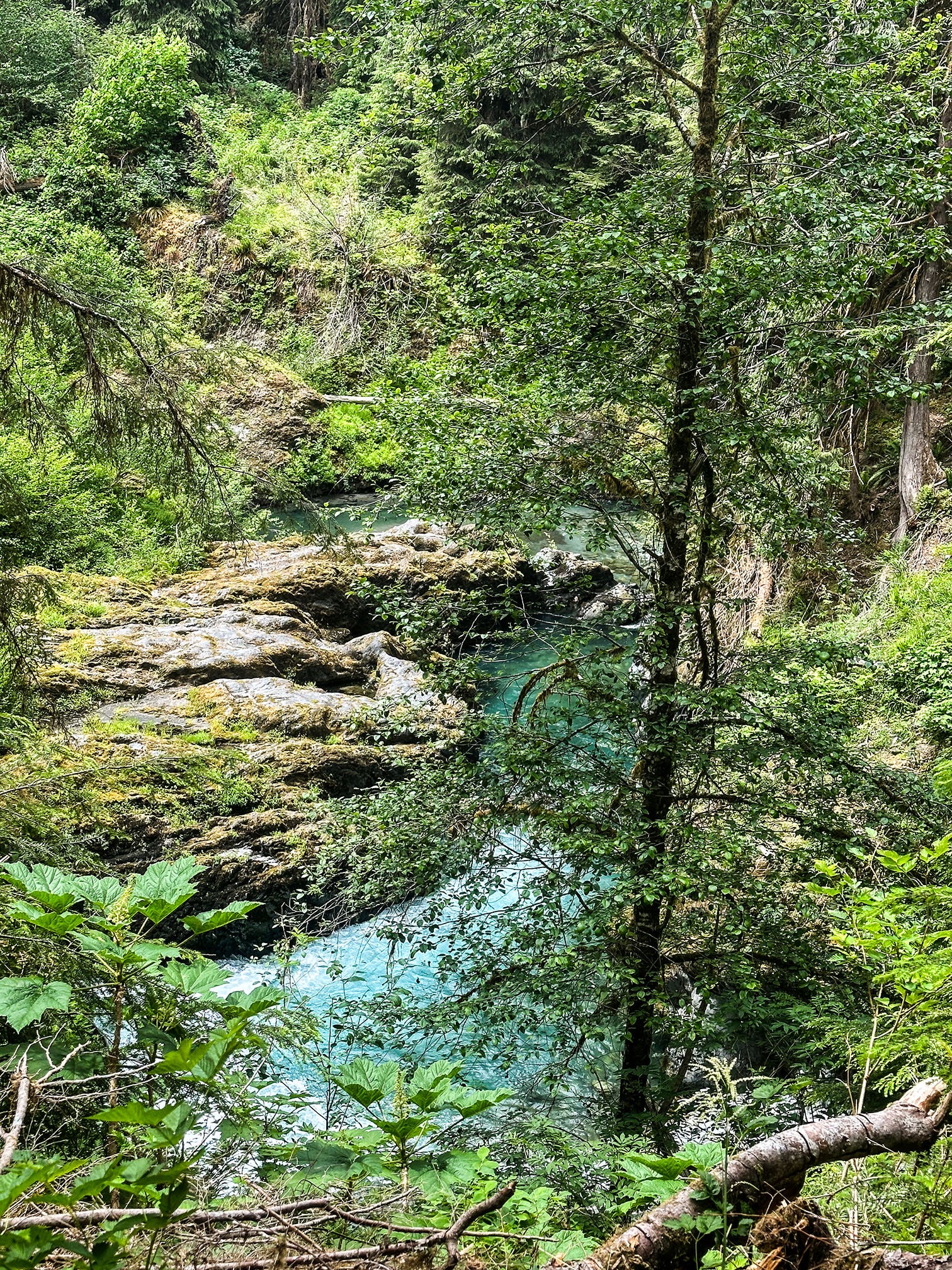
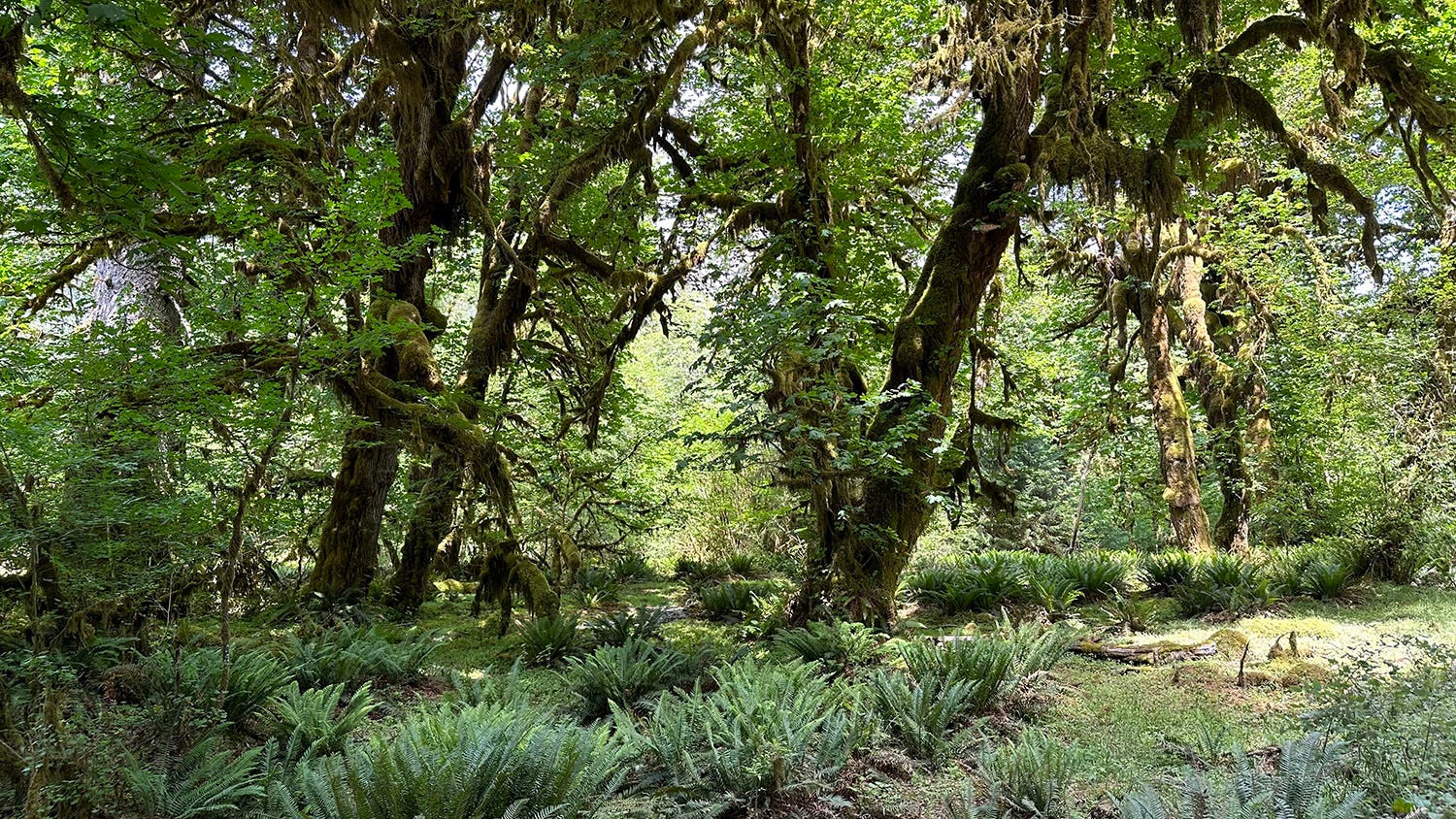
There’s that word again. Calling that assemblage of towering Sitka spruce, ancient Douglas firs, massive hemlocks and lichen-festooned maples a “forest” is sort of like calling a whale shark a fish. It’s accurate but utterly fails to capture the awe-inspiring reality. Beneath the immense trees, an impenetrably dense understory of ferns, thimbleberry, vine maple, skunk cabbage and other leafy plants flanked the trail. The Quinault River valley receives 130 inches of rain a year on average, and the wild profusion of vegetation reflects that. It’s hard to imagine the labor involved in cutting a hiking trail through this countryside, let alone roads and building pads.
Through it all flows the river, fast, cold and deep, tinted aquamarine by suspended rock particles ground fine by glaciers in the park’s mountainous heart. We hiked in 2.5 miles from the trailhead, which was crowded with backpackers setting off into the valley for the weekend, and paused at the newly reconstructed Pony Bridge over the Quinault to enjoy the picnic lunch we’d brought. We found a flat spot with a conveniently positioned log for a bench and unpacked our provisions.
It was not long before another hiker left the trail and worked his way through the undergrowth into our picnic site. He sat down a few feet away from us, and began unwrapping his own meal. It wasn’t rude exactly, but it was odd — it’s a minor breach of hiking etiquette to invite yourself into a stranger’s lunch spot when there are plenty of other options at hand.
We shared a few pleasantries, mostly relating to how beautiful our surroundings were, but our visitor also remarked about how hazardous the setting might be in poor conditions or to inattentive hikers. Downstream of the bridge, the river funneled into a sheer-walled and narrow gorge, all of its icy power focused into a thundering expressway of blue-hued snowmelt. The lip of the stone channel was just a few feet from our picnic spot, and we chose our footing carefully as we moved about.
Our fellow hiker seemed to have something he wanted to talk about, but danced around it for a while. Eventually put away his lunch and said, “OK, here’s the long story.” What he told us next colored the rest of the day and still tugs at us weeks later.
Last October, his daughter Laura Macke, 35, an experienced backcountry hiker from Vermont, had begun a solo backpacking trip along the same Quinault River trail we were hiking. According to her wilderness permit, she intended to spend two nights in the backcountry and was aiming for a popular camping destination 9 miles up the trail in an area known as Enchanted Valley. She arrived at the trailhead on Oct. 30 in a driving rain, began her hike, and then vanished.
Her family reported her missing on Nov. 2, and on Nov. 3 the National Park Service dispatched a search-and-rescue team. The search eventually grew to include rescuers from 20 agencies employing helicopters, K-9 teams, heat-sensing drones and dozens of individuals on the ground, many of whom stayed overnight in the backcountry even though the weather was miserable, with heavy rain and bone-chilling cold. They scoured the trail system and some off-trail areas along her planned route, but turned up nothing except a piece of Laura’s camping gear, found downstream from our picnic spot more than a week after she disappeared.
The active search was halted Nov. 10; with winter weather already moving into the region, her survival was considered unlikely. But SAR searches continued as weather permitted, and Laura’s dad, other family members and friends have made repeated trips to the area since then to continue looking for her. When we met him, he was scouting potential access points for search teams to penetrate the exceedingly rugged reach of river below Pony Bridge, which no one had yet been able to access.
He said his theory is that Laura paused at our lunch spot during her hike to Enchanted Valley, left the trail — perhaps to snap a photo — lost her footing in the slippery conditions, and fell into the river, which would have swiftly carried her away. Weighed down by backpacking gear, she would have had no chance of self-rescue in the turbulent, icy water.
We were all silent for a few moments after he finished telling us this story, the bright day suddenly feeling dark and our spectacular surroundings ominous. What, really, is there to say when confronting the depths of pain, loss and uncertainty he and the rest of Laura’s family must be living with now? We expressed our condolences and wished him luck, and he soon drifted back into the forest to continue his search for answers.
Our hike back to the trailhead that afternoon was a somber one. I thought about the many solo hiking, backpacking and fishing trips I have taken in my life, typically in rugged desert or mountain landscapes full of hazards. Hiking without a companion does not really create new dangers in the outdoors, but it does potentially magnify the consequences if something goes wrong. There’s no one to seek help if you’re incapacitated by injury while alone. And if the worst possibility comes to pass, as it apparently did for Laura Macke eight months ago, there’s no one to explain to family and friends what happened.
Many of the things we love about wild places also render them risky. That’s not a reason to avoid them, but it is a reason to be fully attuned to one’s surroundings while out there, vigilant about preparation, and realistic about personal capabilities and limitations. Over the years, I have learned new skills to make myself more resilient in the outdoors (wilderness first aid and swiftwater rescue courses), and now I carry a technological safety tool not available when I was younger: a Garmin InReach Mini, which allows me to summon an emergency rescue or send text messages to personal contacts from anywhere via satellite.
Although I’ve always been careful out there, I’ve also been lucky. So far, routine natural hazards (the inevitable falling tree limb, the random plummeting rock, a cloud-to-ground lightning strike) have not intersected with my relatively fleeting presence in the wild. But things that did not seem risky to me in my 20s, 30s and 40s feel different now in my 60s. The attraction of solo travel, which I once enjoyed a great deal, is outweighed these days by consciousness of my own physical vulnerability — reinforced most recently by a chance meeting with a grieving stranger in an unforgiving forest.
John: Beautiful piece and important reminder. Before I got to the somber ending, I made anote that this was my favorite line: "only belatedly figuring out that we could have come at it from another direction and spent far less time driving on far better roads. But where would be the adventure in that?" I've a friend who says, "We're never lost. We are only seeing things we had not planned to see." This, she said, when I drove over the wrong bridge twice in 30 minutes.
John,
OH MY GOSH! Such a powerful reminder that we are never fully in charge and must always be so aware of our surroundings. I have backpacked but never alone as you have done. I feel for this families loss...such a heartache. Beautiful descriptions and photos as we have come to expect, and they allow us to be there with you vicariously. We actually were in that area and it seems might have been about the same timeframe. We camped at Lake Siskiyou, Bend OR, Klamath on the Klamath River and on the Eel River near Benbow, stopping at a few other places along the way. Well keep exploring and sharing! Hi to Leslie! Jill