Cacti, Crags and Cranes II
The first road trip of 2023 continues
Part 2: Tucson to Carlsbad, New Mexico
The day we left Tucson, we did not travel far. About 100 miles to the southeast lies the Whitewater Draw Wildlife Area, a former cattle ranch where Arizona Game and Fish manages a pair of year-round ponds (fragments of a much larger lake that largely dries up in summer) to maintain waterfowl habitat. Surrounded by agricultural fields and pastures, it’s an oasis of wetlands, mud flats and open water in a dry region, and more than 300 species of birds have been tallied there.
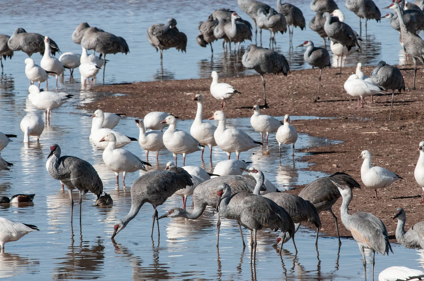
Many of those species are stopping over while migrating, while others call the refuge home year-round. But of all the residents and visitors, none attract quite as much attention as the sandhill cranes, more than 20,000 of which spend the winter there.
It was cranes we wanted to see. And hear.
After a brief detour through the legendary town of Tombstone — which today appears to be equal parts high-desert ranching community, Western theme park and Hollywood movie set — we reached Whitewater Draw in mid-afternoon. We parked Next Chapter in the dirt lot, grabbed photo gear, binoculars and our folding love seat, and followed a trail to the edge of the water, where a berm separating the two ponds provided a perfect perch for birdwatching.
And there were plenty of birds to watch.
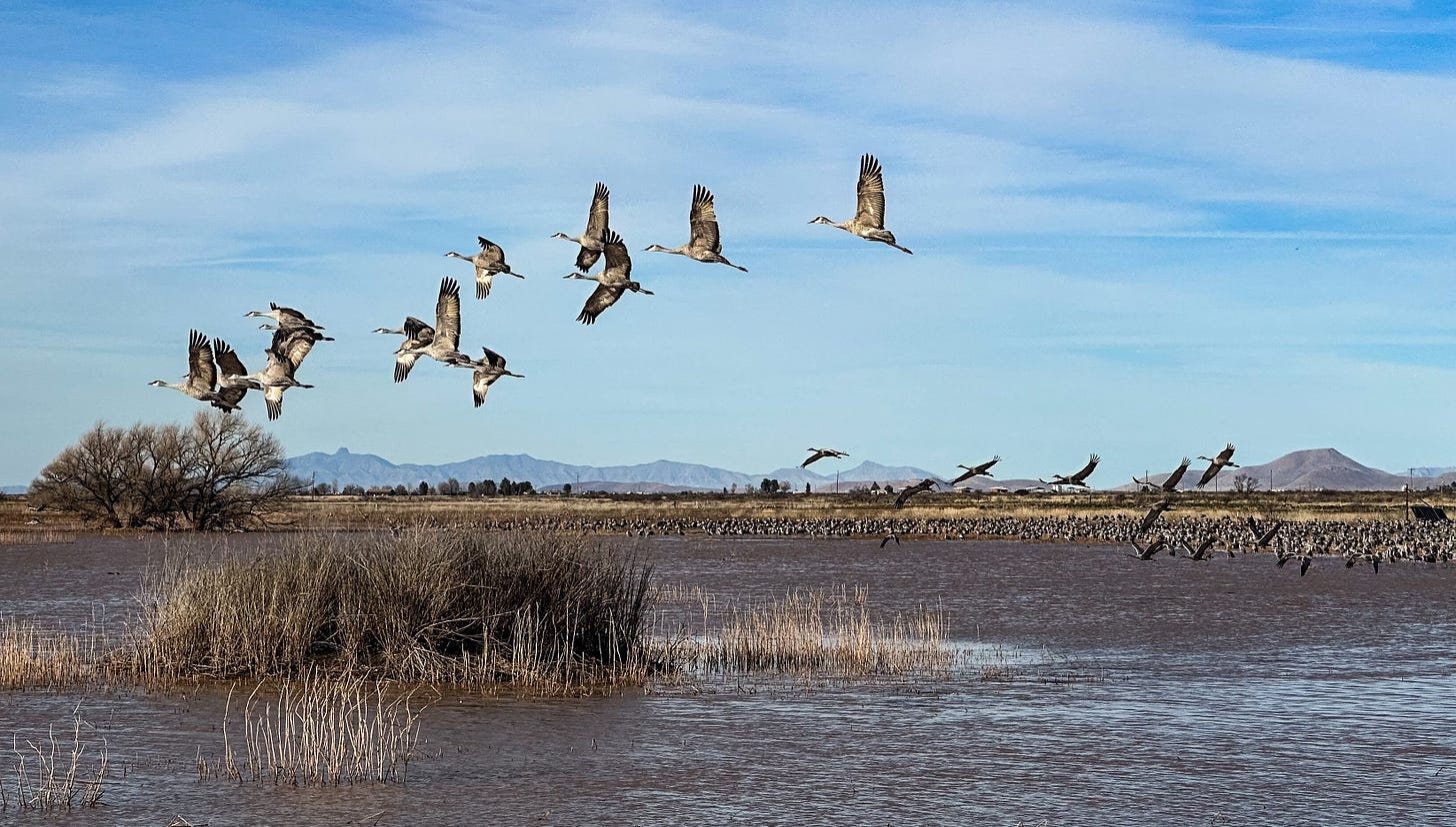
Thousands of cranes, along with snow geese and other waterfowl, were gathered in the shallow water and an adjoining grassland. Sandhills, which were by far the most numerous, are big birds, nearly 4 feet tall, with long legs and a very long neck. They move over land with a distinctive halting elegance, and when they take flight, that long neck and those long legs create an unmistakable silhouette stretched out against the sky. But perhaps their most distinctive feature is their voice. They possess an unusually long trachea that coils behind the sternum, creating a sort of resonator that adds considerable power and complexity to their calls. Multiply it by thousands of individuals, and you get a robust primeval symphony that defies description.
We settled in with the other watchers who’d gathered along the water’s edge. At first, I focused on photography — I’d hauled a pile of gear on this trip, including a big telephoto lens, specifically to take advantage of this opportunity — but eventually I set the gear aside in favor of just watching and listening. A camera viewfinder sometimes can become a barrier to seeing, to taking a scene in with all one’s senses, and I’ve learned over the years not to get so caught up in the quest for the perfect image that I paradoxically miss out on what I actually came to experience.
As the afternoon wore on, the cranes began to leave, sometimes one or two at a time, sometimes as a small group. Occasionally, a few individual takeoffs would trigger a more general exodus, and the air would fill with bugling birds frantically pumping their 6-foot wings to gain altitude. As the crowd of cranes began to shrink, relocating from the grassland to the shallows on the far side of the pond, the small crowd of birders also began to disperse, packing up tripods, cameras and spotting scopes, folding up chairs, and trudging back to the parking lot as the shadows lengthened.
We joined the adjourning flock, packed up and headed to our campsite for the night, in a pasture on a nearby cattle ranch called the Rocking T. Following directions from our Hipcamp hosts, Tony and Hila Vassar, we pulled off the highway into a driveway a few miles south of the blink-and-you-missed-it town of Elfrida, drove past their house, and pulled into a fenced area that had been nicely leveled.
As we were positioning the van, Tony drove up on an ATV, welcomed us and told us the story of the ranch, which he had originally planned to stock with cattle but was increasingly turning over to a herd of goats he rents to public land agencies for brush control, fuel-load reduction and weed management. A lifelong cowboy, he seemed a bit perplexed by this mid-life pivot, but judging by the ranch’s TikTok account — where individual goats have acquired hundreds of fans — he’s also sort of enjoying it. There are some compelling economic factors involved, not the least of which is differential feed consumption — in Tony’s memorable calculus, one horse (a “hayburner”) equals three cows equals 10 goats — and the fact that you can only sell a cow once. Rent-a-goats, on the other hand, earn their keep over and over again.
Eventually, Tony and rumbled off to the house on his ATV, and we got Next Chapter squared away. Enjoying a libation and a colorful sunset, we pondered the unexpected encounters the road often brings us. When planning our trip, we didn’t anticipate running into a voluble goat rancher with a robust social media presence in this remote slice of Arizona desert, but there you have it.
Land of standing up rocks
In our original itinerary for this trip, we had planned to drive the next day to White Sands National Park, 300 miles away in New Mexico. But that evening, as we pored over maps to plot our route, we noticed that we were camped practically on the doorstep of Chiricahua National Monument, which neither of us had visited before. It seemed a shame to leave the area before we checked it out, so the next morning we left the Rocking T, drove 50 miles of country road, and found ourselves in a completely different world.
The road into Chiricahua follows the course of Bonita Creek into a lush wooded canyon, and then climbs steadily into mountainous country. At the monument’s visitor center, elevation 5,400 feet, there was snow on the ground and a bitter bite in the breeze. After collecting maps and brochures, we followed the scenic Bonita Canyon Drive to Masai Point, elevation 6,870 feet. It was too cold to picnic outdoors comfortably, so we had lunch in the van — which also happens to be one of our favorite places to have lunch, particularly if we’re parked somewhere with a fabulous view, as we were at Masai.
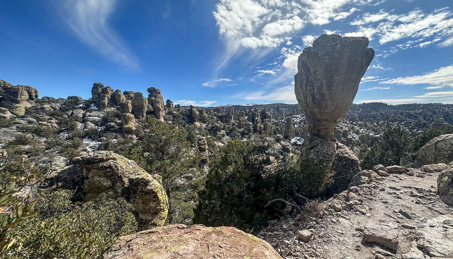
The Chiricahua mountains are the product of vast deposits of ash spewed from the nearby Turkey Creek volcano 27 million years ago. Welded together, uplifted and eroded, the ash deposits have become a fantastical landscape of stone towers, pinnacles, spires, balanced rocks and other intriguing forms. The Chiricahua Apache referred to the landscape as the place of “standing up rocks” and it truly earns that moniker.
The mountains are also what geographers, botanists and others refer to as a “sky island” — an isolated mountain range rising from the surrounding sea of desert, supporting a unique diversity of plant and animal communities. There are many of these scattered through the Basin and Range province of Nevada, southern Arizona, southern New Mexico, western Utah and western Texas. As you gain elevation driving along the park road, the vegetation changes from cactus and grassland in the lowlands to woodland higher up: sycamores and oaks giving way in turn to cypress, pines and firs. In the monument, species representing four distinct regional ecosystems meet and overlap: the Rocky Mountains, the Chihuahuan Desert, the Sonoran Desert and Mexico’s Sierra Madre.
After lunch, we took a couple of short hikes, strolling among surreal rock formations and unfamiliar trees. We then headed back down the mountain and out of the monument. The small campground at Chiricahua was full, but we had identified a likely area for dispersed camping in the surrounding Coronado National Forest, so we headed 7 miles up an unpaved road and found a perfect site alongside a creek.
The next morning, we awoke to temperatures in the 30s and solid cloud cover. By the time we’d finished coffee and stowed our gear in the van, snow had begun to fall. We drove back to pavement along a ribbon of white that the evening before had been ruddy dirt.
The snow had turned to rain by the time we reached Wilcox and picked up eastbound Interstate 10, headed for the outskirts of Las Cruces, New Mexico, 200 miles away. As we drove, the skies began to clear, but the snow and rain were replaced by wind that grew in intensity throughout the day. Next Chapter is 10 feet tall, basically a metal sail on wheels, and gusting crosswinds turned the drive into an hours-long wrestling match with the steering wheel.
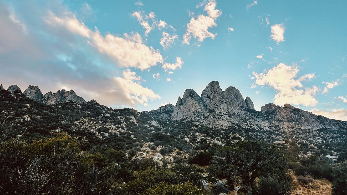
Late that afternoon, worn out and frazzled, we reached our destination for the night, a campground managed by the Bureau of Land Management in Organ Mountains-Desert Peaks National Monument. The gusty winds had lessened in intensity, but it was still blowing and also cold, so we battened down the hatches and spent the evening indoors, grateful for the cabin heater.
Sand dunes and rock art
Thankfully, the wind died down overnight. Had it not, our next destination would have been a hellscape, instead of the bizarre wonderland it turned out to be.
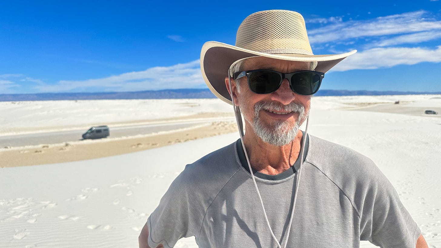
White Sands National Park encompasses more than half of the largest gypsum dune field in the world, 275 square miles of blindingly reflective, drifting powder that feels more like cake flour than beach sand. We reached it before lunch, and after stopping by the visitor center to orient ourselves, drove the 8-mile Dunes Drive into its heart for some hiking. If the wind hadn’t died, we’d have been enveloped in clouds of abrasive grit; instead, we enjoyed a clear, warm day in one of the strangest landscapes in the Southwest.
In terms of geologic time, the dune field was born yesterday, although the full story of its formation begins much farther back in time, nearly 300 million years. That’s when the area that’s now Southern New Mexico was at the bottom of the shallow Permian Sea that covered much of the present-day Southwest. As the sea periodically advanced and retreated, layers of gypsum and other minerals were deposited on its floor.
Later, parts of that sea floor were uplifted to become the mountain ranges that bracket the Tularosa Basin, in which White Sands is located. Precipitation falling on those mountains dissolved the gypsum, which was carried by runoff to a large lake that formed in the basin. That lake began to dry up after the end of the most recent ice age, about 10,000 years ago, leaving the gypsum behind in the form of selenite crystals. Wind picked those up and blew them across the landscape, fragmenting them into smaller and smaller grains as they bounced and crashed into each other. Over time, they coalesced into the dune field. (The process continues today, a small remnant lake periodically forming and then drying up adjacent to the dune field, generating more selenite crystals that the wind pulverizes and moves.)
OK, that is a ridiculously oversimplified account of White Sands’ origins (a more detailed account is on the park website). But even my abbreviated sketch captures the complex set of events that created the landscape: Over 300,000 centuries, a sea turned into mountains, a lake, a desert and then a dune field. Wandering around in a place like that, it’s easy to feel yourself lost not just in space but in time.
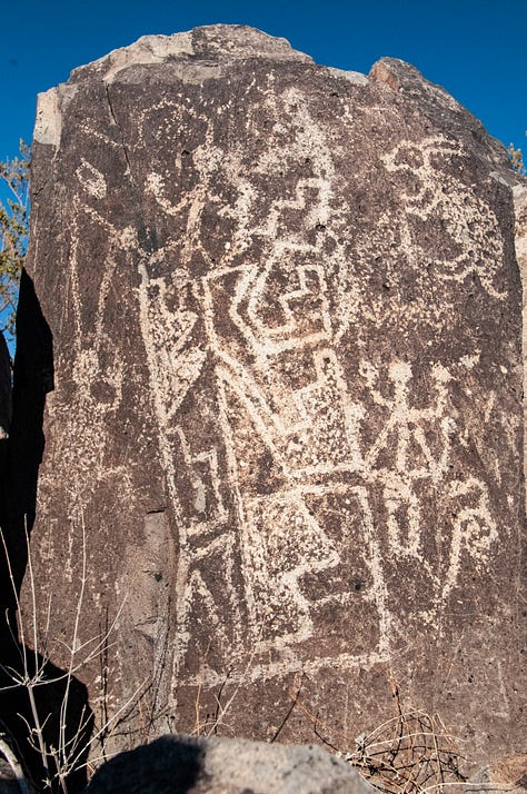
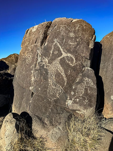
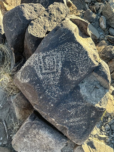
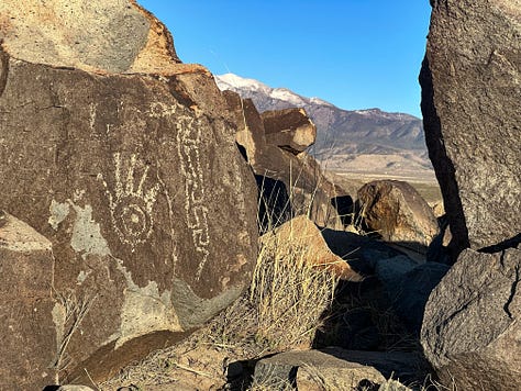
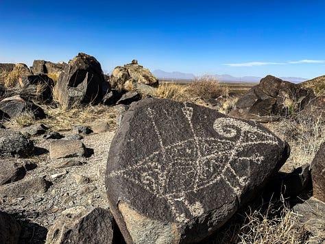
Once we’d had our fill of sand (figuratively speaking) we were back on the road, heading north through Alamogordo toward our day’s-end destination: The Three Rivers Petroglyph Site just outside of Tularosa. In addition to a small Bureau of Land Management visitor center and campground, the site encompasses one of the largest and most striking rock art assemblages in the Southwest: More than 21,000 images meticulously pecked into the surface of basalt boulders scattered along the summit of a mile-long ridge.
Leslie and I are drawn to such sites, intrigued by their mystery and captivated by their artistry, and have visited dozens of them across the Western states. Some of them have been staggeringly beautiful, such as the Great Gallery in Utah’s Horseshoe Canyon, or the Buckhorn Wash panel, in Utah’s San Rafael Swell. But the images in those panels are pictographs, painted on the sandstone walls and therefore lend themselves to nuanced representation. Petroglyphs, on the other hand, are basically a form of visual art created with hammer and chisel. The delicacy and expressiveness that characterize the petroglyph images at the Three Rivers site are rare in that medium. In their variety, sophistication and abundance, the images — created a thousand years ago by indigenous people archaeologists refer to the Jornada Mogollon — are a priceless human heritage.
We explored the gallery that afternoon until a rising wind all but blew us off the ridge. We returned in the calm of the next morning, finding still more dazzling images among the volcanic boulders. We also followed a level trail on the valley floor to the site of a village likely inhabited by those who created the artwork. Bits of pottery littered the ground, reminders of domestic life in a long-ago time.

Although we were somewhat reluctant to leave with so much rock art still unseen, we packed up our camp and returned to the road. We were 9 days into our trip, and it had been 5 days since our last shower. That night in our Airbnb rental in Carlsbad, we enjoyed the luxury of indoor plumbing and consulted maps to plot a route to the next destination on our journey: A sprawling national park in the nation’s southern borderlands.
Coming in Part 3: Carlsbad to Big Bend, Texas.


So happy to be adding fascinating and relatively undiscovered places to our bucket list when we, like you two, hit the road in our retirement. The pictures and descriptions are so compelling!
Hi John: That facial hair is getting whiter and whiter.
As always, I enjoyed this chapter. My last visit to Carlsbad was to cover a "cave-napping." A group if Native American militants held 175 tourists hostage for about eight hours. It ended with a whimper, thankfully no bangs. One of many bizarre stories I covered in NM.
"Big Bend" is also a favorite. Can't wait for that chapter..
Tim